Country:

 City:
City:


Starts at the Tourist Office, Place du Maréchal Foch.
(S/E) With your back to the Tourist Office, cross the square and turn right, away from the church, onto Rue Jules Theulier. At number 29, turn right onto Impasse du Réservoir and, at the end of this, turn left (Rue Gabriel Péri) and carry on straight ahead until you reach a three-way junction a few metres past the cemetery.
(1) Keep to the right onto Route des Abeilles and carry on to the next three-way junction.
(2) Turn left onto the C111 towards Saint-Romain (Route des Palombes) and follow this road until the junction at the corner of No. 1849.
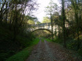
(3) Turn right onto Route de la Voie Verte, then left onto Route du Grand Clos. Pass under the old railway bridge, keep right at the next junction and you’ll reach a farm. Continue to the right until you reach Route des Carrières on your left.
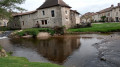
(4) Take this road, head downhill to a pond on your right, then head back uphill to the next junction. Turn left and head towards the bridge over the River Côle
(5) Turn right onto Route de Saint-Saud, heading towards Saint-Jory de Chalais. This section offers a more natural setting, characterised by the presence of the river. Continue along Route des Carrières, pass the turn-off for Beaudouy and reach the first track on the right, Route de la Traverse.
(6) Follow this track towards Traverse Sud, cross the bridge over the Côle and arrive at the hamlet of Les Gadeaux. Continue along the tarmac road, then turn right onto Route de la Plaine, arriving at a four-way junction, with the hamlet and arboretum of Pouyouleix on your right.
(7) Carry on straight ahead along Route de la Plaine, heading down to the Ruisseau du Touroulet. Enjoy this more shaded stretch.
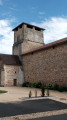
(8) Carry on along Route des Vallons until you reach the church at Pierrefiche.
(9) Turn off onto the D77, Route du Moulin, towards Thiviers. Follow this road, enter Thiviers, cross the level crossing and you’ll reach a four-way junction a few metres before the railway bridge.
(10) Turn right towards Saint-Martin (Rue Henri Saumande) and head for number 15. Use the pedestrian crossing on the left to cross the railway tracks, then turn right (Avenue Charles de Gaulle). At the roundabout, go straight ahead onto the D707, walk past the SNCF station and look for Rue Albert Theullier on the left.
(11) Follow this road uphill to Square Bristol.
(12) Cross the square and Place de la République, then, at the far end, turn left onto Rue du Puits de l’Archer. At No. 16, turn right, then immediately left. This section gradually leads you back into the historic centre of the town. At Rue de la Tour, turn right and, at the corner of No. 3, take the Passage du Pont Fermier on the left and follow it to the end. Turn right, heading towards the Church of Notre-Dame de Thiviers and Place du Maréchal Foch (S/E).
 Visorando Member
 Moderate
 Easy
Easy