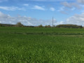
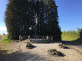
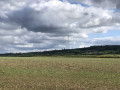
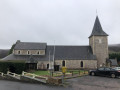
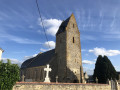
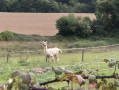
Panoramic views of the pre-bocage landscape at Bonnemaison

Starting from Bonnemaison, walk through the meadows, make your way through the hedgerow countryside, descend into the Vingt-Bec valley, lined with woods, and discover the Valcongrain State Forest.

Details

8507390
Creation:
Last update:
Last review:
  • Walking
    Activity: Walking
  • ↔
    Distance: 5.54 mi
  • ◔
    Average duration: 2h 55 
  • ▲
    Difficulty: Easy

  • ⚐
    Back to start: Yes
  • ↗
    Ascent: + 413 ft
  • ↘
    Descent: - 407 ft

  • ▲
    Highest point: 804 ft
  • ▼
    Lowest point: 554 ft
  • ⚐ Country: France
  • ⚐ City: Bonnemaison (14260)
  • ⚑
    Start/End: N 49.010253° / W 0.584925°
  • ❏
    IGN map(s): Ref. 1513SB
  • Hour-by-hour weather

Photos

Description of the walk

Parking is available at the Bonnemaison town hall car park.

(S/E) On leaving the town hall car park, turn left onto the D234A towards the church to reach the village centre, about 100 m away. At the crossroads, take the Route du Calvaire on the right towards La Rouelle, Le Bois-Normand and Le Haut-Bosq.

(1) At the calvary, ignore the Route de la Rouelle on the right and keep left towards Le Bois-Normand and Le Haut-Bosq. Follow the road for about 1.7 km, during which you’ll pass the hamlet of Le Puits (a dead end on the left), cross the D234B with care and turn right at the Fork in the road, leaving the Chemin du Bois-Normand on your left.

(2) At the hamlet of Haut-Bosq, take the first tarmac track on the left and follow it for about 400 m. Then turn right onto the small road (Chemin du Bois-Normand) and follow it for about 400 m. Before the Bois-Normand farm, turn onto the track on the right and head back towards the hamlet of Haut-Bosq.

(3) Back in the hamlet, turn left onto the track leading to the Valcongrain Forest. At the Fork in the road, keep to the right and head down into the forest for about 800 m until you reach a crossroads where four tracks meet, through which theGRP® Tour de la Suisse Normande passes.

(4) Turn right and follow the path for about 1.2 km, skirting the edge of the forest and the Ruisseau de Vingt-Bec a little further down on your left. The path leads out onto a car park and then onto the D6 at a place called Le Jardin de la Bruyère. Proceed with great caution along the verge and follow the road to the right for about a hundred metres.

(5) Turn right onto the Route des Longrais (D234B) towards Bonnemaison and the hamlet of La Rouelle. Follow the D234B, negotiating the bends: the Longrais picnic area is on the left at the second bend. Further on, ignore the Route de Louvaton on the left and continue to the hamlet of La Rouelle.

(6) Leave the D234B and turn left onto the Route de la Rouelle towards Bonnemaison. Follow the road for about 700 m until you come back to the wayside cross you passed at the start.

(1) Carry on to the left and continue to the village centre. Turn left onto Rue des Prés de Lamberville (D234A) to reach the town hall and the car park (S/E).


Waypoints

  1. S/E : mi 0 - alt. 722 ft - Bonnemaison Town Hall car park
  2. 1 : mi 0.2 - alt. 741 ft - Bonnemaison Calvary, junction of the circular loop
  3. 2 : mi 1.17 - alt. 761 ft - Le Haut-Bosq – North
  4. 3 : mi 2.11 - alt. 751 ft - Le Haut-Bosq – South
  5. 4 : mi 2.72 - alt. 554 ft - Four-way junction
  6. 5 : mi 3.58 - alt. 676 ft - D234B Road – Le Jardin de la Bruyère
  7. 6 : mi 4.65 - alt. 778 ft - La Rouelle
  8. S/E : mi 5.54 - alt. 722 ft - Bonnemaison Town Hall car park

Notes

(S/E) Alternatively, on the return journey, bypass the town hall car park and continue along the D234A for about 200 m until you reach the Fork in the road and the grotto modelled on the one at Lourdes.

Worth a visit

Historical and religious heritage of Bonnemaison:

The Church of Saint Martin, dating from the 18th century, features a massive bell tower and porch. A statue of Saint Martin and a 16th-century Virgin and Child are listed as historic monuments. The church also boasts an altarpiece adorned with four fluted Corinthian columns and a carved frieze.

The grotto, modelled on the grotto at Lourdes, was built in gratitude for the protection granted to the parish in July 1944. This small chapel is dedicated to the Virgin Mary, whose shrine dates from the mid-19th century.

Reviews and comments

3.9 / 5
Based on 4 reviews

Reliability of the description
4 / 5
Ease of following the route
4.5 / 5
Route interest
3.3 / 5
User 27664275

Overall rating : 4.3 / 5

Date of your route : Sep 22, 2025
Reliability of the description : ★★★★☆ Good
Ease of following the route : ★★★★★ Very good
Route interest : ★★★★☆ Good
Very busy route : No

Good evening from Courvaudon
i had done the reconnaissance on Friday and Sunday. There were about fifteen of us and the weather was pleasant
several people were familiar with the route as it is the first hike of the year for the Ass BLD Association Bonnemaison Loisirs Détente club
i will return to the site for future hikes and to draw up the programme for the year

Best regards
VERON Jean Marie

Machine-translated

crevette54
crevette54

Overall rating : 3 / 5

Date of your route : Aug 04, 2025
Reliability of the description : ★★★☆☆ Average
Ease of following the route : ★★★☆☆ Average
Route interest : ★★★☆☆ Average
Very busy route : No

the map does not correspond to the description, too much road, only the path through the forest is interesting.

Machine-translated

Les randonneuses14
Les randonneuses14

Overall rating : 3.7 / 5

Date of your route : Jun 13, 2023
Reliability of the description : ★★★★★ Very good
Ease of following the route : ★★★★★ Very good
Route interest : ★☆☆☆☆ Very disappointing
Very busy route : No

We were a bit disappointed – 6km out of the 9 were on the road.
We took a shortcut to the left at the end – the road was in full sun 🥵
Only the stretch through the forest is nice, and the view of the bocage is pleasant

Machine-translated

Jean-Paul BUTEAU
Jean-Paul BUTEAU

Hello AHQGD,
I’m glad to hear you enjoyed this route; it’s encouraging for me, as the person who posted it.

Machine-translated

ahqgdHSC
ahqgdHSC

Overall rating : 4.7 / 5

Date of your route : Jul 29, 2021
Reliability of the description : ★★★★☆ Good
Ease of following the route : ★★★★★ Very good
Route interest : ★★★★★ Very good
Very busy route : No

A lovely, undulating route, not too challenging, combining small roads and dirt tracks. A few muddy patches in the forest, no doubt down to the vagaries of the weather (we are in Normandy, after all!). Breathtaking views in every direction and, at this time of year, an added bonus: roadside verges bursting with flowers of every colour – a real feast for the eyes. The hamlets we passed through were a delight to see.
A relaxing and enjoyable walk that’s well worth doing again.
Our group of walkers was delighted with this route.
AHQGD 14200 Hérouville Saint Clair

Machine-translated

Other walks in the area

For more walks, use our search engine .

The GPS track and description are the property of this route's author. Please do not copy them without permission.