


 Country:

 City:
City:


Set off from the car park in the village of Les Estables, Place du Mézenc.
(S/E) Head north, pass the town hall and turn right onto the Route des Boutières (D631).
(1) Head towards the top of the village, towards the entrance to the ski slopes, until you reach the start of a ski lift.
(2) Turn left onto a path that starts off running parallel to the ski lift line. After passing a building, the path veers to the right and moves away from the ski lift line. Head north-east, ignoring a turn-off on the left and then one on the right.
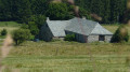
(3) At a fork in the road, take the path on the right and continue to the forest ranger’s house.
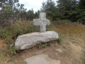
(4) Follow the D274 straight ahead, then take a path running parallel to it on its left-hand side. Continue straight on and climb up to the Croix de Peccata.
(5) Then turn right and follow a path south-east through the forest. This will take you to a crossroads at the foot of the Mézenc.
(6) Take the path on the left and climb up through open terrain.
(7) At the junction, continue straight ahead (north) to reach the northern summit, where the Croix du Mézenc is located.
(8) Then turn right (south-east). Head back down and then climb slightly again until you reach a junction of paths.
(9) Take the path on the left to complete the circular loop around the southern summit in a clockwise direction. Reach the southern summit.
(10) Head back down to the right (north-north-east) along a path with large stones.
(9) Turn left (west) to rejoin a junction you passed earlier.
(7) Turn left again and head down to another junction you have passed earlier.
(6) Turn left (south) and head downhill. After several hairpin bends, you’ll reach the Col de la Croix de Boutières.
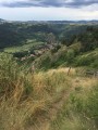
(11) Take the path on the other side of the road directly opposite you. Walk to the viewpoint overlooking the Cirque des Boutières.
(12) Continue along the path (south-south-west) until you reach a narrow track at the edge of the forest. Follow the track as it climbs towards Chaulet. At a junction where several paths meet, carry straight on.
(13) At a junction, take the path on the right which leads into the woods:be careful, as the path isn’t very visible, so keep a watchful eye out for the start of this route. Climb up to Chaulet along this path.
(14) Head back down the northern slope, following a path, first through the woodland and then along the edge of the woods.
(15) You’ll come out onto a road (D631) and follow it to the left. Stay on this main road and ignore any side paths.
(1) Carry on straight ahead, turn left at the corner by the town hall and you’ll soon reach the car park (S/E).

 . The ascent of Mont Mézenc is a "highway" for pedestrians.
 Visorando Member

 Difficult
 Easy
Easy 
