Country:
 City:
City:


Start: Marlow Station (SU 855 865)
(S) From the station entrance, go along Station Road, passing the Marlow Donkey on the left.
(1) Turn left down Mill Road, and near the end, turn right into the alleyway at the Thames Path sign.
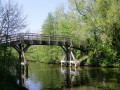
(2) Go through the churchyard of All Saints and turn left on the diverted Thames Path, crossing to the other side of the bridge.
(3) Keep right at the road junction and continue into Bisham, passing the Bull Inn.
(4) At the junction, keep ahead into Temple Lane.
(5) When the lane bears left, keep ahead on the footpath and go under the tunnel. Continue to a path junction.
(6) Turn right to join the original Thames Path just past the defunct Temple Bridge. Turn left, keep to the riverside and cross the bridge to the picnic area just before Hurley Lock.
(7) Keep ahead to the next bridge, cross and turn right along the river through the water meadows.
After about half a mile, the chalk cliffs below Danesfield Hotel come into view across the river.
(8) Pass through the small community of Frogmill, take the shortcut (or not) across a field and keep ahead at the next path junction.
(9) At the path junction just the footbridge, leave the riverside on the Thames Path to go through Culham Deer Park. Turn right at the next junction and follow the Thames Path signs, passing to the right of Culham Court and to the left of Holme Farm. At the lane, turn right to the Flower Pot.
(10)Continue down Ferry Lane to the slipway and turn left on the Thames Path to Hambleden Lock.
The next impressive building is Greenlands, now home to Henley Business School. A little further on is Temple Island, the start of the straight mile of the Henley Regatta course. Further on, a lane to the left leads to the 13th Century Remenham Church.
(11) After another half mile, the Thames Path leaves the river, passes the Leander Club and joins the main road. Turn right over the bridge, then left across the road at the traffic lights and keep ahead along the river frontage.
(12) After the road junction, follow the road round to the right and take the second left for the station.(E)
 Visorando Member
 Easy
Easy  Association / Club / Walk leader