


The Spanish IGN maps do not seem to match the trails indicated on the signs...
Malpaís de Guimar from Puertito


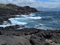
A lovely walk amongst volcanic ash and lava flows pouring into the ocean at the foot of the Socorro volcano.
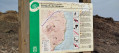
There are several educational signs in the reserve.
Given the darkness of the surroundings, you should definitely avoid doing this when the sun is at its highest, even if the sea breeze offers effective refreshment!
Details
Creation:
Last update:
Last review:
–
–
-
 Activity: Walking
 -
 Distance: 5.61 mi
 -
 Average duration: 3h 05
 -
 Difficulty: Easy
 -
-
 Back to start: Yes
 -
 Ascent: + 617 ft
 -
 Descent: - 597 ft
 -
-
 Highest point: 541 ft
 -
 Lowest point: 0 ft
-
 Country:
Canary Islands
Country:
Canary Islands
-
 City:
Güímar
City:
Güímar -
 Start/End: N 28.298429° / W 16.371126°
 -


 Hour-by-hour weather
Waypoints
- S/E : mi 0 - alt. 16 ft - Punta de los Canarios
- 1 : mi 2.41 - alt. 13 ft - Playa de la Entrada
- S/E : mi 5.61 - alt. 16 ft - Punta de los Canarios
Notes
Other walks in the area
Puertito de Guimar
 Visorando Member
 5.48 mi
+427 ft
-443 ft
2h 55
Easy
5.48 mi
+427 ft
-443 ft
2h 55
Easy
 Departure from Güímar (Province de Las Palmas)
Pleasant hike along the coast...
Good shoes required (mid-cut or high-cut) as the terrain is rather uneven in places and your ankles/knees will be put to the test on the loose stones for much of the route.
On Tenerife in the Malpais de Güímar
 6.02 mi
+600 ft
-604 ft
3h 20
Easy
Departure from Güímar (Province de Las Palmas)
6.02 mi
+600 ft
-604 ft
3h 20
Easy
Departure from Güímar (Province de Las Palmas)
A pleasant hike through the lava blocks along the coast. Malpaís de Güímar is a nature reserve declared a protected area. It's a unique volcanic landscape stretching from the Montaña Grande to the coast. This loop is perfect for children, as it's short and very easy.
A palette of colours at the foot of El Teide
 4.45 mi
+919 ft
-919 ft
2h 50
4.45 mi
+919 ft
-919 ft
2h 50
 Moderate
Departure from La Orotava (Province de Las Palmas)
Moderate
Departure from La Orotava (Province de Las Palmas)
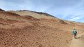
After walking for 800 m, you’d think you were in the middle of the desert. Sandy terrain (but you don’t sink in), a gradient of colours, gentle undulating terrain, and dark rocks providing a striking contrast. A real treat!
A 6 km family walk if you do a return trip to the point (2). A relatively steep climb of 200 m in elevation if you do the full route. El Teide is very close by.
Le Teide by Montana Blanca
 8.06 mi
+4,085 ft
-4,098 ft
7h 15
8.06 mi
+4,085 ft
-4,098 ft
7h 15
 Difficult
Departure from La Orotava (Province de Las Palmas)
Difficult
Departure from La Orotava (Province de Las Palmas)
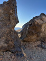
On the slopes of Spain's highest peak, the Pico de Teide, access to which is restricted.
You should book and ask for authorization to access the summit (3715m) with National Park wardens in advance.
A variety of landscapes between El Teide and Montaña Guajara
 6.91 mi
+492 ft
-499 ft
3h 35
Moderate
Departure from La Orotava (Province de Las Palmas)
6.91 mi
+492 ft
-499 ft
3h 35
Moderate
Departure from La Orotava (Province de Las Palmas)
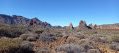
An easy hike on a good path. You’ll enjoy superb views of El Teide and the surrounding area. Then you’ll encounter rugged, eroded rocks in a variety of shapes and colours as you approach Montaña Guajara (alt. 2,717 m), the highest peak in the vast caldera. Towards the end of the route, you’ll see viper’s bugloss, those tall plants endemic to Tenerife that bloom red (in the right season). As a bonus, there’s a safe car park.
A loop of the Pic du Guajara
 6.30 mi
+2,044 ft
-2,057 ft
4h 40
Moderate
Departure from La Orotava (Province de Las Palmas)
6.30 mi
+2,044 ft
-2,057 ft
4h 40
Moderate
Departure from La Orotava (Province de Las Palmas)
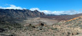
In the Teide National Park, this hike takes you up to a superb summit which offers splendid views of Teide on one side, and the south coast of Tenerife on the other.
The route is very well marked, with signs at every crossroads. It's virtually impossible to get lost.
⚠️Please note the hunting season in the Park. See Practical Information. Updated October 21, 2022.
A loop of the Pic du Guajara
 5.32 mi
+2,408 ft
-2,431 ft
4h 35
Difficult
Departure from La Orotava (Province de Las Palmas)
5.32 mi
+2,408 ft
-2,431 ft
4h 35
Difficult
Departure from La Orotava (Province de Las Palmas)
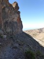
A superb loop on one of Tenerife's most beautiful peaks. The whole circuit offers an extraordinary view of the caldera and the summit of the Pico del Teide. The difficulty lies in the suspended passage below the summit. It's an aerial passage, but never exposed, so don't attempt it if visibility is poor.
New markings have been added to some of the passages, so the description below will probably have to be adapted to the new markings on the summit section.
Sentero de los Roques de Garcia
 2.30 mi
+499 ft
-509 ft
1h 30
Easy
Departure from La Orotava (Province de Las Palmas)
2.30 mi
+499 ft
-509 ft
1h 30
Easy
Departure from La Orotava (Province de Las Palmas)
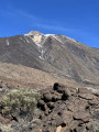
Undoubtedly one of the most interesting hikes for those who don't have much time. Views of Mount Teide, lava flows, "Wild West" rock formations. You'll get an overview of the area's panoramas in a hike that's accessible to all.
For more walks, use our search engine .
The GPS track and description are the property of this route's author. Please do not copy them without permission.

