


Start from the Invermark car park, at the foot of the church and just before the end of the road.
Loch Lee and the Craig Maskeldie circuit, starting from Invermark


The route starts from a large free car park (for the time being). The start and finish are on a track suitable for vehicles. Swimming is possible in summer, provided you can cope with water no warmer than 15°. The route is unmarked and runs through unspoilt countryside. There are some very steep sections.
Details
Creation:
Last update:
Last review:
–
–
-
 Activity: Walking
 -
 Distance: 10.21 mi
 -
 Average duration: 6h 15
 -
 Difficulty: Difficult
 -
-
 Back to start: Yes
 -
 Ascent: + 1,381 ft
 -
 Descent: - 1,378 ft
 -
-
 Highest point: 2,231 ft
 -
 Lowest point: 850 ft
-
 Country:
United Kingdom
Country:
United Kingdom
-
 Area: Cairngorms
 -
 City:
Angus
City:
Angus -
 Start/End: N 56.911239° / W 2.910648°
 -


 Hour-by-hour weather
Description of the walk
Waypoints
- S/E : mi 0 - alt. 853 ft - Car park – Invermark
- 1 : mi 0.22 - alt. 860 ft - Road – Track - Invermark Castle
- 2 : mi 1.03 - alt. 906 ft - Eastern tip of the - Loch Lee
- 3 : mi 2.3 - alt. 932 ft - Junction with the circular Glenlee loop
- 4 : mi 3.53 - alt. 1,001 ft - Bridge
- 5 : mi 4.14 - alt. 1,122 ft - Falls of Unich
- 6 : mi 4.89 - alt. 1,759 ft - Falls of Damff
- 7 : mi 4.98 - alt. 1,795 ft - Bridge
- 8 : mi 5.89 - alt. 2,228 ft - T-junction – Directly above - Cairn Lick (682 m)
- 9 : mi 7.55 - alt. 971 ft - Inchgrundle
- S/E : mi 10.21 - alt. 853 ft - Car park – Invermark
Other walks in the area
Mayar Circular from Glen Doll - Cairngorms National Park
 Visorando Member7.08 mi
+2,165 ft
-2,152 ft
5h 10
Visorando Member7.08 mi
+2,165 ft
-2,152 ft
5h 10
 Moderate
 Departure from Angus
A superb hike, which starts on the Corrie Fee Trail and continues to a waterfall and the summit of Mayar. The view of the waterfall and the heathland is magnificent. The climb is mainly from the waterfall. Make sure you have good hiking boots and a good windbreaker. You will be dazzled by the scenery.
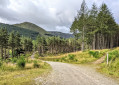
Glen Doll Forest Trail
 Tourism professional
 5.27 mi
+568 ft
-568 ft
2h 55
5.27 mi
+568 ft
-568 ft
2h 55
 Easy
Departure from Angus
Easy
Departure from Angus
Set in the heart of the Angus Glens within the Cairngorms National Park, a walk through Glen Doll offers the perfect balance of forest trails and breath-taking mountain scenery.
Glen Doll Corrie Fee and Mayar circular route from Acharn
7.36 mi
+2,165 ft
-2,165 ft
5h 15
Difficult
Departure from Angus
The Green route takes you to Corrie Fee, an exceptional peat bog set in a magnificent glacial cirque. Many people do a return walk from Acharn. Here we suggest a circular route involving a steep climb over boulders (‘staircase’) to reach the summit of Mayar. From the summit, follow the ridge line eastwards and then north-eastwards.
Kilbo
11.10 mi
+1,765 ft
-1,703 ft
6h 40
Difficult
Departure from Angus
Craig Lodge - Broom Hill - White Glen - Craig Lodge.
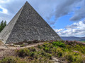
Prince Albert's Pyramid, Balmoral
 3.64 mi
+564 ft
-558 ft
2h 10
Moderate
Departure from Aberdeenshire
3.64 mi
+564 ft
-558 ft
2h 10
Moderate
Departure from Aberdeenshire
There are 11 cairns to discover within the Balmoral Estate and this short walk takes in two of them – Prince Albert’s Cairn (aka “the pyramid”!) and Princess Beatrice’s Cairn. A beautiful forestry trail awaits, and after a fairly steady walk uphill you will reach the summit of Creag an Lurachain (442 m /1450 ft) where the pyramid sits. A steeper but shorter descent follows, and a very lovely suspension bridge crossing.
For more walks, use our search engine .
The GPS track and description are the property of this route's author. Please do not copy them without permission.

