Little Hay and Box Moor Trust

A great circular walk combining canal, chalk stream and woodland, along with some lovely scenic views over the Bulbourne Valley.

The route is described from Little Hay Golf Club, but it is easy to join at Waypoint 7, from the south side of Hemel or the Railway Station.

Details

98105582
Creation:
Last update:
Last review:
  • Walking
    Activity: Walking
  • ↔
    Distance: 4.99 mi
  • ◔
    Average duration: 2h 30 
  • ▲
    Difficulty: Moderate

  • ⚐
    Back to start: Yes
  • ↗
    Ascent: + 279 ft
  • ↘
    Descent: - 272 ft

  • ▲
    Highest point: 531 ft
  • ▼
    Lowest point: 262 ft

Photos

Description of the walk

START and Finish: (A) Little Hay Golf Club, Box Lane, Bovingdon, Herts HP3 0DT.

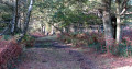
(S/E) From the car park, return along the entrance road and, just after the speed bump, bear left onto the path into the wood on the Hertfordshire Way. Keep straight ahead through the wood and eventually go through a gate to the main road. Turn right along the pavement past Little Hay Cottage and cross the main road into Bushfield Road.

(1) Walk along to the end, turn left along a wide unsurfaced track and take the path on the left opposite ‘Rainhill Springs’. Bear half-right across the field towards a house and through the gap in the fence.

(2) Follow the path between the fencing, cross over two driveways and down to a lane. Turn right up the lane for a few steps before turning left on a bridleway, then fork left through the woods. Follow the bridleway as it drops down to the entrance to a house (Gosnells). Take the wide bridleway to the left of the entrance and climb up and along with open ground to the left ((C) Sheethanger Common). Follow the track as it bends to the right through the trees, ignore the path on the left and continue to meet a surfaced driveway. To the right is a lovely thatched cottage.

(3) Turn left along the driveway to the road. Turn left down the road and take the byway on the right, opposite ‘Hillside’.

(4) Continue uphill on the byway, ignore the path on the left and shortly fork right up to a set of gates directly ahead. Continue past the gates and follow the path down a set of steps. Turn right over the road bridge and stay on the track down to the entrance to Roughdown Common.

(5) Bear left down over the railway bridge to the main road at the bottom. Cross the road via the traffic island and turn left along the pavement to pass through the gate on the right into the Box Moor Trust’s field ((D) Station Moor). Walk along the path to the information board by the footbridge.

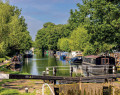
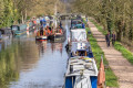
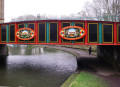
(6) Don’t cross the bridge. Instead, go back a few steps and turn right along the riverbank, then follow this and the canal all the way to climb up to a gate near The Fishery Inn. Go through the gate, cross the road, turn right along the pavement and then left down the steps to the towpath of the (E) Grand Union Canal.

(7) Walk along the towpath for 1.5km to reach the locks at (F) Winkwell. To the right is "The Three Horseshoes" pub. Turn left over the river bridge and follow the narrow lane up to the main road. Turn right along the pavement and, just before Bourne End Village Hall, cross the road and take the wide track to rejoin the Hertfordshire Way.

(8) The track climbs steadily to the A41. Cross on the bridge and continue directly uphill through the golf course to the left of the line of trees to reach the fingerpost at the very top. Bear right, stay on this path along the edge of the course and follow it round to the left to a concrete track in front of a barn. Follow the track round to the right of the barn and continue along it to return to the car park.(S/E)

"We hope you have enjoyed your walk. Please remember to rate the walk and add comments. We are interested in how we could improve the instructions or the route and would like to hear about any issues with paths on the walk."

Waypoints

  1. S/E : mi 0 - alt. 518 ft - Little Hay Golf Club
  2. 1 : mi 0.28 - alt. 528 ft - Bushfield Road
  3. 2 : mi 0.79 - alt. 495 ft - Gap in fence
  4. 3 : mi 1.54 - alt. 482 ft - Left on driveway
  5. 4 : mi 1.85 - alt. 417 ft - Byway
  6. 5 : mi 2.25 - alt. 341 ft - Railway bridge
  7. 6 : mi 2.51 - alt. 279 ft - Along riverbank
  8. 7 : mi 2.82 - alt. 276 ft - Towpath
  9. 8 : mi 4.1 - alt. 308 ft - Uphill track
  10. S/E : mi 4.99 - alt. 518 ft - Little Hay Golf Club

Notes

START: Little Hay Golf Club, Box Lane, Bovingdon, Herts HP3 0DT. ALTERNATIVE START: By canal at Fishery Road (Waypoint 7).

TERRAIN: A moderate stile-free walk on good paths, some of which could be muddy after rain. One climb. Care needed crossing the main roads, and look out for flying golf balls at Little Hay. There are a number of gates

REFRESHMENTS: Par3 Suite bar and restaurant at the Little Hay clubhouse; The Fishery Inn and The Fishery Wharf in Boxmoor; and The Three Horseshoes in Winkwell

PARKING: Little Hay Golf Club car park

LOCAL TRANSPORT: For local bus services please check www.traveline.info. Trains to Hemel Hempstead. Several buses go to the Railway Station which is a short walk from Waypoint 7.

Worth a visit

(A) Little Hay Golf Course: owned by Dacorum Borough Council, is a public course that opened in September 1977. It’s currently part of the Dacorum Sports Trust and managed by the Absolutely Together charity. The course used to be part of the grounds of Westbrook Hay, a Grade II listed country house. You’re very welcome to enjoy some refreshments in the clubhouse before and after the walk.

(B) The Box Moor Trust: was founded in 1594 and manages some 480 acres of agricultural and amenity land for the benefit of the inhabitants of Hemel Hempstead and Bovingdon. A registered charity, the Trust’s mission is to manage the estate in an environmentally sensitive manner for recreation, biodiversity, the provision of diverse opportunities for lifelong learning and to ensure that the enjoyment of such initiatives is accessible to all. This walk visits several of the Trust’s sites.

(C) Sheethanger Common is one of the Box Moor Trust sites. Over 30 acres in size, it’s been designated a Heritage Site. In summer there are many varieties of chalkland plants, including cowslips and spotted orchids. The Common was once part of Boxmoor Golf Club, which closed in 2011.
(D) Station Moor and the Bulbourne: Another Trust site is Station Moor. The avenue of horse chestnut trees was planted in 1902 to celebrate the coronation of Edward VII. The River Bulbourne is a chalk stream that rises near Dudswell and runs for seven miles through Berkhamsted and Bourne End, before joining the River Gade near Hemel Hempstead. Like many rivers in the country, the Bulbourne is threatened by low rainfall, extraction for public use and the supply of water to the Grand Union Canal. In 2017 a major restoration project took place, the details of which are shown on the noticeboard at Waypoint 9.
(E) The Grand Union Canal runs for 137 miles from London to Birmingham and was the main artery for goods between the Midlands and London for about 50 years. It’s an amalgamation of several historic waterways. This section opened at the end of the 18th century as part the Grand Junction Canal, which linked the River Thames at Brentford to Braunston in Northamptonshire.
(F) Winkwell: The name derives from ‘Wincel’, which meant a corner in Old English. The Three Horseshoes is a Grade II listed waterside pub. There used to be a wharf here, and coal was carted up to Westbrook Hay (see above), which is now a school.

Other walks in the area

For more walks, use our search engine .

The GPS track and description are the property of this route's author. Please do not copy them without permission.