


No description
Les Houches Shakeout
Details
Creation:
Last update:
–
–
-
 Activity: Walking
 -
 Distance: 4.40 mi
 -
 Average duration: 3h 00
 -
 Difficulty: Not specified
 -
-
 Back to start: Yes
 -
 Ascent: + 1,148 ft
 -
 Descent: - 1,152 ft
 -
-
 Highest point: 4,354 ft
 -
 Lowest point: 3,274 ft
-
 Country:
France
Country:
France
-
 Areas: Alps, Aiguilles Rouges
 -
 City:
Chamonix-Mont-Blanc (74400)
City:
Chamonix-Mont-Blanc (74400) -
 Start/End: N 45.905271° / E 6.835354°
 -
 IGN map(s): Ref. 3530ET, 3530ETR, 3531ET, 3531ETR, 3630OT, 3630OTR
 -


 Hour-by-hour weather
Description of the walk
Waypoints
- S/E : mi 0 - alt. 3,278 ft - Start on
- 1 : mi 0 - alt. 3,278 ft - Turn sharp right
- 2 : mi 0.03 - alt. 3,284 ft - Turn right onto Chemin des Doux
- 3 : mi 0.1 - alt. 3,281 ft - Turn right onto Chemin des Épinettes
- 4 : mi 0.2 - alt. 3,284 ft - Turn left
- 5 : mi 0.25 - alt. 3,297 ft - Keep right
- 6 : mi 1.28 - alt. 4,350 ft - Turn sharp right onto Petit Balcon Sud
- 7 : mi 1.74 - alt. 3,891 ft - Turn left onto sentier
- 8 : mi 1.93 - alt. 3,885 ft - Keep left onto Petit Balcon Sud
- 9 : mi 2.2 - alt. 3,812 ft - Turn sharp left onto Petit Balcon Sud
- 10 : mi 2.38 - alt. 3,845 ft - Keep right
- 11 : mi 2.66 - alt. 3,615 ft - Turn sharp right
- 12 : mi 2.81 - alt. 3,415 ft - Turn sharp right onto Chemin du Nant Favre
- 13 : mi 2.87 - alt. 3,379 ft - Turn right onto Route des Pècles
- 14 : mi 3.01 - alt. 3,343 ft - Turn right onto Route des Gaillands
- 15 : mi 3.07 - alt. 3,343 ft - Keep right
- 16 : mi 3.13 - alt. 3,343 ft - Turn slight right
- 17 : mi 3.42 - alt. 3,337 ft - Keep left
- 18 : mi 3.91 - alt. 3,301 ft - Turn slight right
- 19 : mi 4.2 - alt. 3,284 ft - Turn left onto Chemin des Épinettes
- 20 : mi 4.3 - alt. 3,281 ft - Turn left onto Chemin des Doux
- 21 : mi 4.38 - alt. 3,284 ft - Turn left
- 22 : mi 4.4 - alt. 3,278 ft - Turn right
- S/E : mi 4.41 - alt. 3,281 ft
Other walks in the area
La Jonction via Montagne de la Côte
 Visorando Member
 9.22 mi
+5,367 ft
-5,377 ft
10 hrs
9.22 mi
+5,367 ft
-5,377 ft
10 hrs
 Very difficult
 Departure from Chamonix-Mont-Blanc (Haute-Savoie)
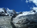
The Montagne de la Côte is a steep ridge separating the final tongues of the Bossons and Taconnaz Glaciers tumbling down from Mont Blanc and Le Goûter.
Historically, the route taken by Balmat and Paccard on their first ascent of Mont Blanc, this climb starts out pleasantly winding through the forest, then onto grassy slopes, and finally into a more mineral setting, ending in a very high-mountain glacial atmosphere.
Flat ground and Charlanoz chalet in Les Houches
 8.42 mi
+4,157 ft
-2,789 ft
7h 30
8.42 mi
+4,157 ft
-2,789 ft
7h 30
 Difficult
Departure from Les Houches (Haute-Savoie)
Difficult
Departure from Les Houches (Haute-Savoie)
This hike takes you from Les Houches to La Charlanoz, via the Aiguillette des Houches, the Bellachat refuge, the summit of Brévent and Panpraz.Breathtaking views of the Mont Blanc massif and the Aiguilles Rouges massif.
⚠️ This route crosses the Aiguilles Rouges nature reserve. Please respect the regulations in force. See practical information.
Aiguillette des Houches and Bellachat Refuge
 6.42 mi
+3,091 ft
-3,097 ft
5h 40
Difficult
Departure from Les Houches (Haute-Savoie)
6.42 mi
+3,091 ft
-3,097 ft
5h 40
Difficult
Departure from Les Houches (Haute-Savoie)
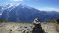
Located at the southern end of the Carlaveyron National Nature Reserve, the Aiguillette des Houches offers an exceptional view of the Mont Blanc massif. You can enjoy these magnificent panoramas all the way to the Aiguillette du Brévent. Further east, the terrace of the Refuge de Bellachat offers another superb view, particularly of the Aiguille du Midi, only 6 km away.
⚠️ This route crosses the Aiguilles Rouges nature reserve. Please respect the regulations in force. See practical information.
Tour des Aiguilles Rouges: Bellachat Refuge - Servoz
 7.13 mi
+738 ft
-5,105 ft
3h 55
7.13 mi
+738 ft
-5,105 ft
3h 55
 Moderate
Departure from Chamonix-Mont-Blanc (Haute-Savoie)
Moderate
Departure from Chamonix-Mont-Blanc (Haute-Savoie)
Fifth and final stage of the Tour des Aiguilles Rouges.
This stage offers panoramic views of the Mont Blanc massif and its glaciers, the Contamines valley and Les Fiz. The descent is through forest.
From Les Houches to the Refuge de la Balme
 15.34 mi
+4,954 ft
-2,654 ft
11h 20
Difficult
Departure from Les Houches (Haute-Savoie)
15.34 mi
+4,954 ft
-2,654 ft
11h 20
Difficult
Departure from Les Houches (Haute-Savoie)
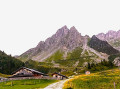
This sixth stage of the GTA GR®5, which is shared with the GR® TMB, takes place in the Mont Blanc massif and then the Beaufortain massif. From Les Houches, the route follows the Maison Neuve chairlift and reaches the Terrain chalets before climbing up to the Col de Voza. The GR®5 descends due south along a wide path towards the Refuge du Fioux and then reaches the hamlet of Bionnassay. It crosses the Torrent de Bionnassay valley and turns sharply westwards before reaching the hamlet of Champel. From there, the path heads south to reach La Gruvaz, from where it descends westwards into the Bon Nant stream, which it crosses to run along the left bank towards the south. It returns to the right bank, passes through Les Contamines-Montjoie following the stream’s axis due south, and goes past the remarkable chapel of Notre-Dame de la Gorge. Continuing to follow the Bon Stream valley, the GR®5 climbs to a natural bridge and crosses a gorge at the Pont Romain de la Téna to reach the Refuge de la Balme.
Tour Mont Blanc in 11 stages
 Association / Club / Walk leader101.99 mi
+36,204 ft
-35,778 ft
11 days
Difficult
Departure from Les Houches (Haute-Savoie)
Association / Club / Walk leader101.99 mi
+36,204 ft
-35,778 ft
11 days
Difficult
Departure from Les Houches (Haute-Savoie)
The Tour Mont Blanc (TMB) is a classic long-distance footpath that goes around Mont Blanc, passing from France into Italy and through Switzerland before returning to France. These 11 stages are one way of doing it but you can make your own version of the TMB. The classic route begins and ends in Les Houches and takes an anticlockwise direction around Mont Blanc and the adjacent peaks. There is a total of 164 km (102 miles) walking these 11 routes and a positive height gain of over 10,000m. Certainly a challenging adventure but well worth the effort. Let's do it!
⚠️ This route passes through nature reserves. Please respect the regulations in force. See practical information.
Les Houches to Les Contamines - Tour Mont Blanc
11.93 mi
+3,212 ft
-2,667 ft
8h 15
Difficult
Departure from Les Houches (Haute-Savoie)
This 1st stage of the Tour Mont Blanc (TMB) is possibly the toughest but the adrenaline is pumping and short-cuts are not on the agenda. Let's do it!
The TMB is a classic long-distance footpath that goes around Mont Blanc, passing from France into Italy and through Switzerland before returning to France.
Chamonix - Zermatt
 117.32 mi
+43,858 ft
-41,952 ft
14 days
Difficult
Departure from Chamonix-Mont-Blanc (Haute-Savoie)
117.32 mi
+43,858 ft
-41,952 ft
14 days
Difficult
Departure from Chamonix-Mont-Blanc (Haute-Savoie)
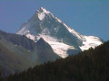
This legendary route connecting these two resorts renowned for skiing and mountaineering is very demanding. It requires excellent physical condition. You will hike through spectacular scenery, starting at the foot of Mont Blanc and ending opposite the Matterhorn. You will pass numerous peaks over 4,000 metres high, such as the Weisshorn and the Dent Blanche d'Hérens.
For more walks, use our search engine .
The GPS track and description are the property of this route's author. Please do not copy them without permission.

