The Gorges de la Frau

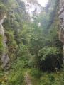
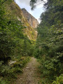
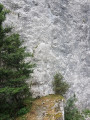
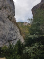
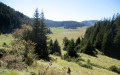
A lovely walk up through these gorges between impressive vertical cliffs, reaching Comus on a plateau that leads to Espezel and Quillan to the east and to Montaillou, Prades and Ax-les-Thermes to the south-west.

Details

102283670
Creation:
Last update:
Last review:
  • Walking
    Activity: Walking
  • ↔
    Distance: 6.83 mi
  • ◔
    Average duration: 4h 40 
  • ▲
    Difficulty: Moderate

  • ⚐
    Back to start: Yes
  • ↗
    Ascent: + 1,729 ft
  • ↘
    Descent: - 1,699 ft

  • ▲
    Highest point: 3,848 ft
  • ▼
    Lowest point: 2,270 ft

Photos

Description of the walk

To reach the starting point: coming from Bélesta, turn left at Barrineuf to follow the D5. At the Fork in the road, keep left until you reach the car park.

(S/E) Continue along the D5 to its end.

(1) Take the path straight ahead which climbs (GR®7B, GR®107, GR®367). Walk up the Gorges de la Frau, keeping to the left of the River Hers. Continue until the path joins a forest track at an elevation of 1,041 metres.

(2) Turn left towards Comus and Camurac.

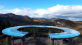
(3) Once you reach Comus, enjoy the view over the start of the plateau and the picnic tables. Return along the same route you took on the way there to the car park by the river (S/E).

Waypoints

  1. S/E : mi 0 - alt. 2,270 ft - Car park by the - Hers (rivière) à finaliser
  2. 1 : mi 0.15 - alt. 2,339 ft - End of the D5
  3. 2 : mi 1.42 - alt. 3,419 ft - Junction with forest track
  4. 3 : mi 3.42 - alt. 3,848 ft - Comus
  5. S/E : mi 6.83 - alt. 2,274 ft - Car park by the - Hers (rivière) à finaliser

Notes

(S) to (2) A steady climb for 2.5 km.

(2) to (3) Gently sloping forest track.

Drinking water at Comus

Worth a visit

Always be cautious and plan ahead when you're outdoors. Visorando and the author of this route cannot be held responsible for any accidents occurring on this route.

The GR® and PR® markings are the intellectual property of the Fédération Française de Randonnée Pédestre.

Other walks in the area

For more walks, use our search engine .

The GPS track and description are the property of this route's author. Please do not copy them without permission.