Les Concluses de Lussan- Le Merderis

There is a lot to see in Lussan. Start with the clear waters of the narrows at the Portail des Concluses and carry on to the Pierre Plantée standing stone. You will be delighted by a breathtaking view of the Cévennes and will cross the scrubland on varied terrain to the Table des Turcs dolmen. Eventually you arrive at La Lèque, which is an ideal spot for a lunchbreak. The last few kilometres are on wide lanes, leading back to the first section of the route.

Technical sheet

224601
Creation:
Last update:
Last review:
  • Walking
    Activity: Walking
  • ↔
    Distance: 14.69 km
  • ◔
    Average duration: 5h 20 
  • ▲
    Difficulty: Difficult

  • ⚐
    Return to departure point: Yes
  • ↗
    Vertical gain: + 397 m
  • ↘
    Vertical drop: - 397 m

  • ▲
    Highest point: 304 m
  • ▼
    Lowest point: 136 m

Photos

Description of the walk

Access: From the village of Verfeuil, head down the D143 towards Lussan. At the intersection, continue right towards Les Concluses. Park in the second car park at the top of a narrow tarmac road. Warning! Do not leave anything in your cars.

(S/F) From the car park, facing the Concluses, head right on the track leading down to the Portail des Concluses.

(1) Pass by the viewoint over Aiguillon stream (there are several in this section) and carry on downhill.

(2) At Portail des Concluses, take in the beauty of the site, especially in the spring, when there is plenty of water in the stream. Cross the wooden footbridge and bear left.

(3) After an uphill section of path, you'll need to climb a few rocks or steps in the rock (more tiring than technical) before reaching a hillside where a rope handrail provides reassurance. Take time to enjoy the view from the path along the Aiguillon and continue into Combe de Queue de Boeuf valley, partly on a path through undergrowth.

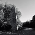
(4) At the junction, head right towards the Pierre Plantée menhir. When the path peters out, head right, up a stony section, followed by a narrow path which winds its way to the menhir.

(5) Pass to the right of the menhir, turn off to the right after 50m and continue through the scrub towards Merderis and Méjannes-le-Clap. A few steps further on, on the plateau, you have a view of the whole range of the Cévennes.

(6) Follow the ridgeline down on a stony path with limestone rocks (watch your step) reaching a "stairway" of wooden poles and ending in the bed of the Merderis.

(7) Head left along the dry riverbed towards the Combe de Ruph valley. About a hundred metres later, bear right on a path which climbs through the woods towards the dolmen of the Table des Turcs.

(8) The rocky path passes through rather curious undergrowth, where the trees seem bearded with moss. Carry on, ignoring several paths to the left.

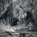
(9) At the fork, bear left towards the Table des Turcs, which is only about a hundred metres further on. You come to the dolmen and the Merderis caves (not shown on the IGN map). Carry straight on to the Le Quarton junction.

(10) Turn left and carry straight on at each intersection to reach the hamlet of La Leque.

(11) At the hamlet, ignore the road to the right which leads to the D979 and continue straight ahead due south-east.

(12) At the intersection, go left, ignore two trailheads to the left and continue to a fork.

(13) Bear right, then turn into the first track on the left reaching a wide dirt road.

(14) Turn left, then right at the next fork and stay on this road until a multiple intersection.

(15) Bear left and continue to Combe de Queue de Boeuf.

(4) Turn right and retrace the first part of the outward route, via the Portail des Concluses, to reach the car park from which you set out. (S/F).

Waypoints

  1. S/E : km 0 - alt. 234 m - 2nd car park on the tarmac road
  2. 1 : km 0.28 - alt. 229 m - View of l'Aiguillon
  3. 2 : km 1.11 - alt. 140 m - Portal of the Concluses
  4. 3 : km 1.31 - alt. 190 m - Tricky passage
  5. 4 : km 2.23 - alt. 229 m - Fork, turn right
  6. 5 : km 3.05 - alt. 301 m - Menhir de la Pierre Plantée
  7. 6 : km 3.52 - alt. 291 m - View of the Cévennes
  8. 7 : km 3.98 - alt. 194 m - Turn left
  9. 8 : km 4.55 - alt. 221 m - Mossy undergrowth
  10. 9 : km 5.54 - alt. 257 m - Combe de Ruth" fork, turn left
  11. 10 : km 6.43 - alt. 304 m - Le Quarton" fork, turn left
  12. 11 : km 8.36 - alt. 261 m - "La Lecque" Proursuivre Direction "Le Portail des
  13. 12 : km 8.94 - alt. 285 m - Turn left
  14. 13 : km 9.59 - alt. 299 m - Intersection turn right
  15. 14 : km 10.07 - alt. 295 m - Intersection turn left
  16. 15 : km 11.34 - alt. 288 m - "Le Plan du Boeuf" turn left
  17. S/E : km 14.69 - alt. 234 m - Second car park on the tarmac road

Practical information

(3) Care is needed on this section, which involves some scrambling up rocks or steps in the rock. Shortly after, a rope handrail affords assistance on a section close to the edge. Take the usual precautions, especially if accompanied by children.__

In the nearby area

(1) Viewpoint over the Aiguillon gorges
(2) The Portail des Concluses
(5) Pierre Plantée menhir

As you approach (6), fine view of the Cévennes range

Between (8 and 9), damp undergrowth with trees draped in moss; Fontaine des Quatre Pattes waterfall

(10) Table des Turcs dolmen and Merderis caves

(11) La Lèque: a fine hamlet, ideal for a picnic

Reviews and comments

4.4 / 5
Based on 113 reviews

Reliability of the description
4.4 / 5
Clarity of route map
4.4 / 5
Route interest
4.6 / 5
User 25974488

Overall rating : 4.7 / 5

Date of walk : May 30, 2025
Reliability of the description : ★★★★★ Very good
Clarity of route map : ★★★★☆ Good
Route interest : ★★★★★ Very good
Busy trail : No

A MUST-DO!! We only saw two people during our hike. The trails were well maintained and it was a beautiful walk. Do as we did and wear hiking boots, as they are safer in some places. Allow at least 5½ hours (including a snack break).

Automatically translated

Eric 07
Eric 07

Overall rating : 5 / 5

Date of walk : May 16, 2025
Reliability of the description : ★★★★★ Very good
Clarity of route map : ★★★★★ Very good
Route interest : ★★★★★ Very good
Busy trail : No

Superb hike with lots of things to see the magnificent concluses the planted stone and the table of the Turk varied circuit but still difficult the passage in edge of cliff is in my opinion not difficult even for the people who fear the vertigo because it is equipped with ropes with the passage on the other hand the difficulty comes from certain portions of climbing where it is necessary to put the hands and two descents made difficult between the rocks thank you because the trace is reliable beautiful course

Automatically translated

marcosolo84
marcosolo84

Overall rating : 4.3 / 5

Date of walk : May 18, 2025
Reliability of the description : ★★★★☆ Good
Clarity of route map : ★★★★☆ Good
Route interest : ★★★★★ Very good
Busy trail : Yes

A lovely walk to do in spring or autumn for the beauty of the waterfalls.
Very easy to follow yellow signposts.

Automatically translated

ed102
ed102

Overall rating : 4.7 / 5

Date of walk : May 11, 2025
Reliability of the description : ★★★★★ Very good
Clarity of route map : ★★★★★ Very good
Route interest : ★★★★☆ Good
Busy trail : Yes

Beautiful when there's water. In my opinion, the loop up to the menhir is the most beautiful. After that, virolots in the heath.

Automatically translated

JP Bariteau
JP Bariteau
• Last modified:

Overall rating : 4.7 / 5

Date of walk : Apr 03, 2025
Reliability of the description : ★★★★★ Very good
Clarity of route map : ★★★★★ Very good
Route interest : ★★★★☆ Good
Busy trail : No

We only walked the trail from the car park to the Table des Turcs and back. It's quite tough physically, especially the climb from the Portail to the combe above, and especially the section that descends into the Merderis riverbed. It's best to have good shoes and avoid hot weather. But the route is very well signposted and very pleasant indeed. A great spring hike!

Automatically translated

maryljoe
maryljoe

Overall rating : 4.7 / 5

Date of walk : Mar 30, 2025
Reliability of the description : ★★★★★ Very good
Clarity of route map : ★★★★☆ Good
Route interest : ★★★★★ Very good
Busy trail : No

What a wonderful discovery this hike was. I totally escaped.

Automatically translated

peliber
peliber

Overall rating : 5 / 5

Date of walk : Mar 09, 2025
Reliability of the description : ★★★★★ Very good
Clarity of route map : ★★★★★ Very good
Route interest : ★★★★★ Very good
Busy trail : No

Everything was perfect for me,
I would recommend

Automatically translated

jpgarand
jpgarand

Overall rating : 4.3 / 5

Date of walk : Oct 13, 2024
Reliability of the description : ★★★★☆ Good
Clarity of route map : ★★★★☆ Good
Route interest : ★★★★★ Very good
Busy trail : No

We go hiking during the week
The Gorges de l'aiguillon is a very beautiful walk...
We particularly like the Concluses portal
It's still a sporty hike if you do the part after the Concluses gate (imposing rocks and chain to hold on to). Then you have to climb back up to the Menhir. A part that, given our 76 and 75 springs, we've done away with...
Because you can do the Menhir from the Leque on both sides... Table des Turcs, etc. These walks around the Concluses and the Menhir can be varied as you wish.
We invite you if you are in shape to explore these magical places...
Enjoy your hike
Hiking greetings
MjJp

Automatically translated

bernard coulomb
bernard coulomb

Overall rating : 4.5 / 5

Date of walk : Sep 11, 2024
Reliability of the description : N/A
Clarity of route map : ★★★★★ Very good
Route interest : ★★★★☆ Good
Busy trail : No

The first half of the trail is an athletic one, complete with superb megalithic objects, menhirs and imposing dolmens.
The rest of the route is much more traditional, more like a simple walk in the forest.
No problem with GPS.

Automatically translated

Saperes
Saperes

Overall rating : 5 / 5

Date of walk : Jun 23, 2024
Reliability of the description : ★★★★★ Very good
Clarity of route map : ★★★★★ Very good
Route interest : ★★★★★ Very good
Busy trail : No

A very nice walk
It's a pity that the concludes were dry

Automatically translated

Le Celte 07
Le Celte 07

Overall rating : 4.7 / 5

Date of walk : May 24, 2024
Reliability of the description : ★★★★★ Very good
Clarity of route map : ★★★★☆ Good
Route interest : ★★★★★ Very good
Busy trail : Yes

The walk itself was not very busy, but on the way back there were lots of people (bathers and walkers) at the stream. Beautiful walk with magnificent views.

Automatically translated

Jacky Anx
Jacky Anx

Overall rating : 5 / 5

Date of walk : Jun 16, 2024
Reliability of the description : ★★★★★ Very good
Clarity of route map : ★★★★★ Very good
Route interest : ★★★★★ Very good
Busy trail : No

A very nice walk. 17.5 km in fact
I loved it

Automatically translated

dobartek
dobartek

Overall rating : 4.3 / 5

Date of walk : Jun 01, 2024
Reliability of the description : ★★★★☆ Good
Clarity of route map : ★★★★★ Very good
Route interest : ★★★★☆ Good
Busy trail : No

Another hike on 2 June. I lead a group of 6 people. Everyone enjoyed it. a few tricky sections. the end by the DFCI is a bit monotonous but encourages discussion.
Done in 5h30.
thanks for the route

Automatically translated

yvesrieder
yvesrieder

Overall rating : 5 / 5

Date of walk : May 26, 2024
Reliability of the description : ★★★★★ Very good
Clarity of route map : ★★★★★ Very good
Route interest : ★★★★★ Very good
Busy trail : No

I did this walk on 23 May in fine weather, despite a few drops of rain that didn't bother us at all. I led a group of 10 people.
Everyone was unanimous in their praise of the walk. The scenery was magnificent, the route quite challenging in places, but very doable. A little adrenalin for some as we crossed the Aiguillon on the little footbridge. The beautiful hamlet of La Lèque, the astonishing Bois Barbu and the unusual Table du Turc.
The paths in the undergrowth are very pleasant against the sun. But, on the downside, they don't offer too many panoramic views. And even though the return journey from La Lèque uses wider, less interesting paths, it's quick and encourages chatter.
There were quite a few walkers between the car park and the gate.
All in all, a very nice walk. Many thanks to the author.

Automatically translated

Baluchons
Baluchons
• Last modified:

Overall rating : 4.7 / 5

Date of walk : Apr 17, 2024
Reliability of the description : ★★★★☆ Good
Clarity of route map : ★★★★★ Very good
Route interest : ★★★★★ Very good
Busy trail : No

A very pleasant walk with plenty of surprises. Perfect signposting. Thank you

Automatically translated

Other walks in the area

For more walks, use our search engine .

The GPS track and description are the property of the author. Do not copy them without permission.