


 Country:
 City:


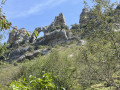
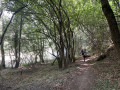
Orbaneja del Castillo is situated on the banks of the Ebro, halfway between Santander and Burgos. At km 60.5 of the N-623, which links Santander to Burgos, lies the village of Escalada, where you’ll take the BU-643 towards Orbaneja del Castillo. After 6 km, park in the well-shaded car park 3 just before the entrance to the village.
(S/E) Walk to the village of Orbaneja along the paved verge of the road. After enjoying the views of the Orbaneja waterfall and the Pozas de la Turquesa, turn right at the waterfall and take the steps leading up to the village. At the top of the steps, turn left to reach the square where the resurgence flows. Look out for Calle La Cuesta on the right, a little further up; take this road after visiting the resurgence, the Cueva del Agua, and tasting the crystal-clear, ice-cold water.
Retrace your steps and follow Calle Cuesta northwards. After 300 metres, near the church, look out for a signpost showing various possible routes.
(1) Leave the street and head left up the path signposted ‘Sendero de los Chozos de Orbaneja’, marked with white and yellow markings. The path makes a hairpin bend then climbs above the village and the Cueva del Agua.
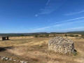
You’ll reach a windswept grassy plateau with a few holm oaks; this is the paramo, reminiscent of the high Andean altitudes. Then cross the village of Estilla, made up of chozos, which are stone shepherds’ huts.
(2) Continue straight on along the main track, leaving the signposted ‘Circuito de los Chozos’ route, which forms a large circular route before returning to Orbaneja.
You can shorten the walk to 5 or 6 km by taking this signposted path.
(3) Take the track on the left for about a hundred metres.
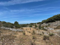
(4) Leave this track and head off-track due west into the páramo towards the valley floor of the Barranco de Valdelaguna. See photo labelled WP4
Look out for old cultivated areas bordered by low stone walls at the bottom of the valley. Descend into this small valley, following sections of animal tracks. Reach a junction with the Barranco de Vadecarril.
(5) Take the path opposite, which climbs uphill and is marked by cairns. Reach a Y-junction.
(6) Take the path on the left, following the cairns, and reach a Y-junction.
(7) Continue straight ahead, still following the cairns, until you reach a wider track.
(8) Turn right onto it and, immediately afterwards, at the top of the climb, you’ll come to a junction of tracks.
(9) Head downhill along the wide path on the left. The path joins a track.
(10) Carry on straight ahead and continue downhill until you reach a Y-junction.
(11) Keep to the right and stay on this track, ignoring the paths branching off to the right or left. You’ll reach the CA-275 road.
(12) Take care here: cross this busy road with caution. Cross the bridge over the Ebro straight ahead and head towards the village of Villaescusa de Ebro. Immediately after the bridge, turn left and follow the Ebro. This is the Camino Natural del Ebro,GR®99, marked in red and white. Follow the signposting through the village. On leaving the village, the road turns into a farm track. At the end of the track, in the next bend, you’ll reach the car park at the Cascada del Tobazo.
(13) Continue straight ahead along the path. The path curves in a wide ‘S’ shape, following the bends of the River Ebro.
(14) Leave theGR®99and head for the footbridge on your left.
Cross the Ebro, head back up onto the road and turn right at the side of the road. Pass the waterfall again and head for car park 3 at Orbaneja del Castillo (S/E).

 Visorando Member
 Easy


