Country:
 City:


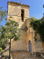
The charming village of Valdelateja is situated 60 km north of Burgos, on the N623 linking Burgos to Santander.
Vehicles are only permitted in the village if they belong to local residents. Park in the small white-gravel car park on the left-hand side of the road, just at the entrance to the village. See Practical Information.
(S/E) From the car park, walk down towards the village, passing the excellent Asador Santa Centola, then turn left onto the downhill street, Calle Ricardo Torriente. Cross the River Rudrón via the bridge and reach the junction a few dozen metres further on.
(1) Ignore the return route straight ahead and head left towards Bar Mesón. Turn right, walk past the Church of Santa Eulalia and head left towards the edge of the village. You will see the start of the path directly in front of you.
(2) This beautiful path, which is well shaded in its first section, initially follows the River Rudrón. It then reaches the confluence of the River Rudrón and the River Ebro, descending gently for about 3 km to reach the ruins of the footbridge opposite the El Porvenir power station on the opposite bank.
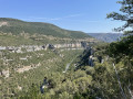
(3) Keep to the right bank. The path becomes narrower and wilder. It follows the bank of the Ebro for a while before climbing up to find a gap in the cliff above us, passing a magnificent tree whose roots encircle the rock and a sort of cave that must have served as a shelter in times long past. You’ll reach a terrace overlooking the River Ebro – “And in the middle flows a river” – though sadly without Brad Pitt....
Go past a low stone wall behind you, then continue along the edge of a wheat field to join theGR®99.
(4) There are two options:
1) Shorten the walk by heading straight towards Valdelateja on the right.
2) Visit the village of Cortiguera – the option chosen on the map and described here.
Turn left onto theGR®99towards Cortiguera along a well-shaded path. You’ll pass a drinking trough fed by a cool spring (I’m not sure if the water is safe to drink – there are no signs).
(5) A few metres past the trough, the path crosses a track, El Camino a Contiguera. Stay on the shadedGR®99path until you reach a Fork in the road just before the entrance to the village.
(6) Ignore the path on the right (the return route) and continue towards the church, which you can see in the distance. You’ll reach the centre of the village, where you’ll see the ruined church and a few beautiful houses.
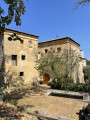
(7) Just past the church, turn right onto Calle Major until you reach a beautiful house proudly displaying coats of arms and crests near a fountain – which, sadly, no longer flows – much to the delight of the amphibians. Walk down past this house and return to the junction at the village entrance.
(6) Head back along theGR®99in the opposite direction to rejoin the path leading up the canyon that you took on the way there.
(4) Continue straight on along theGR®99, a pleasant path in the shade of holm oaks, which joins a track. After a few hundred metres, look out for a path on the right leading to a viewpoint.
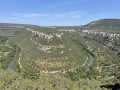
(8) What a beautiful view of this circular bend in the Ebro! Return to the track and follow it for about 100 metres.
(9) TheGR®99leaves the track and takes a well-signposted path on the right; after a few hundred metres across the plateau, a steep descent towards Valdelateja begins. The slope levels out and the village soon comes into view. Return to the junction of the circular route and Calle Ricardo Torriente (opposite, you can treat yourself to a refreshing break at Café Mesón).
(1) Take Calle Ricardo Torriente, cross the bridge and head back up towards the car park (S/E).

 Visorando Member
 Moderate