Country:
 City:
City:


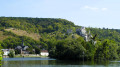
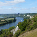
Park on Rue Saint-Jacques, the starting point of the walk.
There is also a car park at the junction of Rue Saint-Jacques and the D9.
PR® (yellow markings)
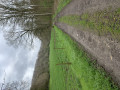
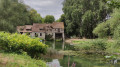
(S/E) To the right of number 36bis on Rue Saint-Jacques, head between the stone walls into the Promenade des Prés. Pass through the wooden gates, then under an old bridge before walking alongside the Rivière du Grand Rang. After crossing several streets, you’ll reach a T-junction with Rue des Déportés Martyres.
Unmarked section
(1) Turn right, cross Boulevard de la République (pedestrian crossing on the right) to reach the pavement on the opposite side. Turn left, staying on this pavement until the next junction. Turn right onto Rue de la Libération, then immediately left onto Boulevard de Verdun, to walk alongside the river. Pass two streets on the left and head for the Sainte-Clothilde Fountain at the third. Cross the river via the footbridge opposite the fountain, then turn left onto Rue Dumont. Follow the first street on the right, towards the cemetery, until you reach a left-hand bend at the funeral parlour (on your left).
(2) Leave Rue du Cimetière and head up to the right onto Chemin du Val Saint Jean. It runs alongside the cemetery at the edge of the woodland, then skirts the field at the edge towards a mobile phone mast. At the junction with Sente Coucoux, turn left along the fence, past the mobile phone mast and then the sports grounds, until you reach the road. Turn right between a football pitch and a baseball ground.
GR® (red and white markings)
(3) Follow the road, which passes the entrance to the sports centre, then crosses through the woodland. As you emerge from the woodland, at the bend, continue straight on towards the car park. Take the path that descends steeply to the left, rejoining the road a little further down, at another bend.
Unmarked route
(4) Cross the road and continue straight ahead onto the path branching off to the right, towards Château Gaillard. At the concrete-slab path, turn left and continue to the sign marking the start of the Chemin du Genévrier on your left (see information board).
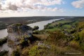
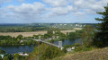
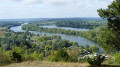
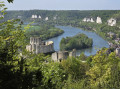
(5) Ignore the return route straight ahead; turn left onto this path, marked by wooden posts topped with blue signs, alternating between direction arrows and numbers. Throughout this route, stay on the main path, ignoring all side paths. Halfway along, there is a panoramic view of the circular bend in the Seine, the Île des Trois Rois, Port Morin and the road bridge spanning the two banks of the Seine.
(6) Then turn sharply left into an area that gradually becomes less wooded and then grassy, before heading back down towards the château. When you reach the concrete path, turn left, passing the start of the Sentier du Genévrier that you encountered earlier.
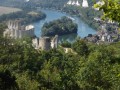
(5) Continue straight on until you reach the wooden viewing platform overlooking the Seine, which features information boards.
(7) Descend from the platform via the stairs, turn left, then left again onto the first path at the foot of the ruins, until you reach the next junction. Turn immediately right to climb up onto the embankment behind the wall with openings in it. Walk past the well, then along the foot of the access ramp to the keep, to reach a second wooden platform featuring information panels.
(8) Walk down to the junction of the paths (sign on the left). Turn left onto the path (to the left of the sign) which gradually leads into the woodland, before descending back towards the road.
GR® (red and white markings)
(9) Walk down to the left along the road until you reach a junction. Turn left onto Rue Richard Cœur de Lion, then left again onto the pavement of Rue Philippe Auguste, until you reach the pedestrian crossing. Cross the road and take the small Rue de la Grâce de Dieu opposite to reach the banks of the Seine.
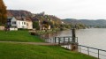
(10) Turn right onto Quai Grimoult, then take the footpath/cycle path which runs to the left of the trees, before continuing along the Seine. Walk to the very end of the quay, to the junction with Rue de Penthièvre. Turn left to cross over the Grand Rang, until you reach the next junction.
(11) Turn right onto Rue de l’Hospice, continuing until you reach Route des Falaises. Cross this road carefully to reach the embankment on the other side. Turn right onto the footpath, then walk alongside the car park until you reach the start of the climb up the hillside (on your left).
Please note: the section of the route between (12) and (14) features steep sections and is not recommended in wet weather.
(12) After an initial flight of steps and a few bends amongst the trees, continue climbing alongside a living hedge through an open area. Then descend alongside a wire fence and continue through a more wooded area. The path then winds its way through a series of ascents, descents and bends, following the contours of the terrain. Just above the Roche de l’Ermite, note the entrance to a cave dwelling.
(13) The path turns at a right angle to the right before continuing on its way. On this section, make sure to stay on the main path, ignoring the side trails on either side. Descend gradually to reach a T-junction, situated just above a tarmac road. Turn sharply left and continue the descent for a few dozen metres until you reach this road.
PR® (yellow markings)
(14) Turn right onto Chemin de la Fontaine. At the Fork in the road, veer left to follow the wide path which climbs into the Bois du Thuit. At the Source Saint-Martin (former wash house), turn left. Carry on straight ahead until you reach the D126. Take it to the left, follow it along and enter Le Thuit; continue to the T-junction. Cross with care.
GR® (red and white markings)
(15) Turn left, walk alongside the property whilst staying on the verge of the Route du Thuit. Take the first path leading off to the right along the field, before turning left. Join the D126. Cross it carefully to take the path opposite, which descends below the road, before crossing it again. Cross it carefully once more, then continue downhill until you reach it again. Follow it downhill to the junction with the D313 (Route du Muids).
PR® (yellow markings)
(16) Turn right along the road, cross at the pedestrian crossing and take the first path on the left. This runs alongside “Les Domaines de Gaston”. Turn left again to walk alongside the Seine. Continue in this direction along Quai Enguerrand de Marigny, then straight on along Rue de Penthièvre until you reach the junction. Return to Rue Saint-Jacques and the car park (S/E).
 Visorando Member

 Moderate
 Easy
Easy  Association / Club / Walk leader