Leabrooks

This walk around the small village of Leabrooks and surrounding areas traces the connections of the town to the Pentrich Rising of 1817.

The Pentrich Revolution started in South Wingfield and Pentrich, but many of the surrounding towns and villages also had men that took part in it. It was a classic case of government entrapment for which three men were executed and another fourteen transported to Australia.
The men were encouraged to rise under the assumption that many thousands of men from other counties were rising to take down an unfair system of governance.
The agent provocateur William Oliver had visited several other counties with the story that seventy thousand men in London were depending upon them to join forces.

This is Walk 25 of The Pentrich Revolution Walks.

Details

104596820
Creation:
Last update:
Last review:
  • Walking
    Activity: Walking
  • ↔
    Distance: 3.47 mi
  • ◔
    Average duration: 1h 40 
  • ▲
    Difficulty: Easy

  • ⚐
    Back to start: Yes
  • ↗
    Ascent: + 118 ft
  • ↘
    Descent: - 141 ft

  • ▲
    Highest point: 492 ft
  • ▼
    Lowest point: 384 ft

Photos

Description of the walk

Start: Car parking at the Crays Hill Park (note gates close at 4pm) SK 41420 53420

(S/E) From the car park, follow the path along the edge of the park, passing behind the cricket pavilion until you reach the road, Sleetmoor Lane. Cross the road taking care with the traffic, and follow the path into the woods and round to the left. At the junction of paths, turn right and walk down the hill along the edge of the woods. (A)

(1) Just before you reach the road, turn right and follow the broad path as it climbs gently back through the woods. The path levels out and at the next junction of paths, turn left and after a few yards turn right. This path passes beside a gate and heads along the track past the allotments to reach Sleetmoor Lane. (B)

(2) Cross the road taking care with the traffic and turn right. After approximately 100 yards, turn left along a farm road. As the road turns to the right, continue ahead to the stile. Cross the field keeping the hedge on your left and through the kissing gate. Continue along the left side of the field and then turn left along the track with Leabrooks cemetery on your right. (C)

(3) When you reach the road, turn right along Bridle Lane. At the junction with Swanwick Road, turn left and cross the road at the traffic lights. Turn right and head back along the road until you reach the bus stop opposite Bridle Lane. Turn left down the alley and then right onto Hathersage Drive. At the road junction, turn left along Devonshire Drive and continue up the hill on Peak Avenue. (D)

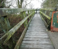
(4) At the top of the hill, as the road goes around to the left, turn right along the narrow alleyway and cross the footbridge over the old Swanwick Railway line. Continue along the path keeping the hedgerow on your right. After five fields, just as you reach the stile in the fence, turn right through the large gate and head to your right diagonally down the field to reach a stile in the far corner and turn left along Turners Lane. (E)

(5) At Cray's Hill, cross the road taking care with the traffic, turn left and after about 100 yards turn right along Broadway. Take the second road on the right, Windsor Close, and follow the path to the left between the houses. Head to your left diagonally up the field past the play area and follow the path on the right through the gap in the hedge. Once past the gardens, climb the bank on the left and turn right to follow the edge of the cricket pitch towards the pavilion and the start of the walk.(S/E)

Waypoints

  1. S/E : mi 0 - alt. 449 ft - Crays Hill Park car park
  2. 1 : mi 0.73 - alt. 407 ft - Path junction just before the road - turn right
  3. 2 : mi 1.28 - alt. 479 ft - Sleetmoor Lane - Turn right and cross
  4. 3 : mi 1.67 - alt. 479 ft - Bridle Lane - Turn right
  5. 4 : mi 2.3 - alt. 456 ft - Top of the hill - Turn right
  6. 5 : mi 3.07 - alt. 397 ft - Cray's Hill - Turn left
  7. S/E : mi 3.47 - alt. 449 ft - Crays Hill Park car park

Notes

Terrain: Easy walk on footpaths. Care is needed when crossing roads.

Parking: Crays Hill Park, car park DE55 1EG

Transport: Nearest bus stop is Crays Hill

Start: Car parking at the Crays Hill Park (note gates close at 4pm) SK 41420 53420

Worth a visit

(A) The march started on the 9th June 1817 from South Wingfield and progressed through Pentrich, Butterley, Ripley, Codnor, Langley Mill, Eastwood and into Giltbrook, where the Hussars and local Magistrates were awaiting them all, informed by the statements of Oliver the spy. 28 men were arrested and taken to Nottingham’s Shire Hall.
After reaching Gilt Brook and retreating from the Hussars, the Pentrich revolutionaries headed back home to find special constables waiting in Riddings and Golden Valley woods to arrest them; any Leabrooks men that may have been included would also have discovered this.

(B) Many more men would be rounded up before the trials for High Treason would start in October of that year; the government thought that they had stopped all civil dissent, but the Chartist movement would soon follow on from this.

(C) Although no Leabrooks men were named in the court depositions, it didn’t mean none took part; they were active in this area when it came to frame breaking. Most Luddite attacks took place with the covert cooperation of the knitters. Maybe one attack was enough in Riddings to teach the hosier a lesson!

(D) 1817 Hampden Clubs: Leabrooks is close enough to the Alfreton Common meetings of the Hampden Club for it to have involved local people. It met at Peach’s public house, The Queen’s Head, and Job Walker called the meetings together. He had strong links to Thomas Bacon and even got Benbow, the ‘missionary’ from Liverpool, to come to speak at a meeting.

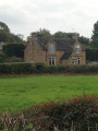
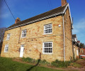
(E) From the top of the field you can see a large property to your right; this was Turner's farm. In 1740, Elizabeth Turner, the daughter of Robert Thoroton, the Nottingham physician and historian. When her husband John Turner died in 1726, she set up a small school which still stands and can be seen on your left as you walk up Turners Lane.
This school taught 20 poor children at a time, girls and boys, to read and write. This was over 100 years before the official schools for poor children were established and education became compulsory.

The children taught here from 1740 onwards would in turn have either sent their children to this same school or taught them the art themselves. This also explains why in a day and age that most people were only able to sign their name with a cross, the majority of the revolutionaries and their families could not only sign their names on their wedding certificates but could read and write coherently. See the letters from Australia with the correct spellings of large words. Education is a dangerous thing to a corrupt government that likes to keep people subdued. Was this one of the reasons this area was the chosen target of the government?

More information at the Pentrich and South Wingfield Revolution website here.

Other walks in the area

For more walks, use our search engine .

The GPS track and description are the property of this route's author. Please do not copy them without permission.