


 Country:

 City:
City:



Start from the motorhome park, Route de Fontienne (D12), in Saint-Étienne-les-Orgues.
(S/E) With your back to the car park, turn right and head towards the roundabout. Turn right onto Route de Panebière and follow the road to a four-way junction.
(1) Turn right towards Sisteron (D951) and follow this departmental road to Cruis. Enter the village and head for No. 65.
(2) Turn left (Chemin des Olivettes) and pass a wash house on your left. At the three-way junction, veer left, then continue along a track until you reach another three-way junction.
(3) Turn right and climb up to a track suitable for vehicles.
(4) Turn left, then right at the next junction, and follow the track until you reach the Carrefour de la Sapée.
(5) Continue along the track to the left, ignoring the side paths on either side, pass a building (Jas Neuf) on your left and reach a three-way junction.
(6) Turn right and climb up to the next junction.
(7) Turn left and continue uphill until you reach a three-way junction.
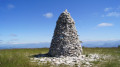
(8) Turn right (signposted ‘Cairn 2000’) and continue uphill, following the crest of the ridge to Cairn 2000.
(9) Cut left, off the path, and join the track. Follow it to the left until you reach the road at Pas de la Graille.
(10) Follow it to the left, continue towards the Lure radio masts and reach the Aire du Sommet de Lure.
(11) Reach the masts via the track branching off to the right.
(12) After enjoying the view, follow the ridge path towards two cairns, pass by the foot of the isolated antenna, then reach the road below and take it to the right. Pass through a small wooded area and reach a second one. Look for the start of a path on the left a few metres before the edge of the woods (signpost marking the start of the enduro mountain bike trail).
(13) Follow this path to the left, marked for mountain biking.
(14) At the fork, take the path on the right which descends to the left of the summit of the ridge. At the track, continue to the right, then turn onto a path on the left which descends until you reach a track. Continue the descent to the next fork.
(15) Turn right, cross over to the other side of the ridge and arrive at a junction.
(16) Turn right and continue along the hillside to Notre-Dame de Lure.
(17) From the chapel, take the path on the left and ignore the main track which joins the road. Follow the valley floor until you reach a fork in the middle of a clearing.
(18) Take the path on the right, then cross a track and reach the bottom of the next valley (Ravin du Pochon du Pommier). Continue downhill straight ahead and join a track.
(19) Follow this track to the right, cross a road twice and pass by the foot of a telecommunications mast. Continue straight on until you reach a junction at the end of the Chemin des Badasses.
(20) Carry on to the left, heading straight down the hill, until you reach the four-way junction you passed on the way there.
(1) Turn right, then, opposite the fountain, turn left onto the D12 and head for the motorhome site via the Saint-Étienne-les-Orgues route, then on to the motorhome site (S/E).

 Visorando Member

