The Sentier des Douaniers from Biriatou

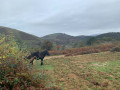
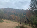
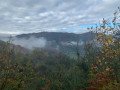
A round trip from Biriatou with a view over Lake Xoldokogaina (Lake Ibardin). The route skirts the Xoldo, which is the westernmost mountain in the French Pyrenees (Xoldokogaina means ‘the summit of the Xoldo’ in Basque).

Details

1987499
Creation:
Last update:
Last review:
  • Walking
    Activity: Walking
  • ↔
    Distance: 5.36 mi
  • ◔
    Average duration: 3h 30 
  • ▲
    Difficulty: Moderate

  • ⚐
    Back to start: Yes
  • ↗
    Ascent: + 1,220 ft
  • ↘
    Descent: - 1,220 ft

  • ▲
    Highest point: 1,037 ft
  • ▼
    Lowest point: 174 ft

Photos

Description of the walk

Head to Biriatou (D258) and park in the car park on Chemin des Écoles, below the town hall.

(S/E) Take the steps, cross in front of the church, follow the road to the left and continue to the edge of the village.

(1) Turn onto the path (GR®10) which heads uphill to the right, then very soon turn right again for about 200 m.

(2) Leave the road and follow the GR®10, which heads off to the right.

(3) Leave theGR®10by turning right before passing under the power line. The path winds southwards and rejoins theGR®10on a track suitable for vehicles.

(4) Follow it straight on until you reach a junction of three tracks.

(5) Leave theGR®®10, which heads into the forest, and keep left onto the track that climbs eastwards to the Col des Poiriers.

(6) Turn back, following the track in the opposite direction to the outward journey until you reach the junction you passed on the way out.

(4) Take the GR®10 on the right until you reach another junction you passed on the way there.

(3) Take the path opposite, following the reverse route of the outward journey, to return to the car park (S/E).


Waypoints

  1. S/E : mi 0 - alt. 174 ft - Car park below the town hall. Near the - Bidassoa (fleuve)
  2. 1 : mi 0.22 - alt. 233 ft - Three-way junction. Out and back
  3. 2 : mi 0.36 - alt. 328 ft - Path-road junction
  4. 3 : mi 0.57 - alt. 499 ft - Common junction for out-and-back route
  5. 4 : mi 2.04 - alt. 656 ft - Common junction for out-and-back route
  6. 5 : mi 2.14 - alt. 653 ft - Junction of three tracks. Round trip
  7. 6 : mi 2.74 - alt. 1,037 ft - Col des Poiriers
  8. S/E : mi 5.36 - alt. 174 ft - Car park below the town hall

Notes

Water point at the start.

Worth a visit

Near the pass there is a menhir.

Always be cautious and plan ahead when you're outdoors. Visorando and the author of this route cannot be held responsible for any accidents occurring on this route.

The GR® and PR® markings are the intellectual property of the Fédération Française de Randonnée Pédestre.

Reviews and comments

3.7 / 5
Based on 5 reviews

Reliability of the description
3.4 / 5
Ease of following the route
4.3 / 5
Route interest
3.5 / 5
Murielle Biez
Murielle Biez

Hello everyone
Personally, I didn’t have any trouble completing this walk. You just need to follow the GPS on the map carefully. As for the instructions, I found them very clear. I do this walk regularly.

Machine-translated

Hervé Bignon
Hervé Bignon

No mention is made of any signposting, as its presence is subject to change; this is a deliberate choice on the part of this app, which encourages users to rely on other methods for navigation.
The various route authors therefore follow this guideline.

I cannot find any mention of“the access road, which should be signposted 300 metres ahead” in my route description.

Nor is there any mention ofaforest track”.

Are you sure you’re commenting on a trip along this route and not another one (this has happened before)?

Machine-translated

dpangloy
dpangloy

That’s true... but at 77, old habits die hard: I prefer paper cards. I’ll just have to get used to it.
Thanks for your reply

Machine-translated

Hervé Bignon
Hervé Bignon

The great thing about Visorando is that it’s a GPS app that guides hikers along the route so they don’t get lost

Good luck next time

Machine-translated

dpangloy
dpangloy

Overall rating : 2 / 5

Date of your route : Apr 08, 2025
Reliability of the description : ★★☆☆☆ Disappointing
Ease of following the route : Not used / Not applicable
Route interest : Not used / Not applicable
Very busy route : No

We couldn’t find the start of the walk.
Firstly, theaccess road,which is supposed to be signposted 300 metres before the village. We initially looked for it after the village, where all the trails start. (The lower part of the village is too vague.)
Then the start of the path on the forest track isn’t signposted. There is, however, a sign for the Comète network, but as the guidebook didn’t mention it, we didn’t dare take it… in short, we had to give up.

Machine-translated

Danaso
Danaso

A lovely walk, where you come across walkers on the GR10.

Machine-translated

Lucjean
Lucjean

The first part of the route is easy to follow. We went as far as the dam but didn’t cross it as it was undergoing repairs. On the way back, the circular route through the forest is less obvious and, more importantly, there are a few short narrow and/or stony sections which are likely to be tricky due to the clay when the ground is damp. The village of Biriatou is picturesque and we enjoyed a cup of coffee at the café-hotel-restaurant.
To reach the dam (at the northernmost end of the lake), you need to extend the walk from marker no. 5 on the PDF map towards the lake.

Machine-translated

Hervé Bignon
Hervé Bignon

I’ve no idea where you’ve spotted a roadblock on this route.
Could you perhaps have confused it with another route?

Machine-translated

Lucjean
Lucjean

Overall rating : 3.7 / 5

Date of your route : May 11, 2024
Reliability of the description : ★★★★☆ Good
Ease of following the route : ★★★★☆ Good
Route interest : ★★★☆☆ Average
Very busy route : No

The first part of the route is easy to follow. We went as far as the dam but didn’t cross it as it was under repair. On the way back, the circular route through the forest is less obvious and, above all, there are a few short narrow and/or stony sections which must be tricky to navigate due to the clay when the ground is damp. The village of Biriatou is picturesque and we enjoyed a cup of coffee at the café-hotel-restaurant.

Machine-translated

gilles-riviere
gilles-riviere

Overall rating : 2.7 / 5

Date of your route : Aug 08, 2022
Reliability of the description : ★★☆☆☆ Disappointing
Ease of following the route : ★★★☆☆ Average
Route interest : ★★★☆☆ Average
Very busy route : No

Despite the rather vague directions, we think we followed the route correctly. There are some really lovely stretches through the forest off the beaten track, but others that are really not very interesting. There’s a ‘customs officers’ path’ which is signposted, but it doesn’t follow the same route all the way. What a shame!

Machine-translated

Murielle Biez
Murielle Biez

Overall rating : 5 / 5

Date of your route : Oct 25, 2021
Reliability of the description : ★★★★★ Very good
Ease of following the route : ★★★★★ Very good
Route interest : ★★★★★ Very good
Very busy route : No

A magnificent hike along the ridges and through the Pyrenees mountain range. A very easy hike.
At the end, we finished off with a drink at La Venta.
The trail wasn’t very busy that day.

Machine-translated

Speedsailing
Speedsailing

Overall rating : 4 / 5

Date of your route : Apr 12, 2021
Reliability of the description : ★★★★☆ Good
Ease of following the route : ★★★★★ Very good
Route interest : ★★★☆☆ Average
Very busy route : No

This route will be lovely once the traces of the last fire (February 2021, I think?) have disappeared

There aren’t many narrow paths, and they’re very easy to navigate apart from a few manageable sections of scree

Machine-translated

Other walks in the area

For more walks, use our search engine .

The GPS track and description are the property of this route's author. Please do not copy them without permission.