The Ourdinse plateau above Bedous

Discover the enormous plateau overlooking Bedous and its region on this circular walk. It is not only a mountain but also an important grazing area for livestock and an exceptional viewpoint over the entire mountain range. The diversity of the natural environments found here is remarkable.

Details

4213457
Creation:
Last update:
Last review:
  • Walking
    Activity: Walking
  • ↔
    Distance: 7.28 km
  • ◔
    Average duration: 4h 20 
  • ▲
    Difficulty: Moderate

  • ⚐
    Back to start: Yes
  • ↗
    Ascent: + 787 m
  • ↘
    Descent: - 785 m

  • ▲
    Highest point: 1,496 m
  • ▼
    Lowest point: 709 m

Photos

Description of the walk

Corrections after the route on 01/11/202...

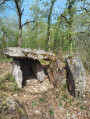
Park just after the orientation table and the Bedous geological area. You can continue a little further up the tarmac road, but it would be a shame not to take advantage of this exceptional point of interest! Please note: do not obstruct the road, as agricultural machinery sometimes passes by. Otherwise, park in the previous hairpin bend.

(S/E) The yellow-marked path starts at the end of the tarmac road, slightly to the right, signposted towards the Ourdinse hut. It starts as a sunken, shaded path that climbs quite steeply before veering slightly to the left (north) at the edge of a meadow and joining a signposted fork.

(1) Take the right fork. The path climbs steadily along the upper edge of the forest.

(2) At one point, the path passes through the undergrowth and leads to the "Font Larrun" spring, whose water quality is not guaranteed. At this point, take the left-hand path uphill and ignore the right-hand path which leads to Aydius (Chemin des Ardoisières). The path leaves the forest and reaches another fork. Turn left again and climb the winding slope before heading north-west.

You will then have to climb the entire grassy slope in a more or less zigzag pattern, but the path remains very well marked. Come out onto a ridge, then cross another grassy slope (see photos).

(3) At the first trees, the slope levels out and you just have to follow a small "suspended" valley and turn right at the end of it, sheltered by a few beech trees. Cross a small, rockier section and you will come out onto a pasture that is half rock, half grass, where the trail markers are less obvious; the Ourdinse hut is visible below on the right.

(4) You will see a ruined circular stone building with two wooden posts in the middle. Take the path that climbs slightly behind it.

(5) After about 150 metres, you will reach a path leading from the Ourdinse hut to the Casteruch hut.

Off the beaten track: it is very easy to climb the Pic des Taulères (about 15 minutes, 1,571 metres), which offers a sweeping panorama.

Climb a few more metres and you will reach the end of the ascent. Continue along the same path, which gradually turns and heads west. After a slight descent and a series of hairpin bends, the path heads straight for the Castéruch hut. Continue down the ridge, without veering towards the grassy slope on the left.

(6) When the ridge reaches a flatter area, at a fence, the path suddenly turns south and crosses the slope before winding downhill and rejoining the ascent route.

(1) All that remains is to follow the path you took on the way up, first through a meadow and then along a sunken path to return to the starting point (S/E).

Waypoints

  1. S/E : km 0 - alt. 709 m - Orientation table
  2. 1 : km 0.76 - alt. 886 m - Crossing the circular
  3. 2 : km 1.39 - alt. 975 m - Larrun fountain
  4. 3 : km 3.12 - alt. 1,436 m - Short descent
  5. 4 : km 3.46 - alt. 1,465 m - Ourdinse Hut
  6. 5 : km 3.58 - alt. 1,479 m - End of the ascent
  7. 6 : km 5.13 - alt. 1,091 m - Closure
  8. S/E : km 7.28 - alt. 711 m - Orientation table

Notes

This route takes place in the mountains. It should therefore only be undertaken with a minimum of organisation and equipment. See the comments posted by Visorandonneurs.

  • Wear good shoes (stony sections, trainers not recommended) and walking sticks
  • There is no water on this route: bring water bottles!
  • The climb is mostly in the sun: avoid doing it in the middle of summer, or do it very early in the morning.
  • Also avoid doing this hike in stormy weather (high risk of lightning on the plateau) or snowy weather (once covered with snow, the plateau can become difficult to cross). Do not hesitate to turn back!
  • In case of frost, the beginning of the descent (traverse path) can be quite slippery (north face). If this is the case, it is better to descend via the path you took on the way up.
  • Do not leave the trail on the plateau as this karstic area is quite difficult to navigate.

Worth a visit

Reviews and comments

4.5 / 5
Based on 15 reviews

Reliability of the description
4.4 / 5
Ease of following the route
4.2 / 5
Route interest
4.9 / 5
User 3162989

Overall rating : 4.3 / 5

Date of your route : Aug 25, 2025
Reliability of the description : ★★★★☆ Good
Ease of following the route : ★★★★☆ Good
Route interest : ★★★★★ Very good
Very busy route : No

We did this hike with four experienced walkers.
After a chaotic start (perhaps my description of the start was a little vague),
We found the path again with a little extra...
A very beautiful hike, but you do need to be in good shape!

Machine-translated

bobca
bobca

Thank you!
GPS is your friend

Machine-translated

User 25558877

Overall rating : 4.7 / 5

Date of your route : May 21, 2025
Reliability of the description : ★★★★★ Very good
Ease of following the route : ★★★★☆ Good
Route interest : ★★★★★ Very good
Very busy route : No

A very beautiful hike! The variety of landscapes, the panoramic view at the peak of Les Taulères and the presence of several herds give it a special charm.
Note that the trail is particularly narrow between markers 2 and 3, after leaving the undergrowth (where the trail is muddy, by the way). For this reason, and because of the considerable elevation gain, I would not risk taking children there.
The trail is not very well defined in the section before the Castéruch hut and marker 6.
For those who are motivated, it is possible to walk from the station to the orientation table, with a mixture of road and undergrowth

Machine-translated

bobca
bobca

For vertigo, ask yourself the question: if I fall, will I suffer serious injuries or not? In other words, is there a risk of sliding far down the slope?

Machine-translated

Annie64250
Annie64250

Overall rating : 4.3 / 5

Date of your route : Apr 05, 2025
Reliability of the description : ★★★★☆ Good
Ease of following the route : ★★★★☆ Good
Route interest : ★★★★★ Very good
Very busy route : No

it climbs right from the start. Nice shaded path.
narrow path on the hillside... may be difficult for those prone to vertigo.
the description is reliable on the way up.
On the descent, it's a little difficult to follow the route, as there are lots of paths close to each other and it's sometimes difficult to identify the right one.
Nice route and beautiful views. I recommend it.

Machine-translated

negre m
negre m

Overall rating : 4 / 5

Date of your route : Sep 12, 2024
Reliability of the description : ★★★★☆ Good
Ease of following the route : ★★★☆☆ Average
Route interest : ★★★★★ Very good
Very busy route : No

A very interesting hike because the plateau is magnificent. We saw horses and cows grazing freely.
The climb is long, and the section through the woods is slippery and rather poorly marked.
When we reached the plateau, we looked for the way back as we hadn't passed by the hut.
The return journey involves multiple S-bends, which is a bit long.
Overall, it's uphill and downhill all the time, but the view is superb.
This hike requires a bit of training and good physical condition.
In agreement with all the reviews.

Machine-translated

bobca
bobca

Hello and thank you,
The path has disappeared somewhat in the spring due to heavy vegetation growth, even though the summer was sunny.
For this reason (among others), it is strongly recommended that you follow the route using the Visorando app. If you don't have the IGN map, use OpenStreetmap rando, which is better than nothing.

Machine-translated

Zane
Zane

Overall rating : 4.3 / 5

Date of your route : Aug 08, 2024
Reliability of the description : ★★★★☆ Good
Ease of following the route : ★★★★☆ Good
Route interest : ★★★★★ Very good
Very busy route : No

Having the GPX track was really helpful because on the way back, there were times when we couldn't see any trace of the path at all. The scenery is magnificent.

Machine-translated

othilie L
othilie L

Overall rating : 5 / 5

Date of your route : Aug 23, 2024
Reliability of the description : ★★★★★ Very good
Ease of following the route : ★★★★★ Very good
Route interest : ★★★★★ Very good
Very busy route : No

A hike that I love. It climbs well and then descends well, but there are superb plateaus in between with shaded areas. Easy to follow with GPS on the Visorando app. And with a bit of luck, a sea of clouds will have arrived at the top.

Machine-translated

MICHEL.SOL
MICHEL.SOL

Overall rating : 5 / 5

Date of your route : Apr 20, 2024
Reliability of the description : ★★★★★ Very good
Ease of following the route : ★★★★★ Very good
Route interest : ★★★★★ Very good
Very busy route : No

Hike done clockwise as indicated at the car park. It's a little less steep... but it's still uphill. The return after the hut is not easy and the descent can be daunting. The signposting could do with a bit of updating. I've done this hike three times and this is definitely my preferred route. I've also recommended it to young people who were going up to camp on the plateau. There's a splendid view that can be enjoyed safely, preferably when there's no wind, on the ridge leading to Le Mouste.

Machine-translated

Dbt
Dbt

Overall rating : 4 / 5

Date of your route : Feb 06, 2024
Reliability of the description : ★★★★☆ Good
Ease of following the route : ★★★★☆ Good
Route interest : ★★★★☆ Good
Very busy route : Yes

We only did part of this route because of the fog. We did Bedous, Col de Piau, Point +882m, Cabane Castéruch and back. Despite the fog, we found the route well marked. Be sure not to take the detour leading to point 985m because the slope is more than 34% and there are rocks. We had a group that climbed Pic des Taulères via Cabane de Castéruch and descended via Cabane d'Ourdinse. It is best to descend this plateau in dry weather. Up there, it was above the cloud layer with bright sunshine. A magnificent sight.

Machine-translated

bobca
bobca

At this altitude, they are more like vultures. Kites tend to operate above fields...

Machine-translated

bobca
bobca

Thank you very much

Machine-translated

Marc_Aurele95
Marc_Aurele95
• Edited:

A very beautiful hike. It's quite a climb to the top, but the view is well worth the effort. The panorama from Pic des Taulères is magnificent.
We saw several kites (or vultures?) circling above us. Magical!
We also had a little trouble finding the path on the way down (not well marked!).
Bring plenty of water in summer, and possibly long clothing to avoid stinging nettles, brambles, mosquitoes, etc.

Machine-translated

bobca
bobca

OK for walking poles and shoes: these are necessary even for shorter hikes. It is the mountains, after all...

Machine-translated

Other walks in the area

For more walks, use our search engine .

The GPS track and description are the property of this route's author. Please do not copy them without permission.