Country:
 City:
City:


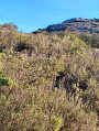
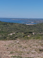
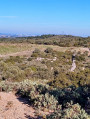
To reach the starting point, take the D114, which links Vic-la-Gardiole to Cournonterral. Halfway between the two main roads, at the highest point, park in the space marked ‘P’ at a place known as Parking de la Tortue, in its southern section (at the entrance to the nature trail), in the Gardiole State Forest, not far from the Bergerie de Saumade.
(S/E) Leave the car park heading south-east, take the path, walk 700 m until you reach a junction.
Turn left, reach a fork and turn right through 90°, heading south-east. Avoid all other exits and, from the 64-metre mark, proceed to a section.
(1) Turn right onto a descending path heading south-west, cross two streams, continue uphill then reach a cistern and a crossroads.
(2) Cross the track, take the left-hand track heading south-east, proceed along the “Combe Fourche” ridge and, at elevation 87, reach a section.
Turn right and pass a power line and its pylon. Stay on the path, avoid all side paths, and reach a crossroads at the bridge. Continue uphill and reach a three-way junction.
(3) Keep to the left, pass elevation 52 then continue downhill. Walk past the water reservoirs on your right, then follow the bends to reach a junction.
(4) Turn right and head up the steep climb. Walk past the vineyard on your left, reach a bend after the climb, and rejoin the path.
(5) Turn left and keep left, round a bend and reach a three-way junction. Walk left, heading south-west to south, along the track known as Chemin de la Jasse aux Chèvres; cross some copses and two streams through arid vegetation, walk past houses on your left, then rejoin a path.
Turn right (Chemin des Bois Communaux); after a climb, reach a junction.
(6) Turn left, heading west, cross a vineyard and reach a junction with three closely spaced paths. Continue straight on uphill, keeping to the right of the vineyards, ignoring all paths to the left, and at the corner of the field reach a junction.
(7) Cross the earth mound and reach a Fork in the road. Head left, keeping the vineyards on your left, cross through the undergrowth and, at a bend, reach a junction (towards the vineyards). Continue uphill to the right, then, in a bend, reach another Fork in the road. Turn left, go round a 90° bend to the right and rejoin a track.
Warning: in this section, the map does not correspond to the terrain; follow the directions.
(8) Turn left, continue along a right-hand bend, avoid all left-hand turn-offs, and reach a crossroads further up the slope. Turn left heading north-west, follow a straight stretch from the 219-metre mark and arrive at a three-way junction.
Turn right, reach a three-way junction, then turn left heading west. Join the DFCI track.
Warning: in this section, the map does not match the terrain; follow the directions given.
(9) Take the track opposite on thePR®® (yellow marker) between two trees, heading south-west. Continue along a long straight stretch, avoiding all side paths, then finish with a descent and rejoin the track.
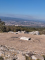
(10) Turn right; at elevation 145, you will come to a water tank and the crossroads. Take the path leading uphill at the cross and its memorial stone, climb a rocky slope, and cross the summit of Le Mouchas.
At elevation 196, carry on straight ahead and, at a right-hand bend, rejoin a section.
Carry on, cross the 166-metre contour line and a steep descent, cross a stream and then join the path. Turn right and rejoin a section of the path.
(11) Switch to the track below, cross a stream and pass under the high-voltage power lines, then head uphill to reach a junction.
(12) Take the track opposite, reach the 54-metre contour, climb up through Les Molières, avoid the turnoffs and reach a section.
(13) Turn right onto the track, follow the power line and pylon, keep the path on your left, pass the power lines and reach a path. Turn left, then head towards the cistern and the crossroads.
(14) Turn right onto thePR®® path (yellow markers), cross the Bois du Moulin de Faivre, follow the Roc de l’Aigle and reach a crossroads.
(15) Continue along thePR®® path (yellow signposts) to the right round the bend (elevation 190), avoiding all side paths, until you reach a section of track.
(16) Turn left onto the ascending track and, on a return leg, head to the Roc d’Anduze. Return along the track in the opposite direction and rejoin thePR®® path (yellow signpost).
(16) On your return, turn left heading north and reach a three-way junction.
(17) Turn left onto thePR®® path (Yellow signpost), avoid all the turn-offs and then reach a junction.
(18) Turn left downhill and reach a Fork in the road.
(19) Turn left and follow thePR®® (yellow markings), walking alongside a low wall on your right, and emerge onto the DFCI path.
(20) Turn left downhill, cross Monceau Abbey on your right and join the road. Continue along it, avoiding all turn-offs, until you reach a junction.
(21) Turn right, continuing uphill; avoid the turn-off to the left and reach a three-way junction. Turn right, head for the 160-metre mark and a section.
(22) Turn left downhill heading north-east. Keep to the left-hand side, passing Rulets and Cabanes; avoid all turn-offs to the right and the last one to the left, then reach a stream. Turn left, follow the stream and, at the signpost, come to a crossroads.
Turn right uphill onto thePR®® (yellow markings), pass a power line and, from the 117-metre mark, reach a three-way junction.
(23) Turn right, heading east to north-east; stay on thePR®® (yellow markings), follow a dry stone wall, avoid the turn-offs, then join a path. Turn left onto thePR®® path (yellow markings) and reach a crossroads. Turn right onto thePR®® path (yellow markings) and reach a three-way junction on a small patch of trees.
Keep to the left and, after 100 m, you’ll reach a section of track. Continue, cross a stream, follow the power line on your right, cross it via another stream, then reach the 127-metre contour and its crossroads.
(24) Continue along thePR®® path (yellow signposts), cross the power line whilst curving to the right, then, at a bend, reach the junction. Turn left uphill onto thePR®® path (yellow signposts) and reach a section of the path. Continue to the left along thePR®® path (yellow signposts) and reach the junction. Keep to the right and, at the bend, you will come to several turn-offs. Continue uphill along thePR®® path (yellow markings) until you reach a path crossing.
(25) Turn left, go round the 221-metre hill on the left, avoid the turn-offs to the left, cross an open area running south-east to east at the bend, then reach the junction.
(26) Turn left onto thePR®® path (yellow markings), pass the power line and its pylon, go round a fire brigade barrier at the side and reach the Gué de Pioch Camille Tower. Turn round, retrace your steps along the same route and return to the junction.
(26) Continue to the crossroads opposite the water tank and turn left downhill onto thePR®® path (yellow markings). Walk along the right-hand side of the Combe de l’Arbousier, ignoring any offshoots, and rejoin the path. Turn right onto thePR®® path (yellow markings) and stay on it until you reach a Fork in the road.
(27) Turn left, leaving thePR®® path, cross a side track, head into the woodland along the north-bound track and reach a junction. Turn right onto the path leading to the Bergerie de Saumade and the square.
(28) Take thesecond exit on the right, continue down the slope, cross a stream, reach the electricity pylon and arrive at the junction. Turn right, follow the road and the woodland path, and return to the car park (S/E).


 Visorando Member
 Difficult
 Moderate
 Association / Club / Walk leader

 Easy
Easy