


 Country:
 City:
City:


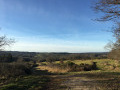
Park in the car park at the Clugnat municipal lake.
(S/E) From the car park, head to the road and follow it to the right until you reach the D11. Turn left onto this road and continue to the next junction by the stadium. Take the road on the left.
(1) At the next junction, continue to the right along the track leading to the hamlet of Domerange.
(2) When you reach the first houses, carry on along the path opposite, which winds its way up to the hamlet. Pass through the hamlet and continue straight on along the south-westerly track for about 1 km until you reach a junction with a road.
(3) Turn left onto this road and continue to the hamlet of Pradelette.
(4) Continue straight on, then turn left to pass through the hamlet and join the D11.
(5) Cross the D11 and continue along the path opposite, then quickly take the one on the right. Cross a stream and rejoin a road at a place called Le Moneyroux.
(6) Follow it to the right, then left, and cross the Verraux via the road bridge.
(7) Immediately afterwards, take the path on the left at the entrance to the hamlet of La Riberolle d’en Bas. Carry on straight ahead until you reach a road again. Walk 130 m straight ahead on the road to the right, then turn left onto the path. Carry on straight ahead. Pass through the hamlet of La Pignolle, then take the path on the left. Ignore a track on the right and continue to a fork in the road.
Shortcut at this point: see practical information. *
(8) Carry on straight ahead for approximately 1.7 km, crossing the Rio Bruzet, until you reach a T-junction.
(9) Turn right and then left. Continue straight on until you reach the D13,
(10) Turn left and immediately take the left-hand road heading west, then north, for about 600 m.
(11) Turn right onto the track, then left, and follow it due north. Continue straight on for about 1.2 km until you reach a junction with several paths.
(12) Keep slightly to the left and carry on to the hamlet of Gadoneix and the crossroads.
(13) Turn left, pass through the hamlet and carry on straight ahead at the end of the tarmac road for about 1.3 km. Join a road and follow it straight ahead to a crossroads.
(14) Turn left onto the road for 20 m, then take the track on the right for 300 m until you reach a fork.
(15) “This is the junction with the short route.” * Then turn right, heading north-west, and rejoin a road.
(16) Turn left onto this road, then immediately left again to follow the path that crosses the Georges Bridge. When you reach the road, head up to the right, then continue along the D11 and turn left to return to the lake and the starting point (S/E).


 Visorando Member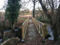
 Easy
Easy 
 Association / Club / Walk leader
 Very difficult
