Along the Marne–Rhine Canal from Hochfelden

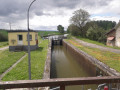
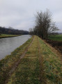
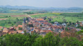
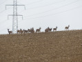
The first part of the walk takes you through fields, whilst the second part follows the canal.

Details

19275897
Creation:
Last update:
Last review:
  • Walking
    Activity: Walking
  • ↔
    Distance: 4.40 mi
  • ◔
    Average duration: 2h 05 
  • ▲
    Difficulty: Easy

  • ⚐
    Back to start: Yes
  • ↗
    Ascent: + 23 ft
  • ↘
    Descent: - 23 ft

  • ▲
    Highest point: 538 ft
  • ▼
    Lowest point: 509 ft
  • ⚐ Country: France
  • ⚐ City: Hochfelden (67270)
  • ⚑
    Start/End: N 48.754068° / E 7.567412°
  • Accessible from the train station Gare de Hochfelden.
  • ❏
    IGN map(s): Ref. 3715ET
  • Hour-by-hour weather

Photos

Description of the walk

Park in the car park at Hochfelden Stadium.

(S/E) Ignore the bridge over the Zorn and head towards the exit from Hochfelden.

(1) Turn right onto the dirt track opposite the one running alongside the football pitch and continue to the Marne–Rhine Canal.

(2) As you approach the towpath, turn right and continue until you reach a track suitable for vehicles.

(3) Turn 90° to the left and head for the bridge crossing the canal.

(4) Just before the bridge, turn left onto the towpath, pass a lock and continue straight on towards the next bridge in the direction of Hochfelden.

(5) Turn left immediately after the bridge, then cross the road to walk along the footpath and cycle path until you reach the starting point of the route.

(1) Follow the same route back to Hochfelden Stadium (S/E).

Waypoints

  1. S/E : mi 0 - alt. 515 ft - Hochfelden Stadium - Gare de Hochfelden
  2. 1 : mi 0.17 - alt. 515 ft - Junction for the out-and-back route
  3. 2 : mi 1.24 - alt. 515 ft - Junction. Near the - Zorn (rivière)
  4. 3 : mi 1.94 - alt. 522 ft - Junction on the road
  5. 4 : mi 2.15 - alt. 535 ft - Bridge - Canal de la Marne au Rhin
  6. 5 : mi 4.01 - alt. 525 ft - Turn left after the bridge
  7. S/E : mi 4.4 - alt. 515 ft - Hochfelden Stadium - Zorn (rivière)

Notes

Depending on the weather, make sure you wear suitable footwear.

Worth a visit

A remarkable tree and a bench halfway between Hochfelden and Wilwisheim.

Reviews and comments

4.1 / 5
Based on 3 reviews

Reliability of the description
4.3 / 5
Ease of following the route
4.3 / 5
Route interest
3.7 / 5
Feuilloman
Feuilloman

Overall rating : 4.7 / 5

Date of your route : Apr 18, 2024
Reliability of the description : ★★★★★ Very good
Ease of following the route : ★★★★★ Very good
Route interest : ★★★★☆ Good
Very busy route : No

A lovely little walk through the fields and along the canal. We were accompanied by birdsong as we walked through the fields. Very pleasant!

Machine-translated

Romain 67350
Romain 67350

Overall rating : 3.7 / 5

Date of your route : Sep 12, 2023
Reliability of the description : ★★★★☆ Good
Ease of following the route : ★★★★☆ Good
Route interest : ★★★☆☆ Average
Very busy route : Yes

A very pleasant walk along the water’s edge

Machine-translated

nenesse
nenesse

Overall rating : 4 / 5

Date of your route : Jun 05, 2023
Reliability of the description : ★★★★☆ Good
Ease of following the route : ★★★★☆ Good
Route interest : ★★★★☆ Good
Very busy route : No

A very pleasant walk along the canal; there were lots of storks in the fields lining the route – highly recommended

Machine-translated

Other walks in the area

For more walks, use our search engine .

The GPS track and description are the property of this route's author. Please do not copy them without permission.