Country:

 City:
City:



Starts from Mer station, accessible by TER on the line between Tours and Les Aubrais or Orléans.
‘Vélo’ (cycle) signs are present at major junctions.
(S/E) With your back to the station, head straight along Avenue du Maréchal Maunoury, taking the clearly marked cycle path on the right-hand side of the pavement.
(1) At the roundabout, cross the D2152, continue straight on towards the gendarmerie and immediately ignore a road on the right.
(2) Go round the next roundabout on the right and take the second exit towards the Loire à vélo cycle route.
(3) At the roundabout shortly afterwards, cross the D112 and turn right onto the cycle path running parallel to it.
(4) Shortly afterwards, turn left towards Blois. Continue straight on along the D112, which is on your right.
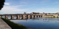
(5) Cross the D112 and immediately turn left towards Muides to take the bridge over the Loire on the cycle path on your right-hand side.
(6) On the other side, turn right onto Avenue de la Loire and enter Muides-sur-Loire.
(7) When you reach the church, turn left.
(8) Take the second right, into Rue du Tramway.
(9) At the Stop sign, turn left.
(10) Immediately take the first right, Rue de la Chaumette, towards Chambord. Carry on straight ahead. After the last few buildings, the tarmac gives way to a dirt track.
(11) Go through the small Porte de Muides to enter the Parc de Chambord and turn immediately right along the wall. Wind your way through the forest along a compacted track.
(12) Turn right and follow a long straight stretch through the forest.
(13) At the end, turn left.
(14) At the T-junction that appears shortly afterwards, turn right. Carry on straight ahead until you reach a road.
(15) Cross the road and continue along the path opposite towards Chambord.
(16) At the junction, go straight on and, at the Fork in the road that appears immediately, keep to the right. The silhouette of the Château de Chambord can be seen on the left.
(17) Just before the bridge, turn left towards the château and walk alongside the River Cosson on your right.
(18) Cross the road at the pedestrian crossing, continue along the path opposite and walk past the jetty.
(19) Immediately afterwards, cross the bridge over the river and you’ll arrive at a square.
(20) First turn left then right to go round the castle on the right, following a tarmac path. If it is busy, you should dismount.
(21) Pass in front of the castle’s main entrance, carry on a little further, then turn right to walk alongside the canal on your left.
(22) At the end, turn right, go through a wooden gate and pass a small car park on your right.
(23) You’ll come out onto the D33; follow it to the left. Carry on straight ahead for about 4 km and leave the Chambord Park behind. Continue straight on and enter Thoury.
(24) At the junction (with the church opposite), turn left onto the D22 towards Muides-sur-Loire and Crouy-sur-Cosson by bike.
(25) After about 1 km, before a sign marking the end of the 70 km/h speed limit, turn right onto the dirt track.
(26) At the junction, turn right and stay on the dirt track for a long stretch, passing between fields and ponds.
(27) At the Stop sign, follow the D33 to the left and turn immediately right to continue along a track.
(28) At the junction, turn left.
(29) At the Stop sign, go straight on towards Muides. Continue along the D33 until you reach a junction near Saint-Martin’s Church.
(30) Turn left onto the D103 towards Muides.
(31) Take the first right onto Rue Creuse.
(32) Ignore the CR16 which branches off to the left and carry on straight ahead. You’ll come to a dirt track.
(33) At the junction, turn right, staying on the dirt track.
(34) At the T-junction, follow the gravel track to the left. At the next junction, go straight on and rejoin the tarmac road.
(35) At the next junction, turn left onto Chemin de Chambord, towards Muides. Cycle through the forest and, at each junction, carry on straight ahead.
(36) After about 2 km, follow the small tarmac road to the right.
(37) After the first houses, turn left onto Rue des Grands Vergers. Turn right, ignore a turn-off on the right and turn left.
(38) At the end, turn right onto Rue de Bourges, cross a main road and carry on straight ahead.
(39) Go under a bridge and carry on along the gravel track. Soon after, turn left and follow the Loire at a short distance to your right.
(40) Pass a chicane, turn left and head uphill.
(41) Turn right twice, return to within a short distance of the Loire and ignore all the turnings on the left.
(42) At the fork in the road, keep left and take the path running parallel to the one-way street (ignore the path leading down to the right towards the Loire).
(6) At the junction you came across at the start of the route, turn right and cross the bridge over the Loire again, on the right-hand side.
(5) Continue straight on along the D112.
(4) Turn right.
(3) Go round the roundabout on the right.
(2) Go round the next roundabout on the right as well.
(1) Cross the D2152 and follow Avenue du Maréchal Maunoury up to Mer station (S/E).
 Visorando Member