Country:

 City:
City:


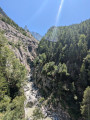
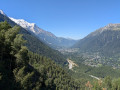
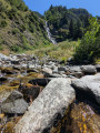
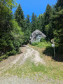
(S/E) Leave the station and head for the Route des Tines (D1506). Cross the road at the pedestrian crossing and follow it to the left for about fifty metres. Then turn right into the forest and you’ll soon reach a junction.
(1) Take the path on the left and walk past a large rock: there is an information sign. You’ll reach the houses after turning right; follow the path which runs alongside the forest track (Chemin du Mauvais Pas) and then joins it at its end. Continue for about twenty metres.
(2) Take the path on the left and you’ll reach a junction.
(3) Ignore the return path on the right; carry on straight ahead for about 150 metres.
(4) Head towards Le Chapeau on the right. Pass the Chalet du Chapeau on your left and reach the junction with the path leading to the Grand Balcon Nord.
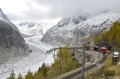
(5) Carry on straight ahead, ignoring this path, and continue to the Mer de Glace viewpoint.
(6) Begin the return journey by following the same route as the ascent.
(3) At the first major junction on the descent after the waterfall, take the path leading down to the left towards the sources of the Arveyron
(7) Turn left towards the springs, which are signposted further on by a small path leading uphill to the left.
(8) Once you reach the viewpoint, turn back and continue the descent by turning left.
(9) Head up to the right, reach a three-way junction and keep left, following the Renard stream downwards. About a hundred metres further on, follow the path to the right, which climbs for a few dozen metres, then turn left.
(10) At the junction, turn right and follow the sign for “Les Tines”. Return to the junction where you started.
(1) Continue down the slope to the left to return to the station (S/E).
 Visorando Member

 Difficult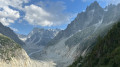
 Association / Club / Walk leader