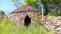
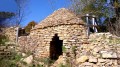
The Bois de la Chaille

A short family walk best enjoyed in dry weather.

Details

n°4512594
Creation:
Last update:
Last review:
  • Walking
    Activity: Walking
  • ↔
    Distance: 2.68 mi
  • ◔
    Average duration: 1h 25 
  • ▲
    Difficulty: Easy

  • ⚐
    Back to start: Yes
  • ↗
    Ascent: + 180 ft
  • ↘
    Descent: - 177 ft

  • ▲
    Highest point: 1,079 ft
  • ▼
    Lowest point: 899 ft
  • ⚐ Country: France
  • ⚐ City: Besançon (25000)
  • ⚑
    Start/End: N 47.240252° / E 5.965991°
  • ❏
    IGN map(s): Ref. 3323ET
  • Hour-by-hour weather

Description of the walk

Reach the starting point via the Chemin de la Chaille to the west of Besançon.

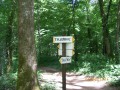
(S/E) Set off from the car park along the small tarmac road heading south-west. Marked in yellow and red. After 200 m along this road, leave the marked route and turn right onto the path; this is a soil interpretation trail with an information board.

(1) Turn left onto a wider path and head down towards La Chaille. When you reach the corner of a pasture on the left, do not continue straight on, but take the path to the right, then left, to walk along the edge of the woodland and reach the tarmac road leading to La Chaille (D75). Turn right along the wooden fence.

(2) Follow the path on the right for about 600 m and turn left onto a wide path towards the ‘Zone d’Activités de l’Orée du Bois’.

(3) Do not enter this area; instead, take the path on the right.

(4) Turn right to join theGRP® Ceinture de Besançon.

(5) Continue along this section ofthe GRP®, marked in yellow and red, until you reach the car park (S/E).

Waypoints

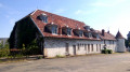
  1. S/E : mi 0 - alt. 1,076 ft - Car park on Chemin de la Chaille
  2. 1 : mi 0.33 - alt. 1,014 ft - Information board
  3. 2 : mi 1.19 - alt. 922 ft - Path on the right
  4. 3 : mi 1.78 - alt. 919 ft - Business park
  5. 4 : mi 2.07 - alt. 994 ft - Turn right at the fork
  6. 5 : mi 2.36 - alt. 1,030 ft - Junction with the GRP
  7. S/E : mi 2.68 - alt. 1,079 ft - Car park on Chemin de la Chaille

Notes

An easy family walk.
In wet weather, some paths are particularly muddy.

Reviews and comments

4.2 / 5
Based on 2 reviews

Reliability of the description
3.5 / 5
Ease of following the route
5 / 5
Route interest
4 / 5
KristouV
KristouV

Easy and shaded.
Tracked using Visorando + GPS on a smartphone.
Not a single mistake....

Machine-translated

meet-and-see
meet-and-see

Overall rating : 4 / 5

Date of your route : Apr 16, 2021
Reliability of the description : ★★★☆☆ Average
Ease of following the route : ★★★★★ Very good
Route interest : ★★★★☆ Good
Very busy route : Yes

A lovely, refreshing walk in the Bois de la Chaille. Perfect for a stroll near Besançon.
The description is good, but with so many little paths, it’s easy to get a bit lost. As the woods aren’t very big, you can find your way around intuitively.

Machine-translated

Popol25
Popol25

Overall rating : 4.3 / 5

Date of your route : Mar 28, 2021
Reliability of the description : ★★★★☆ Good
Ease of following the route : ★★★★★ Very good
Route interest : ★★★★☆ Good
Very busy route : Yes

A lovely, easy walk through the woods.

Machine-translated

Other walks in the area

For more walks, use our search engine .

The GPS track and description are the property of this route's author. Please do not copy them without permission.