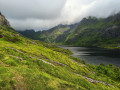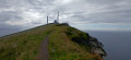
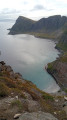
The Håen viewpoint on the island of Værøy

As the island of Værøy is not connected to the rest of the Lofoten Islands by bridges, you must take a ferry from Bodø or Moskenes. The walk starts in the Rømdalen valley, just north of the main village of Sørland, at a small car park. Once at the summit, near the NATO radar station, you’ll be faced with vertiginous cliffs plunging straight into the Norwegian Sea.

Details

n°105409466
Creation:
Last update:
Last review:
–
  • Walking
    Activity: Walking
  • ↔
    Distance: 3.35 mi
  • ◔
    Average duration: 2h 55 
  • ▲
    Difficulty: Moderate

  • ⚐
    Back to start: Yes
  • ↗
    Ascent: + 1,581 ft
  • ↘
    Descent: - 1,552 ft

  • ▲
    Highest point: 1,558 ft
  • ▼
    Lowest point: 177 ft

Photos

Description of the walk

Park in a car park at the end of a small road, north-west ofSørland.

(S/E) Head north-west.

(1) Turn right and head for a viewpoint overlooking the Lofoten Islands . You can make a quick round trip up Mount Hornet to the north-east.

(2) Turn left and follow the ridges in a south-south-westerly direction, towards the radome. Reach the NATO radome and go round the back to reach the viewpoint. N.B. Photography of the radome is prohibited.

(3) Head back and descend north-east via the access road to the radome.

(4) Leave the road and take a path on the right. Pass close to several bends in the road.

(1) Return to the junction you passed at the start of the walk and turn right. Following the outbound route in the opposite direction, head back down to the car park (S/E).

Waypoints

  1. S/E : mi 0 - alt. 180 ft - Start from the car park
  2. 1 : mi 0.32 - alt. 476 ft - Junction of the circular loop – Access to the - Hornet (346 m)
  3. 2 : mi 0.63 - alt. 659 ft - Viewpoint over the Lofoten Islands
  4. 3 : mi 1.87 - alt. 1,542 ft - Radome - Belvédère de Hâen
  5. 4 : mi 2.42 - alt. 1,286 ft - Start of the trail
  6. S/E : mi 3.35 - alt. 194 ft - Arrival

Notes

If you are prone to vertigo, please do not attempt this or take the road instead. No photos of the NATO radome. At (2), there is the option to climb the Hornet and return.

Worth a visit

The viewpoint behind the NATO radome.

The village of Nordland with its cemetery and church. The cod-drying sheds at Sorland.

For more walks, use our search engine .

The GPS track and description are the property of this route's author. Please do not copy them without permission.