


 Country:

 City:
City:


From the old Bauche railway station, the route takes the road towards Crupet before following a wooded path opened in 2022 by the Assesse Paths and Trails Group.
After passing through Crupet via the Donjon Carondelet, Saint-Antoine Cave and its famous founding priest, the route heads due south through rather rural countryside towards Chansin and the old railway station that served Dorinne and Durnal.
The walk then follows the River Bocq through the woodland before climbing towards the rural hills of Purnode.
After Purnode, the route returns to woodland before opening out onto the countryside once more as it approaches Évrehailles.
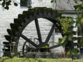
The descent towards Bauche follows a path that runs alongside a Fluxsys pipeline, sometimes along a small road, sometimes through the countryside, and sometimes through woodland; it passes just above Château Harnoy before crossing the small bridge over the leat of the old watermill, where you can still catch a glimpse of the wheel… depending on the state of the vegetation.
A detour via Bocq from Bauche


The walk takes you on a journey of discovery through the most wooded part of the Bocq valley, between the hamlets of Bauche and Chansin.
The Bocq is the birthplace of numerous quarries and of the railway line that once linked Yvoir to Ciney, thereby facilitating the transport of quarry products. There are numerous drinking water abstraction points, now managed by VIVAQUA, as well as the brewery of the same name situated in the heart of Purnode.
Details
Creation:
Last update:
Last review:
–
–
-
 Activity: Walking
 -
 Distance: 10.85 mi
 -
 Average duration: 6h 10
 -
 Difficulty: Moderate
 -
-
 Back to start: Yes
 -
 Ascent: + 1,362 ft
 -
 Descent: - 1,375 ft
 -
-
 Highest point: 938 ft
 -
 Lowest point: 390 ft
Photos
Description of the walk
Waypoints
- S/E : mi 0 - alt. 410 ft - Former Bauche-Évrehailles railway station
- 1 : mi 0.22 - alt. 394 ft - Railway bridge - Bocq (rivière)
- 2 : mi 2.02 - alt. 630 ft - Saint-Roch Chapel
- 3 : mi 2.48 - alt. 587 ft - Carondelet Keep
- 4 : mi 2.7 - alt. 663 ft - Saint-Antoine Cave
- 5 : mi 3.58 - alt. 883 ft - Herleuvaux
- 6 : mi 4.94 - alt. 571 ft - Chansin, the former Dorinne railway station, Durnal - Bocq (rivière)
- 7 : mi 6.14 - alt. 587 ft - View of the railway line from the - Bocq (rivière)
- 8 : mi 7.93 - alt. 774 ft - Purnode town centre
- 9 : mi 9.58 - alt. 814 ft - On the outskirts of Évrehailles
- 10 : mi 10.69 - alt. 397 ft - View of the Bauche Mill - Bocq (rivière)
- S/E : mi 10.85 - alt. 410 ft - Former Bauche-Évrehailles railway station
Other walks in the area
Bauche to Durnal and back down to the Bocq valley
 Visorando Member4.19 mi
+587 ft
-558 ft
2h 25
Moderate
Visorando Member4.19 mi
+587 ft
-558 ft
2h 25
Moderate
 Departure from Assesse (Province de Namur)
A beautiful, not too long route starting from the old Bauche railway station. Parking is available for several cars. The route can be done in either direction. It's up to you to choose whether you prefer to return via the Bocq valley, which is very pretty. Be careful in wet weather, as some paths are slippery. Allow 3 hours and 15 minutes for a leisurely walk.
Between Bauche and Durnal, along the Bocq
4.19 mi
+587 ft
-558 ft
2h 25
Moderate
Departure from Assesse (Province de Namur)
The walk between Bauche, Durnal and the Bocq Valley is a pleasant circular route in Wallonia, ideal for a nature walk lasting a few hours.
It combines: forest paths, rural landscapes and a walk through the Bocq Valley, renowned for its charm.
It is a varied and accessible walk, perfect for regular walkers.
Circular through the woods and along the Bocq river from Bordon.
5.04 mi
+577 ft
-587 ft
2h 50
Moderate
Departure from Yvoir (Province de Namur)
Parking at the start. Descent towards Bauche in the shade. At Bauche, follow Chansin then head back up towards Durnal at the crossroads near the barriers. The climb is long but the surface is more pleasant and flatter than on the descent.
Hike without description, to be followed with the Visorando app.
Circular around the Bocq
 9.51 mi
+1,342 ft
-1,355 ft
5h 30
Moderate
Departure from Yvoir (Province de Namur)
9.51 mi
+1,342 ft
-1,355 ft
5h 30
Moderate
Departure from Yvoir (Province de Namur)
Numerous quarries have been or are still being exploited in the Bocq valley between Spontin (upstream) and Yvoir (downstream), and a railway line was built there connecting Yvoir to Ciney - via a few bridges and tunnels - to facilitate the transport of production. The line, which has been officially decommissioned, is operated between Évrehailles-Bauche and Ciney by the non-profit organisation Chemin de Fer du Bocq, which offers various activities, including, of course, trips in historic railcars and/or passenger carriages pulled by a steam locomotive. In short, the section between Bauche and Spontin has been reoriented towards tourism, and there are numerous trails and paths for exploring this beautiful region on foot. This walk is an invitation to explore, starting from Purnode.
Hike without description to be followed with the Visorando app.
Along the wild Bocq from Crupet
9.41 mi
+1,093 ft
-1,093 ft
5h 15
Moderate
Departure from Assesse (Province de Namur)
A varied hike in the heart of the Namur Condroz, amidst deep forests, hidden valleys and Walloon heritage.
The route passes through magnificent wooded areas such as the Bois des Loges, the Bois du Sergent and the Bois d’Insefy, before reaching the superb Bocq Valley and its steep-sided landscapes. It also passes through the villages of Durnal, Evrehailles and Chansin, as well as near Harnoy Castle, the Niersant Cave and the remarkable site of Tienne du Hé. Crupet, listed among the most beautiful villages in Wallonia, reveals its famous medieval keep surrounded by water, as well as the Saint-Antoine Cave and its famous devil. The typical terrain of the Condroz, formed over 350 million years ago, alternates between limestone ridges, damp valleys, beech forests and hedgerow landscapes.
With its unspoilt nature, local history and wild atmosphere along the Bocq, this walk promises a wonderful immersion in one of the most beautiful regions of Wallonia.
Totemus in Crupet
 3.98 mi
+469 ft
-469 ft
2h 15
3.98 mi
+469 ft
-469 ft
2h 15
 Easy
Departure from Assesse (Province de Namur)
Easy
Departure from Assesse (Province de Namur)
Revitalising the concept of the treasure hunt and pioneering educational and fun routes in partnership with local tourism stakeholders, Totemus invites you to discover the undulating landscape of the Condroz, characterised by alternating ridges and valleys, as well as some of the gems of the village of Crupet.
From Crupet to Ronchine
 3.05 mi
+397 ft
-407 ft
1h 45
Moderate
Departure from Assesse (Province de Namur)
3.05 mi
+397 ft
-407 ft
1h 45
Moderate
Departure from Assesse (Province de Namur)
After approximately 960 metres, the slope is steep, then reasonably uphill for about 2.3 kilometres.From there, it is all downhill until the last 200 metres.Very steep descent at around 4 kilometres, with a chain provided as a handrail.Start and finish at the same place. Car park 30 metres away.
The Bocq de Bauche valley in Chansin, starting from Crupet
 9.78 mi
+1,158 ft
-1,161 ft
5h 30
Moderate
Departure from Assesse (Province de Namur)
9.78 mi
+1,158 ft
-1,161 ft
5h 30
Moderate
Departure from Assesse (Province de Namur)
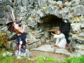
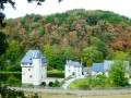
After the magnificent view at the start of the walk over the Carondelet keep and its immediate surroundings, the walk passes by (and through) the surprising Crupet cave, built by the parish priest of the time (1866–1926), before heading towards Bauche along a lovely forest path.Just after the Bauche bridge, the route turns onto a path on the left, quickly joining the Bocq Tourist Railway, which it follows as far as the first level crossing.From there, the route begins to follow the River Bocq, passing under the railway line several times beneath the arches of beautiful stone bridges … or through tunnels, until it reaches the old Durnal-Dorinne station at Chansin.After the steep climb towards Durnal, the walk continues through the countryside towards Herbefays before turning left onto the small ridge road (this is the Condroz) and its northern viewpoint overlooking Maillen and Jassogne.Return to the starting point via the Bois des Comognes in Jassogne and the Insefy path.
For more walks, use our search engine .
The GPS track and description are the property of this route's author. Please do not copy them without permission.

