The Oise Canal from Vadencourt to Lesquielles-Saint-Germain

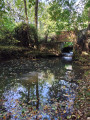
A delightful route that allows you to discover, amongst other things, the village of Vadencourt, situated in the heart of the Oise Valley, set in lush green surroundings and rich in architectural, cultural and historical heritage.
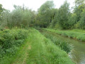
This route will also take you to Lesquielles-Saint-Germain via a local attraction: the Rigole de l’Oise.

Details

n°62491995
Creation:
Last update:
Last review:
  • Walking
    Activity: Walking
  • ↔
    Distance: 5.10 mi
  • ◔
    Average duration: 2h 25 
  • ▲
    Difficulty: Easy

  • ⚐
    Back to start: Yes
  • ↗
    Ascent: + 105 ft
  • ↘
    Descent: - 89 ft

  • ▲
    Highest point: 381 ft
  • ▼
    Lowest point: 289 ft
  • ⚐ Country: France
  • ⚐ City: Vadencourt (02120)
  • ⚑
    Start/End: N 49.927876° / E 3.577519°
  • ❏
    IGN map(s): Ref. 2608E, 2708O
  • Hour-by-hour weather

Photos

Description of the walk

Park on Rue de Bovalon, opposite Vadencourt Town Hall (free parking).

(S/E) Opposite Vadencourt Town Hall, turn left, and after about a hundred metres, join Rue Wasselin (D66). Then turn right, towards Lesquielles Saint-Germain. Continue for about 130 metres until you reach a junction with several streets.

(1) Turn left onto Rue de la Vicomte and continue along this road for 600 metres, before reaching the village of Grand-Verly (the ‘entering built-up area’ sign is next to the one for Vadencourt). Enter the village of Grand-Verly via the Grand Rue, and after 400 metres, you will come to a junction with several roads, marked by a traffic island (Grande Rue – D66 opposite, Rue de Grougis – D665 on the left).

(2) Turn right off the traffic island onto Rue de la Prairie, go past the church and the cemetery, and continue for 160 m.

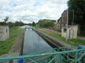
(3) Turn right onto Rue du Moulin, pass between the abutments of an old railway bridge, cross the bridge over the Noirieux, then the one over the Canal de la Sambre à l’Oise.

(4) Carry on straight ahead for 1,300 metres.

(5) As you reach the D666, cross the road and continue straight on for 50 m, then turn right onto Chemin de la Rigole. Follow this path downhill for 200 m, crossing a culvert fitted with metal guardrails.

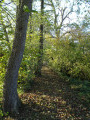
(6) Immediately after the culvert, turn left onto a grassy track running alongside the Rigole de l’Oise. Continue straight on for 1 km until you reach a building (a former mill), which takes you onto Rue du Moulin.

(7) Turn right and walk for about 80 m, then turn right into a narrow lane running alongside a brick wall on your left and a branch of the Oise on your right. Continue for 130 m until you reach Rue de la Gare (D694).

(8) Turn right, carry on straight ahead, cross the Oise tributary, then the Oise itself. Continue for a further 200 m to reach the hamlet of Sainte-Claire, in front of a former railway station (with a sign reading ‘Chemin de fer du Nord’).

(9) Turn right, then left 30 metres further on to join the EuroVelo 3.

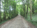
(10) Head straight on and follow the EuroVelo for 2.5 km until you reach the RD69 (Rue de Bovalon).

(11) Turn right onto this road. Follow the pavement for 650 m until you return to the car park in front of the town hall (S/E).

Waypoints

  1. S/E : mi 0 - alt. 289 ft - Parking on Rue de Bonvalon, in front of the Town Hall
  2. 1 : mi 0.14 - alt. 308 ft - Rue de la Vicomte
  3. 2 : mi 0.8 - alt. 374 ft - Rue de la Prairie
  4. 3 : mi 0.94 - alt. 315 ft - Rue du Moulin - Noirrieu (rivière) - Affluent de l'Oise
  5. 4 : mi 1.1 - alt. 308 ft - Canal de la Sambre à l'Oise
  6. 5 : mi 1.93 - alt. 358 ft - Chemin de la Rigole
  7. 6 : mi 2.05 - alt. 302 ft - Country lane
  8. 7 : mi 2.7 - alt. 312 ft - Rue du Moulin
  9. 8 : mi 2.83 - alt. 302 ft - Rue de la Gare. Just off the - Oise (l')
  10. 9 : mi 3.1 - alt. 308 ft - Sainte-Claire
  11. 10 : mi 3.25 - alt. 325 ft - EuroVelo 3
  12. 11 : mi 4.75 - alt. 295 ft - Rue de Bonvalon - Canal de la Sambre à l'Oise
  13. S/E : mi 5.1 - alt. 292 ft - Parking is available on Rue de Bonvalon, in front of the Town Hall. - Oise (l')

Worth a visit

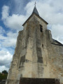
The Church of Saint-Quentin in Vadencourt.

The Cistercian Abbey of Bohéries

Nicolas Grain’s House – 5, 7 Rue Nicolas Grain 02120 Vadencourt

Both houses were designed and built by master mason Nicolas Grain (1750–1823), a stonemason by trade, but also a sculptor, bookbinder, poet and amateur memoirist. The first house is known as the ‘House of the Sun’ (after the central motif on the gable). The second house, built around 1775 and known as the ‘House of Marital Fidelity’, features carved details and motifs evoking Nicolas Grain’s married life.

Reviews and comments

5 / 5
Based on 1 review

Reliability of the description
5 / 5
Ease of following the route
5 / 5
Route interest
5 / 5
User 9947728

Overall rating : 5 / 5

Date of your route : Mar 22, 2026
Reliability of the description : ★★★★★ Very good
Ease of following the route : ★★★★★ Very good
Route interest : ★★★★★ Very good
Very busy route : No

A lovely walk with some gentle hills, which makes a nice change from the usual local scenery. A variety of landscapes and charming little houses. The only downside is that there’s a bit of road walking at the start, but it’s necessary to complete a circular walk.

Machine-translated

Other walks in the area

For more walks, use our search engine .

The GPS track and description are the property of this route's author. Please do not copy them without permission.