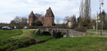
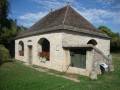
The Debreuille Estate Vineyard Walk

Come and discover our estate and explore the Mâconnais vineyards with friends or family.
Throughout the trail, you’ll be able to learn more about various topics – the estate, the winegrower’s work, the world of wine and the biodiversity found in the vineyards – through a series of information boards situated along the path. A friendly and educational outdoor walk, suitable for all ages.
A walking trail, free of charge and accessible to all, which you can enjoy at your own pace and in complete freedom.

Details

n°47021689
Creation:
Last update:
Last review:
  • Walking
    Activity: Walking
  • ↔
    Distance: 3.14 mi
  • ◔
    Average duration: 1h 50 
  • ▲
    Difficulty: Easy

  • ⚐
    Back to start: Yes
  • ↗
    Ascent: + 417 ft
  • ↘
    Descent: - 417 ft

  • ▲
    Highest point: 1,063 ft
  • ▼
    Lowest point: 814 ft

Description of the walk

Domaine Debreuille is accessible by car and there is a car park available.

(S/E) Follow the road on your right for about 600 metres.

(1) Turn left into the row of vines. Once you reach the top of the plot, turn left, then carry on straight ahead. At the T-junction, turn left.

(2) Take the road on your left, then, at the junction, carry on straight ahead.

(3) As the road curves to the left, turn right onto the track.

(4) Turn left at the junction, join the road and follow it to the left.

(5) Take the first path through the vineyards on the right.

(6) Take the stone steps and follow the path on your left. You’ll come to a crossroads.

(7) Carry on straight ahead along Rue de la Cra.

(8) Opposite the well, carry on straight ahead and go down Rue Mazenot to the estate (S/E).

Waypoints

  1. S/E : mi 0 - alt. 866 ft - Domaine Debreuille
  2. 1 : mi 0.39 - alt. 919 ft - Walk through the vineyards
  3. 2 : mi 1.26 - alt. 823 ft - Route
  4. 3 : mi 1.5 - alt. 886 ft - Stony path
  5. 4 : mi 1.78 - alt. 863 ft - Path through the vineyards
  6. 5 : mi 2.16 - alt. 932 ft - Sixth stop through the vineyards
  7. 6 : mi 2.4 - alt. 1,063 ft - Stone steps
  8. 7 : mi 2.72 - alt. 968 ft - Rue de la Cra
  9. 8 : mi 3.03 - alt. 938 ft - Well
  10. S/E : mi 3.14 - alt. 866 ft - Domaine Debreuille

Notes

A route that is fully accessible to children. Before setting off on this walk, children can, if they wish, collect activity booklets from the estate’s courtyard to follow the information boards along the route.

To follow the route, you can also pick up a paper map available in the estate’s courtyard.

To help protect the environment, please do collect your rubbish and take it with you when you leave.

Worth a visit

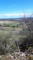
At the viewpoint (6): you can stop for a meal whilst enjoying a magnificent view over the Burgundy vineyards.

Reviews and comments

4.7 / 5
Based on 1 review

Reliability of the description
5 / 5
Ease of following the route
5 / 5
Route interest
4 / 5
domaineD
domaineD

Thank you for your positive feedback!

Machine-translated

Emmanuel Nice
Emmanuel Nice

Overall rating : 4.7 / 5

Date of your route : Nov 10, 2025
Reliability of the description : ★★★★★ Very good
Ease of following the route : ★★★★★ Very good
Route interest : ★★★★☆ Good
Very busy route : No

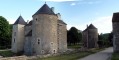
A short, easy walk through the vineyards, which also allows you to discover the pretty village of Royer.

Machine-translated

Other walks in the area

For more walks, use our search engine .

The GPS track and description are the property of this route's author. Please do not copy them without permission.