La Petite Bruyère in Bloux

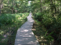
A route along wide paths that are shaded in summer and wonderfully colourful in autumn. Best avoided in wet weather (slippery).

Details

384162
Creation:
Last update:
Last review:
  • Walking
    Activity: Walking
  • ↔
    Distance: 4.48 mi
  • ◔
    Average duration: 2h 05 
  • ▲
    Difficulty: Easy

  • ⚐
    Back to start: Yes
  • ↗
    Ascent: + 52 ft
  • ↘
    Descent: - 52 ft

  • ▲
    Highest point: 860 ft
  • ▼
    Lowest point: 771 ft
  • ⚐ Country: France
  • ⚐ City: Lurcy-Lévis (03320)
  • ⚑
    Start/End: N 46.748937° / E 2.871723°
  • ❏
    IGN map(s): Ref. 2426SB, 2526SB
  • Hour-by-hour weather

Description of the walk

(S/E) Park in the small square where there is a sign for “chemin du village d’en bas”. Head north-east and continue to the first junction.

(1) Take the path opposite, veering slightly to the right, towards the electricity pole, between the houses, and continue straight on until you reach the D144.

(2) Cross the road, ignore the path on your right and continue along this long path until you reach a junction where the path meets the road.

(3) Follow the road to the right and carry on until you reach the D144 again; cross it and continue along the path opposite.

(4) At a fork in the road where there is a small house, turn onto the track to the left of the house and carry on until you reach a road.

(5) Turn right and carry on for about 300 metres.

(6) Take the first path on the right and follow it to the junction with a road.

(7) Turn slightly left, then right at the three-way junction to return to the small square (S/E).

Waypoints

  1. S/E : mi 0 - alt. 823 ft - Small square in Bloux
  2. 1 : mi 0.2 - alt. 814 ft - Junction “Chemin du village d’en”
  3. 2 : mi 0.61 - alt. 784 ft - Crossing the D144
  4. 3 : mi 1.71 - alt. 807 ft - Crossroads of paths and roads
  5. 4 : mi 2.54 - alt. 820 ft - At the fork, take the path on the left
  6. 5 : mi 3.33 - alt. 860 ft - Junction with a road
  7. 6 : mi 3.47 - alt. 856 ft - Path on the right
  8. 7 : mi 4.36 - alt. 823 ft - Junction with a road
  9. S/E : mi 4.48 - alt. 823 ft - Small square in Bloux

Reviews and comments

4.6 / 5
Based on 3 reviews

Reliability of the description
4.3 / 5
Ease of following the route
5 / 5
Route interest
4.3 / 5
User 26405633

Overall rating : 5 / 5

Date of your route : Sep 16, 2025
Reliability of the description : ★★★★★ Very good
Ease of following the route : ★★★★★ Very good
Route interest : ★★★★★ Very good
Very busy route : No

Very pleasant walk. Peaceful and bucolic.

Machine-translated

_110010100_
_110010100_

Overall rating : 4.3 / 5

Date of your route : Jun 13, 2021
Reliability of the description : ★★★★☆ Good
Ease of following the route : ★★★★★ Very good
Route interest : ★★★★☆ Good
Very busy route : No

I agree with Azimut71’s view. You need to take the small dirt track behind the square.
However, the paths we took weren’t necessarily very well maintained.

In some places, the grass was quite tall… about 80 cm!

My partner and I didn’t really see the point of sections 5 and 6… apart from making the walk longer!

Otherwise, it’s an easy, well-shaded walk… which is just what we need at the moment!

Machine-translated

Azimut71
Azimut71

Overall rating : 4.3 / 5

Date of your route : Jun 05, 2020
Reliability of the description : ★★★★☆ Good
Ease of following the route : ★★★★★ Very good
Route interest : ★★★★☆ Good
Very busy route : No

From the plot, take a dirt track heading NORTH-WEST.
The paths are wide and well-maintained.

Machine-translated

Other walks in the area

For more walks, use our search engine .

The GPS track and description are the property of this route's author. Please do not copy them without permission.