The Carnelle Forest

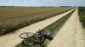
A mountain bike route through the Carnelle Forest, starting from Viarmes.

Details

5794
Creation:
Last update:
Last review:
  • Mountain biking
    Activity: Mountain biking
  • ↔
    Distance: 5.80 mi
  • ◔
    Duration according to the author: 2 hrs 
  • ▲
    Difficulty: Moderate

  • ⚐
    Back to start: Yes
  • ↗
    Ascent: + 561 ft
  • ↘
    Descent: - 564 ft

  • ▲
    Highest point: 692 ft
  • ▼
    Lowest point: 161 ft
  • ⚐ Country: France
  • ⚐ City: Viarmes (95270)
  • ⚑
    Start/End: N 49.125771° / E 2.369198°
  • ❏
    IGN map(s): Ref. 2313OT, 2412OT

  • ◶
    Type of surface:
  •  
     
     
     60% Road  5% Byway  35% Path
  • ⇧
    Bike carrying: No
  • ▲
    Difficulty: Easy
  • Hour-by-hour weather

Photos

Description of the route

Park in the car park by the church and town hall in Viarmes.
(S/E) Take Rue Noire, passing the town hall, then Rue du Gaudron. You’ll reach the junction with the Route des Princes (a steep climb).

(1) Turn left onto this road; you’ll reach a square with a green barrier and a ‘no vehicles’ sign opposite – go round the back.

(2) Take the track, initially called Chemin de la Forêt à Viarmes; further on, it becomes Route de Chantilly, a tarmac road that’s easy to cycle on. Follow it to the Motte crossroads.

(3) Continue straight on along the same path until you reach the Chêne Quentin crossroads.

(4) Turn right at the crossroads to follow the Route du Chêne. Continue to the Carnelle crossroads.

(5) Turn sharply right onto the Route de la Touffe, which is signposted with theGR®1red and white markings. Cross the Route des Poissons and turn right onto it. You’ll soon reach a four-way junction.

(6) Take the path on the right, leaving theGR®1here. Continue along this path through the Fond des Vaux, ignoring all tracks or roads to the right or left. You’ll reach the junction with the Route de l’Orme.

(7) Turn left here; you’ll soon rejoin theGR®1and follow it to the right. Reach Asnières-sur-Oise via Rue de l’Orme. Continue to the junction with Rue du Four.

(8) Turn right onto this street, then continue along Rue Pierre Brossolette and then Rue des Courdeaux. You’ll reach the first junction, known as ‘la boucle’.

(1) Follow the outward route back to the car park (S/E)

Waypoints

  1. S/E : mi 0 - alt. 187 ft - Viarmes Town Hall car park
  2. 1 : mi 0.38 - alt. 164 ft - Route des Princes
  3. 2 : mi 0.75 - alt. 381 ft - Barrier
  4. 3 : mi 1.35 - alt. 512 ft - Carrefour de la Motte
  5. 4 : mi 1.9 - alt. 689 ft - Carrefour du Chêne Quentin
  6. 5 : mi 2.55 - alt. 692 ft - Carnelle crossroads
  7. 6 : mi 2.94 - alt. 515 ft - Four-way junction
  8. 7 : mi 4.27 - alt. 423 ft - Route de l’Orme
  9. 8 : mi 4.75 - alt. 171 ft - Rue du Four
  10. S/E : mi 5.8 - alt. 187 ft

Notes

- Much of the route runs through woodland.
- You should wear a helmet, as part of the path is uneven.

Worth a visit

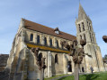
- The churches in Viarmes and Asnières-sur-Oise are well worth a visit for some lovely photos.
- There’s a lovely little market on Saturday mornings in Viarmes.
- For walkers, theGR®1route can be joined from this starting point.

- The route mentioned above is just one of many in this area; there are several alternative routes.

Always be cautious and plan ahead when you're outdoors. Visorando and the author of this route cannot be held responsible for any accidents occurring on this route.

The GR® and PR® markings are the intellectual property of the Fédération Française de Randonnée Pédestre.

Reviews and comments

4.2 / 5
Based on 4 reviews

Reliability of the description
3.8 / 5
Ease of following the route
4 / 5
Route interest
4.8 / 5
alsaco2
alsaco2

Overall rating : 4 / 5

Date of your route : Sep 05, 2016
Reliability of the description : ★★★☆☆ Average
Ease of following the route : ★★★★☆ Good
Route interest : ★★★★★ Very good

As is often the case, things change over time in the forest.
Here are my comments on the description of the starting point, where we’d been a bit unsure.

Park your car in the car park by the church and Viarmes Town Hall.
- Take Rue Noire (keeping to the right of the Town Hall), then Rue du Gaudron.
- At the stop sign, take the Route des Princes (a lovely, long climb)
- You’ll come to a square with a white barrier on the right (with a
‘No Vehicles’ sign); go round the back and take the track. (Go far enough along, to the left of the barrier, where a sign hidden by vegetation indicates the name of the track)
- This is a tarmac track (Route de Chantilly) that is easy to follow. Follow it to the Motte crossroads.
- At the La Motte crossroads, carry on straight ahead along the same path until you reach the Chêne Quentin crossroads.

For the rest of the route, follow the directions on the website

Enjoy your walk

Machine-translated

Jane95
Jane95

Overall rating : 5 / 5

Date of your route : Jun 13, 2016
Reliability of the description : ★★★★★ Very good
Ease of following the route : ★★★★★ Very good
Route interest : ★★★★★ Very good

Thank you all!!!

Machine-translated

gazok54
gazok54 ★

Thank you, danielgrange, for this information. Let’s wait for the warmer weather to go on this walk.

Machine-translated

danielgrange
danielgrange

Overall rating : 3.3 / 5

Date of your route : Dec 13, 2015
Reliability of the description : ★★★☆☆ Average
Ease of following the route : ★★★☆☆ Average
Route interest : ★★★★☆ Good

In fact, this walk needs to be split into two parts: from the starting point to the furthest point, which is excellent in every respect (description, scenic interest, signposting, etc.); once you reach the start of the circular return route, the route description becomes rather vague and difficult to follow, and the ground becomes very muddy and slippery, but the worst section is in this part, roughly in the last quarter of the route(roughly at the junction with the Route de la Tour du Moulin), as they’ve recently carried out extensive tree felling and the forestry machinery has completely destroyed the paths, rendering them utterly impassable. Furthermore, the undergrowth at the edges of the woodland is far too dense and waterlogged to allow you to make your way through alongside the path. We had great difficulty making our way back up to the starting point to finish the walk.
For the time being, whilst the forestry work is ongoing and the ground hasn’t had time to dry out, this is really not a route I would recommend.

Machine-translated

marcodelamarche
marcodelamarche

Overall rating : 4.3 / 5

Date of your route : Oct 04, 2015
Reliability of the description : ★★★★☆ Good
Ease of following the route : ★★★★☆ Good
Route interest : ★★★★★ Very good

A beautiful, enjoyable route over varied terrain and slopes, not suitable for everyone or for those who are inadequately prepared. You should be used to hiking with a map. Issues: not enough clear signposting at certain junctions, which causes hesitation; on the path leading to the high-voltage power line clearing, at one point, we weren’t sure whether to turn left or right. Left was the right choice – a stroke of luck. If I’d gone right, I would have strayed from the route. You follow the field on the right, not the left. At the end, the Route du Gaudron isn’t signposted, so you might have ended up walking further to reach Viarmes town centre. The plus points: picnic tables, greenery, woodland, a well-chosen route, and a café in Asnières-sur-Oise. Kind regards.

Machine-translated

For more walks, use our search engine .

The GPS track and description are the property of this route's author. Please do not copy them without permission.