Country:

 City:
City:


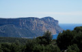
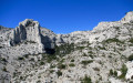
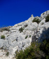
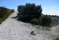
Park at the Col de la Gineste. Use the shaded car park on the right-hand side when coming from Marseille and on the left-hand side when coming from Cassis.
(S/E) Head towards the pass via the path running alongside the departmental road and proceed to the signpost next to the information board about the Calanques National Park and the regulations in force on the site.
Red + Green markings
Take the wide, stony path branching off to the left. After running almost flat for a while, the path climbs steeply to a high point, then levels out again before reaching a junction that is not very clearly marked on the ground.
Red Markings
(1) Leave the green markings and continue straight on; you will very quickly reach another junction marked by a large, shapeless pile of stones serving as a cairn. Keep to the left, then further on you’ll come out onto a track suitable for vehicles; follow it downhill to the left to the bottom of the valley. Then leave the track and turn right onto a path that enters a narrow, pine-covered valley and soon reaches a three-way junction at the foot of a small rock face (markings on the ground and on the rock face).
Red + Green + Blue markings
(2) Turn left to reach another junction marked by a sign on a rock on the ground.
Red + Blue markings
(3) Ignore the green markings and continue straight ahead. The valley narrows and the path eventually comes up against the rocky ridge that blocks it. This is followed by a very steep, winding climb with a few rocky sections where you’ll need to use your hands. You’ll emerge onto the ridge at a large cairn; go past it for about twenty metres to reach a wide, cross-country track.
Yellow markings
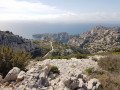
(4) Turn left to follow this track, which winds gently along the Crête de l’Estret , offering superb views of Cassis and Cap Canaille. Pass a huge cairn on your left and continue, alternating between gentle ascents and descents, until you approach the 440-metre mark.
No markings
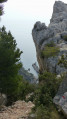
(5) Look out for the cairn on the right-hand side marking the start of the Cirque des Pételins path. Turn right here and begin the descent, following the well-marked path on the ground which draws closer to the rock face and runs alongside it. The route is tricky on very unstable ground in the steep sections due to loose stones rolling underfoot: caution is advised. After a short, easy section of downclimbing, the path splits in two: take the left-hand path, which is better marked and easier to follow, and eventually joins the thalweg path at a large cairn.
(6) Turn left to follow this winding path which descends the Vallon des Rampes and leads onto a track opposite a large solitary pine tree.
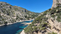
(7) Continue in the same direction and head straight on until you reach the junction with the access path to the Calanque d’en Vau.
Red markings
(8) Turn left. At a hairpin bend to the right, the path becomes tarmac and climbs steeply, winding its way round several hairpin bends.
Brown markings
(9) Turn left onto a stony path which climbs straight up the slope before levelling out after a 90° bend to the left. Follow the path as it curves widely to the right (the path branching off to the left no longer exists on the ground) and come out onto a cross-country track.
Yellow markings
(10) Turn right, pass the underground water tank no. 27 and continue until you reach a forest gate giving access to the vast open space of the Col de la Gardiole, where the tarmac road of the same name intersects with several tracks and paths. Head left towards a marker post.
Red and Green Markings
(11) Take the path starting at the foot of this post. Cross the Route de la Gardiole twice, ignore a turn-off to the right and reach a junction situated on a bend and marked by a stone with signposting.
Green markings
Leave the main track and the red markings, which continue to the right. Head straight on along a much narrower path which joins Route de la Gardiole one last time opposite a forest gate.
(12) Cross and then go round this gate to follow the wide track, which is suitable for vehicles but closed to traffic, as it winds almost flat through the Vallon de Chalabran, in the shade of the pine trees.
(13) Turn right onto the narrow path, the start of which is marked by two cairns and a green marker. After an initial very steep climb, the path levels out and runs along the hillside, alternating between flat sections and short, awkward, stony inclines, before reaching the first junction on the outward journey.
Red + Green markings
(1) Turn right and follow the ascent route back to the starting car park (S/E).

 Visorando Member

 Difficult
 Very difficult