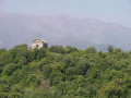
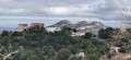
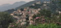
The circular Balcons loop from Campu Gallu

Here is a suggested walking route that is circular and connects three itineraries published on the website: almost the entire “Les Balcons du Nebbiu” route (currently a return journey), published by the Grand Site de France Conca d’Oru – Vignoble de Patrimonio – Gulf of Saint-Florent, a large part of the “Dans les vignes de Patrimonio” route written by Phil Decr, and, to a very limited extent, the “Nature, patrimoine et terroir des plaines d’Oletta et de Poggio d’Oletta” route devised by our association

All of this takes place within the Nebbiu-Conca d’Oru micro-region, which boasts exceptional landscapes and points of interest. This is undoubtedly why these places have been awarded the Grand Site de France designation.

Details

n°111969434
Creation:
Last update:
Last review:
–
  • Walking
    Activity: Walking
  • ↔
    Distance: 8.88 mi
  • ◔
    Average duration: 5h 15 
  • ▲
    Difficulty: Moderate

  • ⚐
    Back to start: Yes
  • ↗
    Ascent: + 1,329 ft
  • ↘
    Descent: - 1,342 ft

  • ▲
    Highest point: 1,381 ft
  • ▼
    Lowest point: 95 ft

Description of the walk

The start/finish point is situated beside the D238 road, also known as the “Strada di Vignaghjoli” or the “Route des Vignerons”. To reach it by car:

Via the D81 from Bastia: take the D38 from the Col de Teghime junction and turn onto the D238, turning right at the low point, before reaching the village of Poggio d’Oletta.

Via the D81 from the centre of Saint Florent: head towards the Cathedral of Nebbiu, then continue along the Stretti di Poggio – the D238

From Oletta – the D82: leave the D82 at the village of Oletta and take the D38 towards Bastia. Pass through the village of Poggio d’Oletta. At the junction, after the bridge over the Chioselle stream, take the D238 to the left, leaving the D38 (Route de Bastia) on your right

Park on a lay-by at the junction of Strada di u Vignaghjoli – D238 and Stradunettu di San Quilico

(S/E) Head straight ahead, northwards, onto Stradunettu di San Quilico. Then continue along Strada di u Mulinu Biancu, which runs through the heart of the Patrimonio AOC vineyards. After about 2.5 km, you’ll reach the junction with Pietricincolo and Lucitello.

(1) At the junction, turn right towards Lucitello. Continue until you reach Strada Napoleone.

(2) On Strada Napoleone, turn right and continue for about 250 m. Then turn right onto the track which passes some houses and climbs through woodland to a water reservoir on the left

(3) At the reservoir, continue along the track for about 600 m. You’ll reach a junction with a path leading uphill to the left

(4) At the junction, head up the path on the left until you reach the junction with the “Balcons du Nebbiu” route, situated below the viewpoint.

(5) At the junction of the paths, head down to the right, heading south, running parallel to the D38 road above. At the end of the path, join the D238 road.

(6) Cross the D238 road with care. Walk uphill for about a hundred metres on the right-hand side until you reach the junction with a concrete track.

(7) Leave the road and head down the concrete track to the right. At the lowest point, after the bridge over the Ruisseau de l’Olivella, the track passes through an olive grove before reaching a junction with the main track of the Vincenti estate

(8) At the junction with the estate’s main track – which runs straight ahead – turn right and continue for about 300 metres. You’ll reach a crossroads by a cluster of tall oak trees.

(9) Turn right at the spot known as the “Capra Sorda” plot and continue for about a hundred metres.

(10) Continue along the track, which curves sharply to the left further on. Carry on along the track that runs between the “Croce” and “Pastoreccia” plots, heading north-west. Continue for about 1.8 km before changing direction at the junction of the tracks.

(11) At the track junction – the plot known as “Partinelone” – turn right to reach the D238 road a little further on

(12) Turn right onto the D238 road, Strada di Vignaghjoli, passing the Y. Leccia estate, then continue to the car park (S/E).

Waypoints

  1. S/E : mi 0 - alt. 180 ft - Roadside parking on the D238
  2. 1 : mi 1.54 - alt. 295 ft - Crossroads
  3. 2 : mi 1.85 - alt. 361 ft - Strada Napoleone
  4. 3 : mi 2.31 - alt. 554 ft - Municipal water reservoir
  5. 4 : mi 2.96 - alt. 840 ft - Junction of tracks, uphill path
  6. 5 : mi 3.36 - alt. 1,362 ft - Junction of routes
  7. 6 : mi 6.15 - alt. 571 ft - D238 road
  8. 7 : mi 6.21 - alt. 574 ft - Concrete track
  9. 8 : mi 6.61 - alt. 410 ft - Main track, olive and wine-growing estate
  10. 9 : mi 6.8 - alt. 354 ft - Crossing of paths, large oak trees
  11. 10 : mi 6.88 - alt. 364 ft - Track, 90° bend
  12. 11 : mi 8.04 - alt. 128 ft - Junction of trails
  13. 12 : mi 8.32 - alt. 102 ft - D238
  14. S/E : mi 8.89 - alt. 180 ft - Roadside parking on the D238

Notes

  • There is no shelter or drinking fountain anywhere along the route.
  • Make sure you bring rainwear and plenty of water.

Worth a visit

  • Wineries in the Patrimonio AOC between (S/E) and (2).
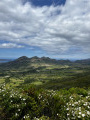
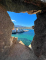
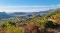
  • The scenery of the vineyards, the limestone hills and the Gulf of Saint-Florent between (4) and (6).
  • The ruins of the Nebbiu bishopric’s summer residence, between (5) and (6).
  • The Vincenti olive and wine estate and its cellar, well worth a short 200-metre round trip from (8).
  • The Paradella and Clos Signadore vineyards, situated between (11) and (12).
  • The Y. Leccia vineyard between (S/E)
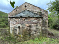
  • From point (S/E), a 1.5-kilometre round trip takes you to the ruins of the Chapel of San Quilico. Extract from Poggio d’Oletta Town Hall: This chapel dates from the11th century. It was formerly known as San Quilico di Casatico e di Brietta, named after two hamlets that no longer exist. In 1492, under the name Casatico, it appeared on the list of benefices of the Diocese of Nebbiu. The building was remodelled in the 16th and 17th centuries, with the addition of an arcaded bell tower surmounting the western façade. The nave, which ends in a semi-circular apse, is oriented along an east–west axis, with the apse to the east and the main façade with its portal to the west, as is the case in the vast majority of Corsican Romanesque churches.

Other walks in the area

For more walks, use our search engine .

The GPS track and description are the property of this route's author. Please do not copy them without permission.