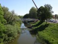
Donnenbach Pond via the Petite Pierre State Forest

This mountain bike ride is suitable for those who enjoy wide trails with little elevation gain.

Details

n°27097590
Creation:
Last update:
Last review:
  • Mountain biking
    Activity: Mountain biking
  • ↔
    Distance: 9.22 mi
  • ◔
    Duration according to the author: 1.5 hrs 
  • ▲
    Difficulty: Moderate

  • ⚐
    Back to start: Yes
  • ↗
    Ascent: + 630 ft
  • ↘
    Descent: - 636 ft

  • ▲
    Highest point: 1,204 ft
  • ▼
    Lowest point: 827 ft
  • ⚐ Country: France
  • ⚐
  • ⚐ City: La Petite-Pierre (67290)
  • ⚑
    Start/End: N 48.866062° / E 7.299717°
  • ❏
    IGN map(s): Ref. 3614ET, 3714ET

  • ◶
    Type of surface:
  •  
     
     
    ■ 20% Road ■ 75% Byway ■ 5% Path
  • ⇧
    Bike carrying: No
  • ▲
    Difficulty: Moderate
  • Hour-by-hour weather

Description of the route

The starting point is at the old football pitch at La Petite Pierre. Accessible by car from the D9 with a large car park. No access by public transport, although Tieffenbach-Struth station is a 15-minute cycle ride away.

(S/E) From the car park, head back onto the road and immediately turn right onto the dirt track that runs alongside the old football pitch.

(1) At the three-way junction at the corner of the field, turn right and continue along this track until you reach a cross-track.

(2) Turn left and, after about 200 m, you’ll reach a three-way junction.

(3) Take the path on the right and carry on straight ahead at the next crossroads of tracks, then look for the start of a footpath on the right (GR®). Follow it until you reach a track.

(4) Carry on to the right and, a few metres further on, turn left onto the road. Join thefirst small road on the right, the Route Forestière de Grand Kuhberg.

(5) Ignore this and take the track opposite which branches off to the left, running parallel to the departmental road. Stay on the main track and continue slightly downhill until you reach the road and then the Maison de l’Eau et de la Rivière.

(6) Carry on along the track, then take thefirst left and continue alongside the pond until you reach the end.

(7) Enjoy a magnificent view of the pond, then carry on along the track. You’ll reach a fork after climbing up into a small valley on the right.

(8) Turn left to head back down the valley on the other side, then continue rightwards downhill until you come to a path branching off to the left.

(9) Take this path and cross the bridge over the Eichel, turn right onto the track and head for the next junction.

(10) Turn right and continue straight on at the following junctions. Walk alongside a pond (not very visible) on your left and arrive at a wide bend to the right. At the end of this bend, turn left and cross the stream.

(11) At the fork, take thesecond path from the left. It’s a footpath with loose stones; it’s easy to ride up on an e-MTB in turbo mode. If you’re on an e-MTB, it’s easier; for regular mountain bikes, it’s tougher!

(12) At the grassy track at the top of the climb, turn right and rejoin the route you took at the start.

(3) Carry on straight ahead and, following the path in the opposite direction to the outward journey, head for the old Petite Pierre football pitch (S/E).

Waypoints

  1. S/E : mi 0 - alt. 1,194 ft - Former football pitch at La Petite Pierre
  2. 1 : mi 0.2 - alt. 1,181 ft - A three-way junction at the corner of the field
  3. 2 : mi 0.94 - alt. 1,198 ft - Crossing path
  4. 3 : mi 1.05 - alt. 1,155 ft - Return route
  5. 4 : mi 2.04 - alt. 1,165 ft - Trail
  6. 5 : mi 2.38 - alt. 1,175 ft - Track to the left of the road
  7. 6 : mi 5.49 - alt. 830 ft - Maison de la Rivière - Étang de Donnenbach
  8. 7 : mi 5.91 - alt. 830 ft - Stunning view - Étang de Donnenbach
  9. 8 : mi 6.36 - alt. 843 ft - Junction
  10. 9 : mi 6.7 - alt. 843 ft - Bridge over - Eichel (rivière)
  11. 10 : mi 7.36 - alt. 869 ft - Junction
  12. 11 : mi 7.81 - alt. 889 ft - Junction, tough climb
  13. 12 : mi 7.95 - alt. 1,047 ft - Grassy path
  14. S/E : mi 9.22 - alt. 1,194 ft - Former football pitch at La Petite Pierre

Notes

(6) Maison de la Rivière: you can rest and enjoy a bite to eat here in summer.

(7) A magnificent view of the pond.

(11) If you’re on an e-MTB, switch to the highest gear and use the turbo mode; for regular mountain bikes, good luck!

This route passes through a protected area, which may be subject to special regulations:

Worth a visit

La Petit Pierre is a pretty village in the mid-mountains; there are plenty of restaurants, lots of shops, a castle to visit, and it’s very popular with tourists.

In Struth, there’s a honey farm that we can visit by appointment and buy delicious honey in their shop – everything is handmade.

At the Étang du Donnenbach, there’s the Maison de la Rivière, a relaxing and fun place for children.

Always be cautious and plan ahead when you're outdoors. Visorando and the author of this route cannot be held responsible for any accidents occurring on this route.

The GR® and PR® markings are the intellectual property of the Fédération Française de Randonnée Pédestre.

Reviews and comments

4.7 / 5
Based on 1 review

Reliability of the description
5 / 5
Ease of following the route
5 / 5
Route interest
4 / 5
seiji45
seiji45

Overall rating : 4.7 / 5

Date of your route : Aug 28, 2023
Reliability of the description : ★★★★★ Very good
Ease of following the route : ★★★★★ Very good
Route interest : ★★★★☆ Good
Very busy route : No

A brilliant outing – and yes, it really does hurt around point 11

Machine-translated

For more walks, use our search engine .

The GPS track and description are the property of this route's author. Please do not copy them without permission.