


Kirkstone Pass To Staveley 3.4.16 A+
Details
Creation:
Last update:
–
–
-
 Activity: Walking
 -
 Distance: 12.65 mi
 -
 Average duration: 7h 55
 -
 Difficulty: Not specified
 -
-
 Back to start: No
 -
 Ascent: + 2,411 ft
 -
 Descent: - 3,550 ft
 -
-
 Highest point: 2,559 ft
 -
 Lowest point: 308 ft
-
 Country:
United Kingdom
Country:
United Kingdom
-
 Area: Lake District
 -
 City:
Lakes
City:
Lakes -
 Start: N 54.464906° / W 2.924997°
 -
 End: N 54.377604° / W 2.817422°
 -


 Hour-by-hour weather


Waypoints
- S : mi 0 - alt. 1,476 ft
- E : mi 12.65 - alt. 308 ft
Other walks in the area
Rydal - Loughrigg Fell
 Visorando Member4.13 mi
+928 ft
-938 ft
2h 40
Visorando Member4.13 mi
+928 ft
-938 ft
2h 40
 Moderate
Departure from Lakes (Westmorland and Furness)
Moderate
Departure from Lakes (Westmorland and Furness)
A few kilometres from Ambleside, a walk to the top of Loughrigg Fell overlooking the lakes of the National Park Lake District.
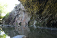
Rydal Cave
 1.65 mi
+282 ft
-259 ft
1h 00
1.65 mi
+282 ft
-259 ft
1h 00
 Easy
Departure from Lakes (Westmorland and Furness)
Easy
Departure from Lakes (Westmorland and Furness)
Short walk to see the famous Rydal cave. Dog friendly walk.
The Fairfield Horseshoe from Ambleside
10.27 mi
+2,897 ft
-2,897 ft
7h 15
Moderate
Departure from Lakes (Westmorland and Furness)
The Fairfield horseshoe includes seven other Lake District fells. Low Pike, High Pike, Dove Crag and Hart Crag form the outward route with the return over Great Rigg, Heron Pike and Nab Scar back to Ambleside via Rydal. This is a high level route so choose a good day to make the most of the views.
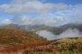
Loughrigg Fell from Ambleside by Lily Tarn
 5.24 mi
+2,267 ft
-2,257 ft
4h 25
Moderate
Departure from Lakes (Westmorland and Furness)
5.24 mi
+2,267 ft
-2,257 ft
4h 25
Moderate
Departure from Lakes (Westmorland and Furness)
A medium level walk with gorgeous views on Ambleside and distant summits. Dog friendly walk.
The Tongue
 Association / Club / Walk leader7.06 mi
+955 ft
-955 ft
4h 05
Moderate
Departure from Lakes (Westmorland and Furness)
Association / Club / Walk leader7.06 mi
+955 ft
-955 ft
4h 05
Moderate
Departure from Lakes (Westmorland and Furness)
A figure-of-eight route which, with only moderate climbing, gives superb views to Windermere.
Wansfell Pike and Ambleside
7.19 mi
+1,732 ft
-1,759 ft
4h 50
 Difficult
Departure from Lakes (Westmorland and Furness)
Difficult
Departure from Lakes (Westmorland and Furness)
Fantastic views over Windermere, a sylvan waterfall, and a gentler woodland return via the village
High Street and Ill Bell
12.59 mi
+3,120 ft
-3,146 ft
8h 30
Difficult
Departure from Lakes (Westmorland and Furness)
A hard fell walk up the valley of Trout Beck to High Street, returning via the Ill Bell ridge.
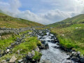
Angle Tarn and Rest Dodd
 6.43 mi
+1,864 ft
-1,860 ft
4h 35
Difficult
Departure from Patterdale (Westmorland and Furness)
6.43 mi
+1,864 ft
-1,860 ft
4h 35
Difficult
Departure from Patterdale (Westmorland and Furness)
A steady climb up to Angle Tarn from Hartsop via Boredale Hause followed by a stroll along a ridge with great views over to Helvellyn then up to Rest Dodd dropping down to Hayeswater and back to the car park.
For more walks, use our search engine .
The GPS track and description are the property of this route's author. Please do not copy them without permission.

