


Jubilee Bridge HM
Details
Creation:
Last update:
–
–
-
 Activity: Walking
 -
 Distance: 13.18 mi
 -
 Average duration: 6h 10
 -
 Difficulty: Not specified
 -
-
 Back to start: Yes
 -
 Ascent: + 85 ft
 -
 Descent: - 102 ft
 -
-
 Highest point: 66 ft
 -
 Lowest point: 0 ft
-
 Country:
United Kingdom
Country:
United Kingdom
-
 City:
Halton
City:
Halton -
 Start/End: N 53.34236° / W 2.739169°
 -


 Hour-by-hour weather


Waypoints
- S/E : mi 0 - alt. 66 ft
- 1 : mi 1.23 - alt. 30 ft - Keep left onto Ditton Road
- 2 : mi 4.27 - alt. 33 ft - Turn right onto Cocklade Lane
- 3 : mi 4.3 - alt. 33 ft - Turn right onto Carr Lane
- 4 : mi 5.54 - alt. 46 ft - Turn right onto Higher Road
- 5 : mi 6.58 - alt. 36 ft - Turn right onto Hale Gate Road
- 6 : mi 7.88 - alt. 33 ft - Turn right onto Cocklade Lane
- 7 : mi 7.92 - alt. 33 ft - Turn right onto Carr Lane
- 8 : mi 9.15 - alt. 46 ft - Turn right onto Higher Road
- 9 : mi 10.2 - alt. 36 ft - Turn left onto Hale Road
- 10 : mi 11.87 - alt. 26 ft - Keep right onto Ditton Junction
- S/E : mi 13.18 - alt. 62 ft
Other walks in the area
Helsby Hill and Alvanley
 Association / Club / Walk leader6.75 mi
+764 ft
-748 ft
3h 45
Association / Club / Walk leader6.75 mi
+764 ft
-748 ft
3h 45
 Easy
Easy
 Departure from Frodsham (Cheshire West and Chester)
Two hillforts, mixed walking in farmland and woodland, and rocky outcrops with wide views.
Overton Hill
2.06 mi
+348 ft
-328 ft
1h 15
Easy
Departure from Frodsham (Cheshire West and Chester)
A pleasant woodland stroll to a nearby war memorial with fine views over the Mersey Estuary to Liverpool.
Frodsham Marsh
4.57 mi
+82 ft
-82 ft
2h 10
Easy
Departure from Frodsham (Cheshire West and Chester)
An interesting, level walk around the bird-rich lagoons and reed-beds of Frodsham Marsh – take your binoculars!
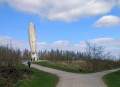
Sutton Manor, The Dream, Clockface Park Circular
 Visorando Member
 5.49 mi
+102 ft
-121 ft
2h 35
Easy
Departure from St Helens (Liverpool City Region)
5.49 mi
+102 ft
-121 ft
2h 35
Easy
Departure from St Helens (Liverpool City Region)
Starting at Sutton Manor Park visiting The Dream sculpture, Clockface Country Park, Sutton Mill Dam, Brickfields Nature Reserve and Daisyfields Reserve.
Clock Face Colliery Moss Circular
 5.98 mi
+75 ft
-72 ft
2h 50
5.98 mi
+75 ft
-72 ft
2h 50
 Average
Departure from Bold (Liverpool City Region)
Average
Departure from Bold (Liverpool City Region)
A circular route beginning at Clock Face Park onto Wheatacre Reserve and returning via Colliery Moss.
Bold Heath 'Ladies'
 5.62 mi
+154 ft
-151 ft
2h 45
Average
Departure from Bold (Liverpool City Region)
5.62 mi
+154 ft
-151 ft
2h 45
Average
Departure from Bold (Liverpool City Region)
A circular walk starting from Clock Face park then taking 'Ladies Walk' between Bold New and Old Halls to Bold Heath. The return section includes a disused railway track and The Dream sculpture.
For more walks, use our search engine .
The GPS track and description are the property of this route's author. Please do not copy them without permission.

