


Autour d'Isola

Un circuit en boucle autour d'Isola 2000, du côté italien au Refuge de Nice, des lacs du Diable à Saint-Martin-Vésubie.
Details
Creation:
Last update:
Last review:
–
–
-
 Activity: Walking
 -
 Distance: 63.40 mi
 -
 Average duration: 7 days
 -
 Difficulty: Very difficult
 -
-
 Back to start: Yes
 -
 Ascent: + 30,020 ft
 -
 Descent: - 29,974 ft
 -
-
 Highest point: 9,409 ft
 -
 Lowest point: 3,022 ft
 Country:

 City:
City:


Stages of the route
This route needs several days, find the details below:
This route passes through a protected area, which may be subject to special regulations:
Other walks in the area
Isola 2000 – Rifugio Questa
 Visorando Member7.19 mi
+4,163 ft
-3,159 ft
6h 55
Visorando Member7.19 mi
+4,163 ft
-3,159 ft
6h 55
 Difficult
 Departure from Isola (Alpes-Maritimes)
The first stage of a circular walk around Isola. The route starts at the top of the resort and finishes at Rifugio Questa, on the Italian side, passing by the Terre Rouge Lakes and Lake Tavels.
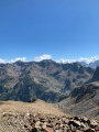
Cime de la Lombarde via Terre Rouge and Pas du Loup
 6.89 mi
+2,946 ft
-2,953 ft
5h 45
Difficult
Departure from Isola (Alpes-Maritimes)
6.89 mi
+2,946 ft
-2,953 ft
5h 45
Difficult
Departure from Isola (Alpes-Maritimes)
A relatively easy summit above Isola 2000, the Cime de la Lombarde offers superb views of the French and Italian Alps. The route described here is a beautiful circular loop that is relatively uncrowded, except for chamois, and offers beautiful views of the Orgials and Rio Freddo valleys.
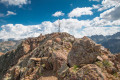
Mount Malinvern via the Terre Rouge Lakes.
 6.77 mi
+2,762 ft
-2,746 ft
5h 30
Difficult
Departure from Isola (Alpes-Maritimes)
6.77 mi
+2,762 ft
-2,746 ft
5h 30
Difficult
Departure from Isola (Alpes-Maritimes)
A technical hike starting from Isola 2000 that will take you to the highest point in the area, with breathtaking views of the resort and the Italian Alps. Up to the beautiful Terre Rouge Lakes and Baisse du Druos, this route is accessible to all; things get a little more challenging once you reach Italy.
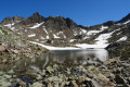
Lakes of Terre Rouge and Baisse du Druos
 5.23 mi
+1,759 ft
-1,755 ft
3h 55
5.23 mi
+1,759 ft
-1,755 ft
3h 55
 Moderate
Departure from Isola (Alpes-Maritimes)
Moderate
Departure from Isola (Alpes-Maritimes)
An easy round trip hike that allows you to discover a wild area very close to the Isola 2000 ski resort.
During the ascent, you will pass close to the 5 Lacs de Terre Rouge lakes before arriving at the Baisse du Druos, which offers a beautiful view of the many Lacs Supérieurs de Valscura lakes.
Although this route is outside the Mercantour National Park, you may encounter some chamois.
The Lausfer lakes and the Italian border from Isola 2000
 13.67 mi
+3,724 ft
-3,707 ft
10 hrs
Very difficult
Departure from Isola (Alpes-Maritimes)
13.67 mi
+3,724 ft
-3,707 ft
10 hrs
Very difficult
Departure from Isola (Alpes-Maritimes)
Starting from the Isola 2000 resort, hike towards the Lausfer lakes and, following the French-Italian border, return via the Col de la Lombarde.
From the Lacs de Terre Rouge to Lac de Tavels circular
 9.87 mi
+3,652 ft
-3,645 ft
6 hrs
Very difficult
Departure from Isola (Alpes-Maritimes)
9.87 mi
+3,652 ft
-3,645 ft
6 hrs
Very difficult
Departure from Isola (Alpes-Maritimes)
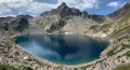
A very beautiful hike starting from Isola 2000, allowing you to discover six lakes, some of which are in Italian territory.
The hike is varied in that it follows a fairly busy route offering magnificent views, as well as a much wilder and less frequented section.
The numerous lakes and water sources along the way are an invitation to cool off.
Please note: there are some difficulties on the terrain => see § Practical information.
Pas du Loup from Isola 2000
 4.96 mi
+1,978 ft
-1,982 ft
4h 00
Moderate
Departure from Isola (Alpes-Maritimes)
4.96 mi
+1,978 ft
-1,982 ft
4h 00
Moderate
Departure from Isola (Alpes-Maritimes)
A viewpoint over Mont Viso (weather permitting!); in any case, a wild landscape just a few minutes from civilisation (Isola 2000 resort).
Crête de la Lausetta from the Col de la Lombarde
 3.24 mi
+630 ft
-633 ft
2h 00
3.24 mi
+630 ft
-633 ft
2h 00
 Easy
Departure from Isola (Alpes-Maritimes)
Easy
Departure from Isola (Alpes-Maritimes)
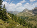
A short, easy walk between France and Italy.
You'll find yourself trying to guess which country you're in as you walk along the ridge.
I've never crossed the border so many times in such a short space of time...
And you can admire the view of the two valleys below.
For more walks, use our search engine .
The GPS track and description are the property of this route's author. Please do not copy them without permission.

