
Hydra Mandraki

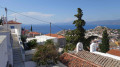
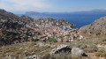
Hydra is a stunning island in the Aegean Sea, south of Athens. On this car-free island, you get around on foot or by donkey. There is no shortage of walking trails. This short, easy coastal walk can be enhanced by a quick dip at Mandraki. The return route takes you up to the higher parts of the village of Hydra, offering superb views over the harbour.

Details

n°1526045
Creation:
Last update:
Last review:
  • Walking
    Activity: Walking
  • ↔
    Distance: 4.26 mi
  • ◔
    Average duration: 2h 50 
  • ▲
    Difficulty: Easy

  • ⚐
    Back to start: Yes
  • ↗
    Ascent: + 997 ft
  • ↘
    Descent: - 981 ft

  • ▲
    Highest point: 656 ft
  • ▼
    Lowest point: 16 ft

Photos

Description of the walk

Getting to the port of Hydra from Ermioni.

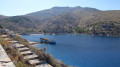
(S/E) From the harbour, head left towards Mandraki. Walk along the quay and take a small tarmac road running along the coast.

(1) Climb the steps leading to the fortifications guarding the harbour entrance (superb view of the village of Hydra and the harbour). After this short stop, continue the walk towards Mandraki (north-east). You’ll reach the villas overlooking the sea.

(2) After following the coastline, the path descends towards Mandraki. At the bottom of the path, a gate leads to the beach, which is protected by a surrounding wall.

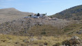
(3) If the gate is open, cross the beach. If not, a path takes you round the (ruined) buildings. After the beach, continue along a stony path until you reach a small fort.

(4) From this small fort, reached via a few steps, there is a superb view over Mandraki Bay. After this brief stop, head down the stony path to return to the beach.
From this point, access to the beach is unrestricted (swimming is possible).

(3) Return to the tarmac road towards Hydra for about 500 metres to reach the villas you passed earlier.

(2) Take a flight of steps on the left where there is a signpost indicating Hydra. These steps end after a small white house. Take the narrow track leading uphill towards a monastery; after about 800 metres, you’ll reach a wide path. Follow this to the right for 150 metres.

(5) Turn right onto a path leading towards a small chapel. This path then runs alongside a small dry-stone wall and descends towards Hydra (superb views of the harbour). At the bottom of this path, you’ll reach the first houses. Turn right, then left, and walk down to a small square, where you turn right.

(6) From here, head downhill, take the second left and then the right. Continue downhill to reach the harbour (S/E)

Waypoints

  1. S/E : mi 0 - alt. 30 ft - Port of Hydra
  2. 1 : mi 0.23 - alt. 43 ft - Fortifications protecting the harbour
  3. 2 : mi 1.05 - alt. 121 ft - Crossroads by the houses overlooking the sea
  4. 3 : mi 1.48 - alt. 49 ft - Buildings on Mandraki beach.
  5. 4 : mi 1.87 - alt. 36 ft - Mandraki Fort
  6. 5 : mi 3.22 - alt. 646 ft - Head towards a chapel.
  7. 6 : mi 4.04 - alt. 49 ft - Return to the main street in Hydra.
  8. S/E : mi 4.26 - alt. 30 ft - Port of Hydra

Notes

Getting to Hydra:
- 40 minutes from the port of Ermioni at 10.00, 12.00 and 14.00. Return at 15.00 or 18.00 with a different ferry company),
- there are also services from the port of Piraeus.

Reviews and comments

4.3 / 5
Based on 2 reviews

Reliability of the description
4.5 / 5
Ease of following the route
4 / 5
Route interest
4.5 / 5
Séverine Al
Séverine Al

Overall rating : 4.3 / 5

Date of your route : Apr 26, 2024
Reliability of the description : ★★★★☆ Good
Ease of following the route : ★★★★☆ Good
Route interest : ★★★★★ Very good
Very busy route : No

A really lovely walk. I’d recommend doing it the other way round: climb up the footpath first, come back down the steps, have a swim, then take it easy on the way back along the little road that runs alongside the sea.
Hardly anyone there in April.
No shade at all – best avoided in summer.

Machine-translated

Nocibella
Nocibella

Overall rating : 4.3 / 5

Date of your route : Oct 22, 2019
Reliability of the description : ★★★★★ Very good
Ease of following the route : ★★★★☆ Good
Route interest : ★★★★☆ Good

The walk is much more enjoyable on the way back – it’s more undulating, with a bit of an incline, lovely views, and a more ‘hiking’ atmosphere.
The outward leg is very easy; it’s mainly a pedestrianised seafront path. We carried on as far as we could through some very prickly vegetation. It’s a dead end that ends at some foul-smelling sewers.
A lovely walk with a swim.

Machine-translated

For more walks, use our search engine .

The GPS track and description are the property of this route's author. Please do not copy them without permission.