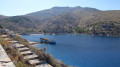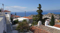
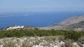
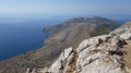
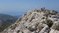
Ilias Monastery and Mount Eros on the island of Hydra

Hydra is a stunning island situated in the Aegean Sea, south of Athens. On this car-free island, you get around on foot or by donkey. There is no shortage of walking trails. This walk will take you to the highest point of the Saronic Islands (588 metres above sea level) via the Monastery of Ilias. The 360° view from the summit is magnificent.

Details

n°1537856
Creation:
Last update:
Last review:
  • Walking
    Activity: Walking
  • ↔
    Distance: 5.39 mi
  • ◔
    Average duration: 4h 15 
  • ▲
    Difficulty: Moderate

  • ⚐
    Back to start: Yes
  • ↗
    Ascent: + 2,064 ft
  • ↘
    Descent: - 2,060 ft

  • ▲
    Highest point: 1,903 ft
  • ▼
    Lowest point: 36 ft

Photos

Description of the walk

Getting to the port of Hydra from Ermioni.

(S/E) From the port, head up towards the village along Andreas Miaoulis Street (the street opposite the landing stage) until you reach a Fork in the road.

(1) At this fork in the road, turn left onto the small tarmac road that passes close to a small farm. After a few hairpin bends, this road joins a track.

(2) Follow the track up to the left. This unpaved track becomes tarmac after a few hundred metres and a few bends.

(3) From this point, the paved track climbs in wide zigzags through the pine forest.

(4) Continue along this track. You have the option of taking a more direct route up via some steps, which you’ll take on the way down (less pleasant on the way up).

(5) Continue to the left towards the monastery (do not take the path on the right; we’ll come back that way on the return journey). Climb the steps and enter the Monastery of Ilias. N.B. You are free to explore the monastery as you wish; photography is permitted.
Then head left, due west, following the wall. Next, head north-west towards a gate leading out of the grounds.

(6) On leaving the grounds, join a path heading due south. Continue for several hundred metres. Descend slightly into a small hollow before climbing back up towards the south-west. Ignore the path on the right. Follow this track all the way to the summit of Mount Éros (an uneven path with a few sections requiring the use of your hands).

(7) Follow the same route back to the previous point.

(6) Head towards the Convent of St Ag. Efpraxia (open to visitors). From the convent, take the path heading north-east, then go round the buildings by turning left. Continue north-east to rejoin the path taken on the ascent.

(5) Head for the steps leading straight down alongside a low wall.

(4) Follow the paved path you took on the way up in the opposite direction until you reach the junction of the road and the track.

(2) Take the small tarmac road heading due north and walk to St Konstantinos Church. From the church forecourt, there is a superb view of Hydra and its harbour.

(8) Walk round the church and head down towards Hydra via the small, stepped, cobbled alleyways. Take the alleyway on the right to reach Andreas Miaoulis Street.

(1) Walk down Andreas Miaoulis Street to the harbour (S/E).

Waypoints

  1. S/E : mi 0 - alt. 39 ft - Port of Hydra
  2. 1 : mi 0.38 - alt. 207 ft - Street on the left
  3. 2 : mi 0.93 - alt. 430 ft - Track
  4. 3 : mi 1.25 - alt. 646 ft - Paved track
  5. 4 : mi 1.89 - alt. 1,283 ft - Zigzagging paved path
  6. 5 : mi 2.08 - alt. 1,440 ft - To the Monastery of Ilias
  7. 6 : mi 2.37 - alt. 1,493 ft - Exit from the monastery grounds
  8. 7 : mi 2.91 - alt. 1,877 ft - Summit of Mount Eros, 588m
  9. 8 : mi 4.78 - alt. 394 ft - Church of St Konstantinos
  10. S/E : mi 5.39 - alt. 43 ft - Port of Hydra

Notes

Getting to the Port of Hydra:
- From Ermioni in 40 minutes (departures from the port of Ermioni at 10.00, 12.00 and 14.00. Return at 15.00 or 18.00 with a different ferry company).
- There are connections from the port of Piraeus to Hydra.

N.B. When visiting the monastery and convent, modest clothing is required; legs and shoulders must be covered.

Worth a visit

From the summit of Mount Eros (7), there is a 360° view of the Aegean Sea, the Peloponnese coastline and the surrounding islands.

Reviews and comments

4.2 / 5
Based on 2 reviews

Reliability of the description
4 / 5
Ease of following the route
3.5 / 5
Route interest
5 / 5
Séverine Al
Séverine Al

Overall rating : 4.7 / 5

Date of your route : Apr 26, 2024
Reliability of the description : ★★★★★ Very good
Ease of following the route : ★★★★☆ Good
Route interest : ★★★★★ Very good
Very busy route : No

A pleasant walk. Breathtaking views. Regular panoramic views.
Shade on the first section but not on the final stretch up Mount Eros.
Not many people in April.
It’s possible to do a much longer circular route via Epidkopi, but you need to be a keen walker as it takes 7 hours in total and the path becomes more challenging after Mount Eros.

Machine-translated

Nocibella
Nocibella

Overall rating : 3.7 / 5

Date of your route : Oct 23, 2019
Reliability of the description : ★★★☆☆ Average
Ease of following the route : ★★★☆☆ Average
Route interest : ★★★★★ Very good

We had a bit of trouble finding the way to Eros from the monastery, but it was well signposted in blue and white after that.
Stunning views at the summit. Very windy and cold.
We didn’t encounter any technical difficulties as a family; the climb is steep but not insurmountable.
You should definitely avoid the steps on the way up.
A lovely walk to do.

Machine-translated

For more walks, use our search engine .

The GPS track and description are the property of this route's author. Please do not copy them without permission.