


Horton To Brill Round Trip
Details
Creation:
Last update:
–
–
-
 Activity: Walking
 -
 Distance: 12.92 mi
 -
 Average duration: 6h 25
 -
 Difficulty: Not specified
 -
-
 Back to start: No
 -
 Ascent: + 551 ft
 -
 Descent: - 558 ft
 -
-
 Highest point: 640 ft
 -
 Lowest point: 226 ft
-
 Country:
United Kingdom
Country:
United Kingdom
-
 City:
Horton-cum-Studley
City:
Horton-cum-Studley -
 Start: N 51.807091° / W 1.135678°
 -
 End: N 51.808199° / W 1.13395°
 -


 Hour-by-hour weather


Waypoints
- S : mi 0 - alt. 308 ft - Start on Horton Hill
- 1 : mi 0.02 - alt. 315 ft - Turn left
- 2 : mi 0.05 - alt. 322 ft - Turn slight left
- 3 : mi 0.39 - alt. 328 ft - Turn left
- 4 : mi 0.62 - alt. 312 ft - Turn left onto Brill Road
- 5 : mi 0.81 - alt. 322 ft - Turn sharp left
- 6 : mi 1.91 - alt. 322 ft - Turn sharp right onto Brill Road
- 7 : mi 2.8 - alt. 341 ft - Turn sharp right
- 8 : mi 2.98 - alt. 335 ft - Keep left
- 9 : mi 3.15 - alt. 335 ft - Turn slight right
- 10 : mi 3.33 - alt. 341 ft - Turn right onto Brill Road
- 11 : mi 3.48 - alt. 335 ft - Turn left onto Piddington Circular Walk
- 12 : mi 4.36 - alt. 358 ft - Turn left onto Piddington Circular Walk
- 13 : mi 4.48 - alt. 335 ft - Turn sharp right onto Piddington Circular Walk
- 14 : mi 4.83 - alt. 367 ft - Turn right
- 15 : mi 5.42 - alt. 374 ft - Turn right onto B4011
- 16 : mi 5.43 - alt. 374 ft - Turn left
- 17 : mi 6.06 - alt. 636 ft - Turn right
- 18 : mi 7.29 - alt. 607 ft - Turn right onto High Street
- 19 : mi 7.37 - alt. 604 ft - Keep right onto The Square
- 20 : mi 8.71 - alt. 276 ft - Turn right onto Bicester Road, B4011
- 21 : mi 8.97 - alt. 279 ft - Turn left onto Brookside
- 22 : mi 8.99 - alt. 282 ft - Turn right onto Brookside
- 23 : mi 9.05 - alt. 282 ft - Turn left onto Brookside
- 24 : mi 9.07 - alt. 279 ft - Turn right onto Bicester Road, B4011
- 25 : mi 9.1 - alt. 279 ft - Turn right onto Manor Road
- 26 : mi 9.26 - alt. 279 ft - Keep right onto Oxford Road
- 27 : mi 10.15 - alt. 279 ft - Turn right
- 28 : mi 10.23 - alt. 279 ft - Turn sharp right
- 29 : mi 10.66 - alt. 305 ft - Turn left
- 30 : mi 10.93 - alt. 299 ft - Turn left
- 31 : mi 10.94 - alt. 299 ft - Turn left
- 32 : mi 11.03 - alt. 299 ft - Turn right
- 33 : mi 11.03 - alt. 299 ft - Turn left onto Oxford Road
- 34 : mi 11.85 - alt. 269 ft - Turn right onto Oakley Road
- 35 : mi 12.62 - alt. 305 ft - Turn left onto Horton Hill
- 36 : mi 12.81 - alt. 315 ft - Turn right
- 37 : mi 12.83 - alt. 322 ft - Turn slight left
- E : mi 12.92 - alt. 322 ft
Other walks in the area
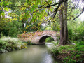
Oxford to Thame
 Visorando Member
 13.01 mi
+285 ft
-404 ft
6h 15
13.01 mi
+285 ft
-404 ft
6h 15
 Difficult
Departure from Forest Hill with Shotover (Oxfordshire)
Difficult
Departure from Forest Hill with Shotover (Oxfordshire)
This is the first stage of the multi-day route "Railways and Waterways, between Oxford and London".
A varied countryside walk linking open farmland, landscaped parkland and a world-renowned golf course, with highlights including Waterperry house and gardens, the first sight of the River Thame at Bow Bridge and Rycote Chapel.
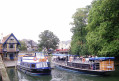
Railways and Waterways, between Oxford and London
 150.37 mi
+1,572 ft
-1,637 ft
14 days
Difficult
Departure from Forest Hill with Shotover (Oxfordshire)
150.37 mi
+1,572 ft
-1,637 ft
14 days
Difficult
Departure from Forest Hill with Shotover (Oxfordshire)
A mainly level circular walk of about 150 miles along the waterways between Oxford and the London suburbs. It can be done in day trips by train or express bus from all the towns en route.
This circular long-distance path starts in rural Oxfordshire, then follows the Grand Union Canal, which has a close-knit narrowboat community, into the Chilterns before winding through the suburbs of London. It crosses the playing fields of Eton to join the Thames Path, which meanders all the way back to Oxford. The route passes over and under bridges of every kind, through country parks, idyllic villages with thatched cottages, grand estates and historic market towns like Aylesbury, Henley-on-Thames and Wallingford. The lakes, chalk rivers and water meadows are home to a diversity of wildlife, and traditional waterside pubs provide welcome refreshment.
Rushbed Woods and Brill circular
4.78 mi
+315 ft
-315 ft
2h 30
 Moderate
Departure from Brill (Buckinghamshire)
Moderate
Departure from Brill (Buckinghamshire)
A gentle walk near Brill, including a nature reserve with lots of butterflies (in June and July) woods and a hill.
Cowley to Shotover Circular, Oxford
5.45 mi
+377 ft
-377 ft
2h 50
 Easy
Departure from Oxford (Oxfordshire)
Easy
Departure from Oxford (Oxfordshire)
This circular walk goes through three SSSIs from urban Oxford. Starting from urban Cowley, walk up to the top of Shotover country park SSSI (Site of Special Scientific Interest) for nature and views to the South West, then through Rock Edge SSSI, for Upper Jurassic limestone, and then through Lye Valley SSSI to experience nationally rare calcareous fen habitat from the last ice age.
Hampton Gay
 Association / Club / Walk leader2.98 mi
+39 ft
-39 ft
1h 25
Easy
Departure from Hampton Gay and Poyle (Oxfordshire)
Association / Club / Walk leader2.98 mi
+39 ft
-39 ft
1h 25
Easy
Departure from Hampton Gay and Poyle (Oxfordshire)
Stroll across the meadows to an isolated church and ruined 16th-century manor house.
Cherwell valley
4.19 mi
+26 ft
-26 ft
1h 55
Easy
Departure from Hampton Gay and Poyle (Oxfordshire)
Visit four historic churches, plus a ruined manor house and a pretty riverside return.
Hampton Poyle & Bletchingdon
4.39 mi
+135 ft
-135 ft
2h 10
Moderate
Departure from Hampton Gay and Poyle (Oxfordshire)
Climb to a pretty village with a historic church, country house and village green.
Wolvercote Circular
6.21 mi
+69 ft
-69 ft
2h 55
Easy
Departure from Oxford (Oxfordshire)
An almost flat, circular walk following the Thames Path and Oxford Green Way. The walk starts in Wolvercote, passes Godstow Abbey, then follows the banks of the River Thames, taking in some interesting islands and weirs. The return is past Wytham Woods and across fields, returning via the Trout Inn for well-earned refreshments at the end of the walk.
For more walks, use our search engine .
The GPS track and description are the property of this route's author. Please do not copy them without permission.

