Country:

 City:
City:


Start: Henley-on-Thames Station (SU 763 822)
(S) From the station, turn right and immediately right along the alleyway to the road. Cross and continue to the riverbank past the children’s playground.
There are public toilets on the right.
(1) Turn right along the towpath through Mill and Marsh Meadows.
(2) The original Thames Path is indefinitely closed at Marsh Lock, so turn right along the lane on the diversion. Pass a car park where refreshments are available in summer and cross the railway. At the main road, carefully cross and keep ahead along Noble Road into a bridleway, then turn left along Harpsden Way. Continue to the road junction and turn right to Harpsden Church.
(3) Take the left fork after the church, then bear left on a bridleway on rising ground. Bear left at the junction with a footpath and continue to Woodlands Road. Cross and bear left on a wide path. Keep parallel to the lane, then join it along a track. Keep ahead along the lane, then turn left on a bridleway which reaches the main road after half a mile.
(4) Carefully cross and bear right on the fenced path which leads along Northgate Avenue.
(5) Cross to the lane ahead with the Baskerville Arms on the left, and follow it for 400 yards.
(6) Turn left at the Thames Path sign, then left and right to duck under the railway. Follow the path to the river bank.
(7) Turn right along it.
(8) At the bend in the river, turn right along the byway and go under the railway bridge. At the end of the housing, turn left on a footpath to Shiplake Lock.
(9) Turn right and continue along the riverbank to the Shiplake College boating area.
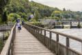
(10) Go over the bridge and keep to the riverbank for another two miles.
(11) Go over the footbridge to reach the road at Sonning. Carefully cross at the traffic lights, turn left over the bridge, then turn right on the towpath. Pass Sonning Lock and the boatyard of Reading Bluecoat School.
(12) Pass through the water meadows, which are full of wildflowers in summer, then the water sports area before coming to the Horseshoe Bridge, where the River Kennet flows into the Thames.
(13) Turn left under the bridges along the Kennet and Avon Canal. Pass Blakes Lock, the Fisherman’s Cottage and the weir.
(14) At the road bridge, go up the steps and turn right over the canal. Take the side road on the right and turn right along Gasworks Road.
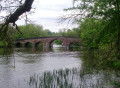
(15) Go over the green-painted bridge and turn left on the path along the river, passing new apartment blocks. Go under the bridge, then up to Chestnut Walk and past the former Reading Jail.
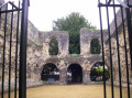
(16) Turn right through the Abbey ruins, then under the bridge into the Forbury Gardens.
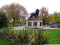
(17) Pass the Maiwand lion with its impossible gait and leave the gardens by the north-west arch.
(18) Turn left along the cycleway, carefully cross the road and turn right to the traffic lights. Cross and turn left for Reading Station.(E)
 Visorando Member
 Easy
Easy  Tourist office
 Tourism professional
 Association / Club / Walk leader