Grand Tour of the Val d’Onzon

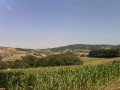
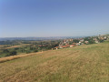
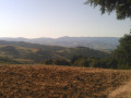
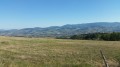
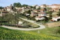
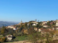
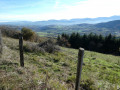
A lovely route – long but not difficult – which takes you on a complete route of the Val d’Onzon, offering beautiful views of the Pilat massif, the Monts du Forez and the Northern Alps (on a clear day!). A wide variety of idyllic landscapes.
The route mainly follows the higher parts of the terrain.

Details

1292597
Creation:
Last update:
Last review:
  • Walking
    Activity: Walking
  • ↔
    Distance: 14.85 mi
  • ◔
    Average duration: 8h 30 
  • ▲
    Difficulty: Difficult

  • ⚐
    Back to start: Yes
  • ↗
    Ascent: + 1,896 ft
  • ↘
    Descent: - 1,896 ft

  • ▲
    Highest point: 2,838 ft
  • ▼
    Lowest point: 1,696 ft

Photos

Description of the walk

Park in the car park at the Sorbiers post office.

(S/E) Cross the town hall garden diagonally, heading towards “La Maison des Cloutiers”.
Walk briefly along Avenue du Général de Gaulle, then turn right onto Rue Pierre Mas. Continue along the pedestrianised street, which goes round a house before coming out onto Rue de la Montat. Turn right briefly.

(1) Take Rue Antoine Marquet (crossroads) which slopes down to the left. At the bottom of the street, turn left onto Rue de l’Onzonnnière, then right onto Rue de l’Entente, which leads to the traffic lights on the D3.

(2) Cross the road and enter Valjoly Park, first following the D3 and then heading up towards the château. Go round it on the left. Follow the wooden steps leading to a shaded path until you reach Impasse des Confidences.

(3) Take this lane, turn right onto Rue Lamartine, then continue along Chemin Guy de Maupassant. After a short tarmac section, the path becomes a farm track and joins Rue des Pins.

(4) Go straight on, heading uphill. Continue to the junction at a place called La Voûte.

(5) Turn left and, once in the hamlet, take the path on the right. Continue to the junction with the D23.

(6) Cross the junction and carry on along the path opposite. At the edge of the woodland, take the path leading uphill to the right and you’ll soon reach the summit of Mont Morin at 821m.

(7) Continue straight on towards the north-east. At the junction (820m), carry on straight ahead until you reach the D54 at the entrance to the hamlet of Gonachon.

(8) Turn right onto the D54, cross Gonachon, take the path on the left as you leave the hamlet and turn immediately right at the next junction. The path running parallel to the road leads to Le Pilon, where it rejoins the D54. Walk carefully alongside the road to reach La Grande Borne.

(9) Turn right towards “Crêt des Alouettes”. Continue along this path, ignoring all turn-offs to the right or left. After the 836-metre mark, you’ll reach a multi-way junction.

(10) Turn right to reach the hamlet of Fonbonnond. The tarmac road turns into a dirt track shortly before the bottom of the valley.

(11) In the hamlet, take the tarmac road on the left which climbs up to the D6. Follow it to the left for 50 metres.

(12) Follow it to the right for about a hundred metres, then leave it at the cross and take the path on the right. Further on, rejoin the D6 and follow it to the right to enter the village of Saint-Christo-en-Jarez.

(13) At the cross, turn left onto the Chemin des Mitanes. At the junction with the Croix des Mitanes, go straight on along the Chemin des Flaches du Plein. Continue straight on until you reach the edge of the village and keep heading towards Prassaint. At the crossroads, join theGR®7.

(14) Turn right onto it and, after a gentle descent, you’ll reach the D6. Cross the road with care, then rejoin it to reach another path junction further on.

(15) Take the path to the left of the D6, ignoring the one that runs perpendicular to the road. Follow it to the Col de la Gachet. Cross the D6 and walk for about a hundred metres, keeping in the same direction.

(16) The rest of the route follows theGR®7variant, marked in white and red. Walk past a rest area on your right and take the ascending dirt track. After Montomet, the track descends to a tarmac road at the bottom of the valley.

(17) Turn left, then right at a cross. Climb up to Cochollon.

(18) Continue to the right along the farm track running parallel to the D106, which joins it at La Faverge. Continue along the D106 with care until you reach Fayet.

(19) Turn right to stay on theGR®7variant. Keep left at the next two junctions, pass Albuzy then the Red Cross and reach the crossroads marked with a cross.

(21) Take the dirt track on the left. You’ll reach the entrance to a housing estate. Turn right onto Rue des Sapins. A few metres further on, you’ll come to a junction with a footpath.

(22) Take this path to the left, walking alongside the housing estate and ignoring all the streets on the left. At the end of the path, you’ll reach Rue du Midi. At the next junction, turn right onto Rue de la Flache to return to the car park where you started (S/E).


Waypoints

  1. S/E : mi 0 - alt. 1,837 ft - Sorbiers Post Office
  2. 1 : mi 0.45 - alt. 1,903 ft - Turn left onto Rue Antoine Marquet
  3. 2 : mi 1.02 - alt. 1,706 ft - D3
  4. 3 : mi 1.41 - alt. 1,870 ft - Impasse des Confidences
  5. 4 : mi 2.1 - alt. 2,037 ft - Rue des Pins
  6. 5 : mi 2.76 - alt. 2,205 ft - La Voûte
  7. 6 : mi 3.36 - alt. 2,169 ft - Cross the D23
  8. 7 : mi 4.03 - alt. 2,687 ft - Mont Morin
  9. 8 : mi 4.73 - alt. 2,703 ft - Le Gonachon
  10. 9 : mi 5.62 - alt. 2,661 ft - La Grande Borne
  11. 10 : mi 6.76 - alt. 2,723 ft - Crossroads with multiple junctions
  12. 11 : mi 7.32 - alt. 2,644 ft - Fontbonnond
  13. 12 : mi 7.66 - alt. 2,782 ft - D6
  14. 13 : mi 8.39 - alt. 2,776 ft - Towards the - Croix des Mitanes (Saint-Cristo-en-Jarez)
  15. 14 : mi 9.08 - alt. 2,762 ft - Junction with the GR°°®°°7. Near the source of the - Onzon (rivière)
  16. 15 : mi 9.58 - alt. 2,513 ft - Farm track
  17. 16 : mi 10.43 - alt. 2,480 ft - Col de la Gachet (748m)
  18. 17 : mi 10.94 - alt. 2,313 ft - Tarmac path, on the left
  19. 18 : mi 11.42 - alt. 2,382 ft - Cocholon
  20. 19 : mi 12.17 - alt. 2,333 ft - Fayet
  21. 20 : mi 12.84 - alt. 2,221 ft - Crossroads – cross
  22. 21 : mi 13.92 - alt. 2,110 ft - Red Cross
  23. 22 : mi 14.41 - alt. 2,067 ft - Rue des Sapins
  24. S/E : mi 14.85 - alt. 1,837 ft - Sorbiers Post Office

Notes

Head to the village of Sorbiers (church topped by a statue of the Virgin Mary). Park near the post office or take the STAS No. 10 bus to the terminus; the service departs from Place Jean Jaurès in Saint-Étienne.

(14) This is the highest point on the route. Enjoy the view stretching as far as the Alps (on a clear day!).

Worth a visit

The Maison des Cloutiers, near the town hall, showcases a traditional craft.
A fine collection of well-maintained wayside crosses at various crossroads.
Numerous tastefully restored farmhouses.
Stunning panoramic views of the Pilat massif throughout the walk.
Between (12) and (14), you can catch a glimpse of the Northern Alps on a clear day.
Generally speaking, the route favours higher ground, offering some truly breathtaking views.
Pilgrimage and the church at Valfleury below the Col de la Gachet.

Always be cautious and plan ahead when you're outdoors. Visorando and the author of this route cannot be held responsible for any accidents occurring on this route.

The GR® and PR® markings are the intellectual property of the Fédération Française de Randonnée Pédestre.

Reviews and comments

4.6 / 5
Based on 3 reviews

Reliability of the description
4.3 / 5
Ease of following the route
4.7 / 5
Route interest
4.7 / 5
lucreceneige
lucreceneige

Overall rating : 4.7 / 5

Date of your route : Oct 23, 2023
Reliability of the description : ★★★★★ Very good
Ease of following the route : ★★★★★ Very good
Route interest : ★★★★☆ Good
Very busy route : Yes

This route is very good, but there is an error in the information provided. The elevation gain is 700 metres, not 520 metres; the route was mapped using Iphigénie.

Machine-translated

guy pagat
guy pagat
• Edited:

Overall rating : 5 / 5

Date of your route : May 28, 2020
Reliability of the description : ★★★★★ Very good
Ease of following the route : ★★★★★ Very good
Route interest : ★★★★★ Very good
Very busy route : No

A lovely walk on the outskirts of Saint-Étienne with superb views. We shortened the route and avoided the more urban section by parking at Old Albuzy. It’s easy to join the trail from there. The only downside is that you have to walk along the road for a few hundred metres after Le Pilon. Thanks for the walk.

Machine-translated

grandin
grandin ★
• Edited:

Thank you, jesuisenrandonné07, for these clarifications, which the author may take into account if they wish.

Machine-translated

jesuisenrandonné07
jesuisenrandonné07
• Edited:

Overall rating : 4 / 5

Date of your route : Feb 24, 2019
Reliability of the description : ★★★☆☆ Average
Ease of following the route : ★★★★☆ Good
Route interest : ★★★★★ Very good

A lovely walk with lots of beautiful views. No difficulties apart from the length.
Improvements to the guidebook to avoid mistakes and wasted time:
- (Start/Finish): On leaving the park, turn left onto Avenue du Général De Gaulle.
Continue along the pedestrian path, ignore the GR7 alternative route branching off to the right, and head straight on along the single path marked in yellow and white.
- (1): Turn left onto Rue de l’Onzonnière until you reach the stop sign, then take the second street on the right, Rue de l’Entente (do not take the cul-de-sac)
- (2) Follow the wooden steps leading to a shaded lane; turn left onto this lane until you reach a dead end. At the end of this dead end, take the dirt track leading uphill opposite towards the houses. Turn right onto Rue Lamartine.
- (6): Cross the junction and continue along the tarmac road opposite, which turns into a dirt track.
- (11) Turn left and follow it for 50 metres. On the D6, you must turn right as mentioned in point (12)
- (16) Leave the GR7, which heads off to the left, and take the dirt track leading uphill.

Machine-translated

Other walks in the area

For more walks, use our search engine .

The GPS track and description are the property of this route's author. Please do not copy them without permission.