Long walk around Milly-la-Forêt

A varied walk: a bit of road, some fields, and plenty of woodland. A keen sense of direction is essential.
A preference for wild, off-the-beaten-track paths is advisable.
A gentle start through woods and fields, then a crossing of the Forêt des Trois Pignons and a return via the Forêt de Maisse.
Moderator’s notex issues on this route; see the review dated 02/08/2022

Details

n°1240803
Creation:
Last update:
Last review:
  • Mountain biking
    Activity: Mountain biking
  • ↔
    Distance: 22.49 mi
  • ◔
    Duration according to the author: 3 hrs 
  • ▲
    Difficulty: Difficult

  • ⚐
    Back to start: Yes
  • ↗
    Ascent: + 719 ft
  • ↘
    Descent: - 709 ft

  • ▲
    Highest point: 430 ft
  • ▼
    Lowest point: 190 ft
  • ⚐ Country: France
  • ⚐
  • ⚐ City: Buno-Bonnevaux (91720)
  • ⚑
    Start/End: N 48.381014° / E 2.389387°
  • ❏
    IGN map(s): Ref. 2316ET, 2417OT, 2417OTR, M2417OT

  • ◶
    Type of surface:
  •  
     
     
    ■ 33% Road ■ 34% Byway ■ 33% Path
  • ⇧
    Bike carrying: Not specified
  • ▲
    Difficulty: Not specified
  • Hour-by-hour weather

Photos

Description of the route

The walk starts at Château de Bonnevaux, Rue de Buno Bonnevaux. There’s a small free car park for a maximum of 3 to 4 cars.

N.B. You can also start from Maisse station (RER line D) if you’re using public transport or if the castle car park is full. From the station, cross the level crossing to the right, then turn left onto Rue Buno-Bonnevaux until you reach the castle, about 1,300 metres away.**

(S/E) Head south-east. Cross the railway line.

(1) Continue for about thirty metres along the road, then take the path on the left (south-east). Follow this gently ascending path, ignore the first path on the left and, at the next junction, turn left.

(2) At the top of the hill, on the edge of the forest, at the first Fork in the road, turn left. At the second Fork in the road, immediately afterwards, turn right. Continue across the plateau through open fields.

(3) At the junction with theGR®1, turn right and then take a path on the left leading to the Menhir de la Pierre Droite, in the middle of a field. This path is very narrow and may not be accessible depending on the season and the crops being grown. Then turn back to the junction.

(3) Continue north-north-west along theGR®1. At the first junction, turn right and head towards Le Paly. Pass a factory on your left.

(4) At the next crossroads, at the Corbeau farm, turn right.

(5) At the next junction, follow the D1 to the left (pond on the right), and immediately afterwards take the first path on the right (south-east). At the end, continue left (east) along a road. Pass a road on the right.

(6) At the junction, take a small road to the left (joining theGR®111). Follow this road to Oncy-sur-École.

(7) At the first junction in Oncy, turn right, then carry on straight ahead until you reach a path facing the fields. There, turn left.

(8) At the crossroads, cross the main road (D410) and take the small road on the right. At the next junction, turn left. Pass two roads on the left and continue along a track.

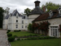
(9) At the T-junction, turn left onto the Chemin de Chambergeot. Carry on straight ahead, ignoring all the side roads. You can admire some magnificent houses along this stretch!

(10) Cross the D16 and carry on straight ahead along the Route des Grandes Vallées.

(11) Take the second right, Rue du Rocher d’Argout, and pass in front of a riding centre.

(12) At the end, turn right, then go round a roundabout and carry on straight ahead. At the T-junction, turn left.

(13) At the end of the road, take the path furthest to the right (east-north-east). At the next junction, turn left onto the path marked in red (Route des 25 Bosses). At a fork in the road, leave this marked path and turn right. Cross the red-marked path again, stay on the main path and climb the slope until you reach the junction with the Denecourt-Colinet path no. 16.

(14) Before the slope becomes any steeper, turn left onto a steep path between the rocks, marked in blue. Get off your bike. Once past the hillock, turn immediately right.

(15) At the crossroads, take the second path on the right, the Chemin de la Justice de Chambergeot, and head east.

(16) At the crossroads where seven paths meet, take the third on the left. At the next crossroads, veer slightly to the right onto a wide path (Chemin de la Gorge aux Chats).

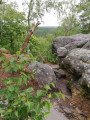
(17) After about 900 metres, take a path on the left – one that’s actually quite hard to spot. Cut across the rocks and ferns. On the uphill section, you’ll probably need to take your shoes off again. Follow this path as best you can; it crosses the Dénecourt No. 16 again (beautiful view from the summit).

(18) At the T-junction, turn right. Enjoy a gentle descent towards easier-to-walk paths. At the crossroads at the bottom, continue straight ahead along a wide path.

(19) Before the car park along the D409, turn left. At the end, turn right.

(20) Cross the D409, ignore the first track after it and carry on straight ahead uphill.

(21) At the junction, take the path furthest to the left and in the worst condition. Turn right at the first junction. Carry on straight ahead (north), ignoring all side paths.

(22) At the T-junction, turn right.

(23) Take the main path again, to the left (Chemin de la Passée aux Moutons), and ignore any paths branching off to the right or left.

(24) At the Petit Montrouget junction, follow theGR®11to the left along the Chemin de la Roche qui Tourne.

(25) At the Carrefour des Côtes de Courances, first turn right then left, staying on the GR®. Again, ignore all paths branching off to the right or left.

(26) Let theGR®11branch off to the left, pass under the arches of the aqueduct and continue straight on along the widest path.

(27) Join theGR® again and carry on straight ahead (west).

(28) At the fork in the road, turn left onto the Chemin de Milly à Melun. Stay on theGR® and ignore a path branching off at right angles to the left.

(29) At a fork in the road, turn right and stay on theGR®, following a narrow path.

(30) Cross the D372 (take care) and continue straight ahead. Then take the D946 on the right towards Moigny (watercress beds).

(31) Turn left twice and follow Rue de Cochet. Continue along a track following theGR®32.

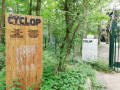
(32) Near Le Cyclop, follow aPR® path (yellow markings) to the left. At the end, first turn right then left, then turn right onto the track.

(33) At the junction, turn left. Climb over a gate and cross what may look like wasteland. At the end, go through another gate, then first turn left then right. You’ll come out onto the D105; follow it to the right for about 250 metres.

(34) Then take a track on the left (gate), cross another track straight away and head south-south-west. Take the first track on the right (marker 76). At the Fork in the road, turn left.

(35) At the junction, first turn right then left. Continue along the winding path, ignoring all turn-offs to the left. Carry on straight ahead until you reach the Maisse ZAC. Turn right and then left at a barrier (you cannot go through this one) and go round the waste collection centre on the right.

(36) Cross the D837 and follow thePR® path opposite. Stay on thePR® path and, further on, join theGRP® du Hurepoix. Follow this west-south-west, along the hillside, until you reach a quarry.

(37) Then turn left along the railway line until you reach the level crossing.

(1) Turn right and head back towards the castle (S/E).

N.B. To return to Maisse station, turn right at the quarry (37), then left onto the D837. The station is a little further on, on the right.


Waypoints

  1. S/E : mi 0 - alt. 217 ft - Bonnevaux Castle - Essonne (l')
  2. 1 : mi 0.19 - alt. 220 ft - Bonneveaux
  3. 2 : mi 0.73 - alt. 384 ft - Fork
  4. 3 : mi 1.16 - alt. 417 ft - Access via the GR1 - Menhir La Pierre Droite (Milly-la-Forêt)
  5. 4 : mi 2.29 - alt. 423 ft - Le Corbeau
  6. 5 : mi 2.86 - alt. 384 ft - La Grange Rouge
  7. 6 : mi 3.9 - alt. 384 ft - Crossroads
  8. 7 : mi 5.14 - alt. 256 ft - Oncy-sur-École
  9. 8 : mi 5.69 - alt. 220 ft - Junction with the D410
  10. 9 : mi 6.21 - alt. 236 ft - Chambergeot
  11. 10 : mi 7.13 - alt. 220 ft - D16 road
  12. 11 : mi 7.57 - alt. 226 ft - Fork in the path
  13. 12 : mi 7.97 - alt. 223 ft - The Croix Saint-Jérôme
  14. 13 : mi 8.42 - alt. 233 ft - Entrance to the Forêt des Trois Pignons
  15. 14 : mi 8.96 - alt. 351 ft - Off-trail 1
  16. 15 : mi 9.06 - alt. 387 ft - Crossroads
  17. 16 : mi 9.54 - alt. 387 ft - Crossroads
  18. 17 : mi 10.08 - alt. 262 ft - Off-trail 2
  19. 18 : mi 10.38 - alt. 315 ft - A lovely descent
  20. 19 : mi 10.71 - alt. 240 ft - Chemin de la Sapinière
  21. 20 : mi 11.08 - alt. 272 ft - D409
  22. 21 : mi 11.31 - alt. 240 ft - Crossroads
  23. 22 : mi 11.83 - alt. 233 ft - T-junction
  24. 23 : mi 11.94 - alt. 253 ft - T-junction
  25. 24 : mi 12.58 - alt. 230 ft - Petit Montrouget crossroads
  26. 25 : mi 13.13 - alt. 236 ft - Carrefour des Côtes de Courances
  27. 26 : mi 13.81 - alt. 285 ft - Loing Aqueduct
  28. 27 : mi 14.63 - alt. 240 ft - Crossroads
  29. 28 : mi 14.79 - alt. 246 ft - Fork
  30. 29 : mi 15.43 - alt. 269 ft - Fork
  31. 30 : mi 15.64 - alt. 240 ft - D372 road
  32. 31 : mi 16.16 - alt. 203 ft - Moigny-sur-École - École (rivière)
  33. 32 : mi 17.06 - alt. 213 ft - Near - Le Cyclop
  34. 33 : mi 17.74 - alt. 223 ft - Crossroads
  35. 34 : mi 18.46 - alt. 249 ft - Start of the path
  36. 35 : mi 19.22 - alt. 407 ft - Crossroads
  37. 36 : mi 20.22 - alt. 400 ft - D837 road
  38. 37 : mi 21.62 - alt. 236 ft - Quarry
  39. S/E : mi 22.49 - alt. 217 ft - Bonnevaux Castle

Notes

Watch out for scratches. I took a lot of paths with brambles. Don’t worry if there are several paths running side by side. Just follow the trail closely. I had to check my bearings very often.

Worth a visit

A menhir in the middle of a field, with no path leading to it.
Several sumptuous mansions.
The Forêt des Trois Pignons: superb, challenging, but with some splendid views.

Always be cautious and plan ahead when you're outdoors. Visorando and the author of this route cannot be held responsible for any accidents occurring on this route.

The GR® and PR® markings are the intellectual property of the Fédération Française de Randonnée Pédestre.

Reviews and comments

3.2 / 5
Based on 4 reviews

Reliability of the description
2.8 / 5
Ease of following the route
2.8 / 5
Route interest
4 / 5
Leraleur
Leraleur
• Edited:

Overall rating : 2.7 / 5

Date of your route : Aug 01, 2022
Reliability of the description : ★★★☆☆ Average
Ease of following the route : ★☆☆☆☆ Very disappointing
Route interest : ★★★★☆ Good
Very busy route : No

This route should be closed for a number of reasons.
Just to let other mountain bikers know, I’ve been riding in three-quarters of the Fontainebleau Forest for 15 years, covering between 30 and 60 km a week on average.
1 – Some sections are simply impossible to cycle on, even on foot with your bike.
2 – Some paths are either impassable or non-existent.
3 – Furthermore, some paths lead onto private property, forcing you to turn back.
In short, you’re forced to take detours and turn back; the route doesn’t even follow the paths.
It’s a shame, as there aren’t many circular mountain bike routes.
Very disappointed

Machine-translated

Patrick team 77
Patrick team 77

Overall rating : 4 / 5

Date of your route : Jun 09, 2020
Reliability of the description : ★★★★☆ Good
Ease of following the route : ★★★★☆ Good
Route interest : ★★★★☆ Good
Very busy route : No

A route that’s closer to 40km!... but with a reasonable elevation gain (350m)
A varied route alternating between forest tracks, rocky terrain, woodland, bumpy paths through fields and roads (many of which are between 6 and 13)
We set off from point 17 (leaving our cars at the Canche car park in Le Mercier, in the Forêt des Trois Pignons). Between points 17 and 18, this single track is an impassable climb on a mountain bike (the Dénecourt trail); once at the top, we had to make our way back down through the rocks and reached point 19 without going via point 18. The area is magnificent but is really best suited to walking!
Between points 32 and 33, we turned off to the left to see the Cyclop (a giant piece of contemporary art in the middle of the forest: majestic and very original!)
At point 33, we couldn’t take the left-hand path as brambles and stinging nettles made it impossible to get through. So we carried on straight ahead and found point 35 after a bit of a struggle, as the paths aren’t maintained in that area :-(
As you come out of this woodland, near the Maisse industrial estate, do pop in to see the sand quarry, which is currently being backfilled (the caretaker’s a lovely chap!): lovely views :-)
As we were heading back to point 17, we ended up on sandy paths in the ‘Forêt des 3 Pignons’ – it was brilliant!
A route worth recommending, with a few adjustments – notably taking alternative routes to avoid paths full of brambles (33 to 35) or footpaths (17 to 19) – and variations to minimise the amount of tarmac between 6 and 13.

Machine-translated

gegeranium
gegeranium

Overall rating : 2 / 5

Date of your route : Aug 04, 2019
Reliability of the description : ★☆☆☆☆ Very disappointing
Ease of following the route : ★☆☆☆☆ Very disappointing
Route interest : ★★★★☆ Good

Despite some promising claims, the route map and description could do with a lot of improvement when it comes to the ‘forest section’.
Many details are missing and the GPX track isn’t always reliable.
We ended up on paths that were impassable by mountain bike (even when taking our feet off the pedals), or else you run the risk of damaging your bike.

As for the sections on tracks and roads, everything is reliable (but that’s no longer mountain biking).

I’d recommend revising certain parts of the route and the description, as this circular route has great potential for a lovely mountain bike ride with some challenging sections.

Machine-translated

thierry.monocycliste

Overall rating : 4 / 5

Date of your route : Nov 01, 2018
Reliability of the description : ★★★☆☆ Average
Ease of following the route : ★★★★★ Very good
Route interest : ★★★★☆ Good

It’s true that the “visorando” app works a treat.
As for the route description, in my opinion there’s a bit of a problem – No. 23, for example – but thanks to the app, we quickly got back on the right track.
So, a really lovely ride – my wife was on a mountain bike and I was, as always, on a unicycle – and apart from a few tricky bits, I’d rate this route as ‘moderately difficult’.
Thanks to those who map out these routes.
See you soon.
Thierry the Unicyclist

Machine-translated

For more walks, use our search engine .

The GPS track and description are the property of this route's author. Please do not copy them without permission.