


 Country:

 City:
City:



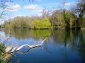

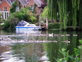
Start: Goring and Streatley Station (SU 602 806)
(S) Leave the station from platform 1, turn left, then left again over the bridge. Keep ahead through Goring village, then over the river into Streatley.
(1) At the Thames Path sign turn right, passing the church of St Mary which dates from the 13th Century. Follow the path round to the right to the riverbank. Turn left through the water meadows and pass Cleeve Lock.
As Moulsford is approached, riverside dwellings start to appear, and soon there is the welcome sight of the Beetle and Wedge.
(2) From here, the Thames Path turns inland and soon joins Ferry Lane. The ferry ceased operating in 1962. Turn right along the main road.
(3) After Moulsford Prep School, turn right and go under the railway where the path rejoins the riverbank. Go through the Cholsey Marsh Nature Reserve and pass North Stoke, which is on the other side of the river. After a mile, the path goes under the A4030, soon coming to the outskirts of Wallingford.
(4) Bear right and follow the Thames Path signs through the back streets, all the way to the main road.
(5) Turn right, left at The Boathouse pub and follow the Thames path signs past it to the riverbank and follow the towpath beside Castle Meadows.
Very little remains of Wallingford Castle, once the home of medieval kings but demolished on the orders of Oliver Cromwell.
(6) Turn right at the newly restored walkway over Benson lock and weir, now with a fish ladder so migratory fish can reach their spawning ground. Turn left after the Old Benson Mill, towards the main road.
(7) Turn left and just before the X40 bus stop on the main road, turn left through the marina and continue for a mile to reach the main road at Shillingford Bridge.
(8) Cross the road at the traffic lights and turn right and then left on the Thames Path. Follow it to a path junction, turning left then right along a back road to the A4074 crossroads.(E)
 Visorando Member
 Easy
Easy  Association / Club / Walk leader
 Tourism professional
