Country:

 City:
City:


Car park on the side of the D250, the second car park coming from Ustaritz; the first is by the ‘Forêt d’Ustaritz’ sign.
(S/E) Cross the D250 towards the forest and take the path heading south, ignoring the return path on the right. Stay on this path for about 900 m.
(1) At the Y-junction, take the path on the left and continue straight on until you reach the stream at the bottom of the valley. Cross the stream via the small bridge on the left, then head towards asecond, larger bridge. Cross the stream and take the path on the right.
(2) At the junction shortly afterwards, take the path on the right; there is a large concrete block across the path to block access to vehicles. Continue along this path (ignore the paths on the left) for about 2.9 km. When you reach a metal barrier, continue to the left of it along the footpath.
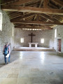
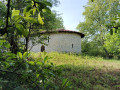
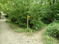
(3) After this barrier, carry on for about 60 m, then take a path on the right signposted ‘Croix des Anglais’. Further on, climb over a fence before crossing the stream via the small bridge on the right. Carry on along this path, which runs alongside the stream for about 30 metres, until you reach the Chapelle la Madeleine; go round it on the right (you can visit the very simple interior; the door is probably open all year round).
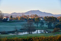
(4) Carry on northwards; do not cross the private property but go round the shed on the right. Then carry on straight ahead until you reach a tarmac track. About 1 km further on, stop for a moment, turn round and look: in good weather, you’ll see, from left to right, Mont Ursuya, Mont Baigura, Mont Arzamendi (with the spherical radar), Mondarrain and, finally, La Rhune. Carry on to the junction with the D3.
(5) Take the path on the right which runs alongside the D3 for about 900 m.
(6) Turn left at the junction to rejoin the D3 on your left. Continue along this path, which runs parallel to the D3, before veering off to the right.
(7) Turn left at the junction to follow the D250 for about 350 m.
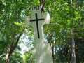
(8) Turn left (signposted) to see the Croix des Anglais. This cross was erected in memory of the English soldiers taken prisoner and killed during the War of the Spanish Succession in 1713. Retrace your steps.
(8) Take the path on the left for about 20 metres, then take the wide track on the left, which you took at the start. Cross the D250 to return to the car park (S/E).

 Association / Club / Walk leader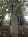
 Easy
Easy 
 Visorando Member