Following the Bièvre river through Saint-Quentin-en-Yvelines in Igny

The upstream part of this series of three hikes devoted to the Bièvre river. A very pleasant walk along the river and its bodies of water, in a mostly rural setting. A hike from station to station, which can be used to adjust the length depending on the weather conditions or desires of the hikers.

This walk is part of a multi-day hike: En suivant la Bièvre

Technical sheet

78033
Creation:
Last update:
Last review:
  • Walking
    Activity: Walking
  • ↔
    Distance: 19.41 km
  • ◔
    Average duration: 5h 35 
  • ▲
    Difficulty: Moderate

  • ⚐
    Return to departure point: No
  • ↗
    Vertical gain: + 26 m
  • ↘
    Vertical drop: - 121 m

  • ▲
    Highest point: 167 m
  • ▼
    Lowest point: 66 m

Photos

Description of the walk

Access:
RER line C. The station is the terminus of a route from Paris via Versailles-Chantiers.

”Red and White markings”

(S) At the exit of the station of St-Quentin-les-Yvelines, go straight ahead. Head across a wide avenue (pedestrian crossing) and continue ahead over an esplanade. After 200 metres, turn right and follow an alley due south with small water pools in the middle. Go around a grove to its left and reach a small road.

(1) Cross the road and head into in the Roussières woods (with a sign). Staying in the underwood and above a lake for about 1 km. Turn right and leave the woods, immediately turn left (stairs) and and go through the tunnel under a 4-lane road.

(2) Shortly after the tunnel’s exit, turn right and then left to follow the Bièvre river (keep it on your right) and reach a road. Cross the road and head along a path through the woods parallel to the road. Join this road at a crossroads and continue straight in the same direction. After a few metres, turn right (small steps) and then immediately left. A paved road over a wooden bridge lets you get closer to the river.

(3) Head on to the Fontaine des Gobelins (with an information panel). Arrive at the the Moulin à Renard lake.

’’No Markings''

(4) Leave the GR® turning right, and then immediately left. Along the lake on the right bank for about 1.5 km. At the other end of the lake, turn left into the car park and then right onto a road. Continue straight for about 400 metres.

(5) Once at the Val d’Or lake, go down the stairs that lead to the bank and walk along the lake on its left bank. The path ends at a car park. Go straight ahead into a tunnel under a 4-lane road. Lead to a path that bypasses the water treatment plant, head down and take a wide turn to the right.

”Red and White markings”

(6) At the crossroads of several paths (marker 115), we find the GR®, which follows a broad alley through the underwood.

(7) At the junction at the corner of the Geneste Lake, go straight ahead and keep it on your right. After the lake, turn right at the dyke to an easily spotted water flow regulating installation. Turn down to the left (on stairs) and follow the course of the Bièvre. The trail winds through meadows, first on the right bank of the Bièvre river then, after crossing a bridge, on its left bank as far as the car park in Buc.

(8) Cross the road, walk along the buildings and head along a path that winds between houses and gardens, keeping the Bièvre river on your left. Turn left and again cross the Bièvre river, then turn right. Along a small pond and climb towards the arches of Buc that can be glimpsed through the leaves. After a sharp left turn, cross the D393 (with caution, the road is busy).

(9) Pass under the arches of Buc (with its information sign) and down a steep slope. Continue on the path on the edge of the woods (keep it on your right) and pasture (keep it on your left). The path turns left and goes around a large farm (horses). Shortly before a road, turn right onto a path along the Bièvre again (keep it on your right). Take a road to the left towards the railway bridge.

(10) After crossing the railway bridge turn right into the street through Les Loges-en-Josas. After 400 metres, turn right down a small street which heads downwards and becomes a path. Before the end of this road, turn left, walk through meadows, crossing a small road to return to the Bièvre river, keep it on your left as far as a road near a roundabout with median.

(11) Cross the roundabout and the railway (level crossing). Then head on to a path on the left that meets up with the Bièvre river. Arrive in an alley, which opens into a small street (level crossing to the left, and the church of Jouy-en-Josas at the end of the street on the right). Turn left and, immediately after crossing the rail tracks, turn right.

’’No Markings''

(12) After 200 metres, to avoid a long paved trail, leave the GR® (the latter portion on the right and cross the railway again). Head across the street that leads to the INRA centre (with a sign that is impossible to miss). Before the barrier, take the impasse that leads to the equestrian centre (there is a sign). After a few tens of metres, take the path to the right that winds through a hedge behind which the railway line is located (on the right hand side) and the fields of the equestrian centre and the INRA centre (on the left hand). After about 1.5km, reach a road at the Vauboyen station. Make a right-left dog-leg to meet up with the GR®.

”Red and White markings”

(13) Follow (heading south-east) the path along the railway. After 800 metres, find the the Bièvre river which is on the left hand. Continue straight ahead. The path is lined with houses and gardens then becomes an alley. Cross the Rue des Petits Ponts and the Rue des Ponts to reach a roundabout. Continue slightly to the right on Avenue de la Gare, and pass the aforementioned station.

(14) Continue straight ahead. Pass under the bridge of the N118. After a left turn, head immediately to the right onto a path that leads on to the right bank of a lake.

(15). Join the Bièvre river and follow its right bank to a small road. Cross this road and continue on the left bank of the Bièvre river. Cross the bridge to end up on the right bank. Continue for about 500 m.

’’Yellow Markings''

(16) After a turn on the path to the left before a bridge (gate system), turn right. Climb gently up a path, pass a forest fence at the Igny station (F).

To head home:
RER line C, either to Versailles-Chantiers or towards Massy with connections to other lines.

Waypoints

  1. S : km 0 - alt. 167 m - Gare de Saint-Quentin-en-Yvelines
  2. 1 : km 0.95 - alt. 152 m - Cemented driveway
  3. 2 : km 1.8 - alt. 157 m - Carrefour
  4. 3 : km 2.54 - alt. 134 m - Gobelins fountain - Bièvre (affluent de la Seine)
  5. 4 : km 2.75 - alt. 132 m - Etang du Moulin au renard
  6. 5 : km 4.72 - alt. 134 m - Stairs on the right - Étang du Val d'Or
  7. 6 : km 6.05 - alt. 114 m - Junction with the GR - Bièvre (affluent de la Seine)
  8. 7 : km 6.66 - alt. 114 m - Étang de la Geneste
  9. 8 : km 8.24 - alt. 105 m - Road in Buc
  10. 9 : km 9.27 - alt. 122 m - Arcades de Buc
  11. 10 : km 10.51 - alt. 98 m - Rond-Point - Access to the - Gare de Petit-Jouy-les-Loges
  12. 11 : km 10.81 - alt. 101 m - Intersection
  13. 12 : km 11.35 - alt. 97 m - Cross
  14. 13 : km 12.32 - alt. 90 m - Access to the - Gare de Jouy-en-Josas
  15. 14 : km 12.98 - alt. 88 m - Rue Oberkampf - Access to the - Église Saint-Martin (Jouy-en-Josas)
  16. 15 : km 13.31 - alt. 87 m - Entrance to the INRAE Centre
  17. 16 : km 15.04 - alt. 82 m - Gare de Vauboyen
  18. 17 : km 16.93 - alt. 75 m - Rue du Petit Bièvres - Access to the - Gare de Bièvres
  19. 18 : km 17.65 - alt. 75 m - Rue de la Gare
  20. 19 : km 18.1 - alt. 71 m - Bifurcation
  21. 20 : km 19.2 - alt. 67 m - Bifurcation
  22. E : km 19.41 - alt. 74 m - Gare d'Igny

Practical information

Hiking shoes are required.
1/25000 map is useful (at least the one that accompanies this description).

Bars, restaurants and shops in Jouy-en-Josas, between (11) (12) and in Bièvres, before (14).

It is possible to end this hike when desired at one of the stations that you come across on the course (RER line C running between Versailles-Chantiers and Massy). According to the chosen finish point, the length of the hike is approximately:
- Petit Jouy-Les Loges (1) 11 km.
- Jouy-en-Josas: 12 km (at (11) take the street on the left at the roundabout, do not cross the tracks).
- Vauboyen (13) 14 km.
- Bièvres (14) 17 km.
- Igny (E) 19 km.
For train schedules, see the website Transilien.

In the nearby area

Fontaine des Gobelins at (4).
Bodies of water between (S) and (8).
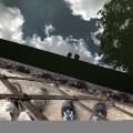
Arches of Buc at (9) there is an aqueduct that carried water from the Saclay Plateau to the Château de Versailles.
Saint-Martin church in Jouy-en-Josas, off the route between (11) and ::12:.

 Always stay careful and alert while following a route. Visorando and the author of this walk cannot be held responsible in the event of an accident during this route.

The GR® and PR® markings are the intellectual property of the Fédération Française de Randonnée Pédestre.

Reviews and comments

4.8 / 5
Based on 35 reviews

Reliability of the description
4.7 / 5
Clarity of route map
4.9 / 5
Route interest
4.7 / 5
afoe
afoe
• Last modified:

Overall rating : 5 / 5

Date of walk : Oct 13, 2024
Reliability of the description : ★★★★★ Very good
Clarity of route map : ★★★★★ Very good
Route interest : ★★★★★ Very good
Busy trail : Yes

One of the most beautiful walks in Ile de France.
It is even more beautiful when it has rained a lot, as the Bièvres River flows more freely and the path is not flooded.
Not very popular with cyclists on Saturdays and Sundays.

Automatically translated

Yannick Barbeau
Yannick Barbeau

Overall rating : 5 / 5

Date of walk : Feb 12, 2024
Reliability of the description : ★★★★★ Very good
Clarity of route map : ★★★★★ Very good
Route interest : ★★★★★ Very good
Busy trail : No

Very nice walk. First a succession of lakes, then the path along the Bièvre, the passage under the arcades of Buc, the horses, Jouy en Josas with the Oberkampf house, a very varied route. The only downside was the passage between 15 and 16, which was very muddy and really difficult today.

Automatically translated

COLIBRI93
COLIBRI93

Overall rating : 4.7 / 5

Date of walk : Jan 02, 2024
Reliability of the description : ★★★★★ Very good
Clarity of route map : ★★★★★ Very good
Route interest : ★★★★☆ Good
Busy trail : No

There's still work being done on the driveway at St Quentin en Yvelines.
There are not too many explanations on site for the diversion.
At the moment, part of the path near a pond in St Quentin en Yvelines has become a river, but it is possible to walk over it.
We finished at Petit-Jouy-les-Loges station.
Thank you for this trail.

Automatically translated

croux74
croux74

Overall rating : 5 / 5

Date of walk : Nov 10, 2022
Reliability of the description : ★★★★★ Very good
Clarity of route map : ★★★★★ Very good
Route interest : ★★★★★ Very good
Busy trail : Yes

Beautiful walk. It's always a pleasure to walk along the Minière ponds. Especially in autumn.
The second part along the Bièvre is just as pleasant and away from the traffic.
You can stop for lunch in Jouy-en-Josas.
Note that the route was popular along the ponds but not along the Bièvres.

Automatically translated

ETA
ETA

Overall rating : 4.7 / 5

Date of walk : Mar 26, 2022
Reliability of the description : ★★★★★ Very good
Clarity of route map : ★★★★★ Very good
Route interest : ★★★★☆ Good
Busy trail : Yes

A bucolic stroll through the tranquil Bièvre valley, which has been partially spared the real estate madness.

The first part takes you past four peaceful ponds, surrounded by forest and a little aquatic wildlife. Once you arrive in Buc, and pass beneath the remarkable Arcades historic monument, you enter a less wild part, between equestrian centres, farms, and even through towns like Jouy-en-Josas. But the route is still pleasant, and you can see horses and cows...
The section through Bièvres is also quite green and away from cars.
A good idea for an afternoon, or why not for a picnic by the ponds.

Automatically translated

veridisqvo
veridisqvo

Overall rating : 5 / 5

Date of walk : Jan 29, 2022
Reliability of the description : ★★★★★ Very good
Clarity of route map : ★★★★★ Very good
Route interest : ★★★★★ Very good
Busy trail : Yes

A very pretty walk! It's true that at the end of the route there are a few stretches that are a bit straightforward and monotonous, but on the whole it's very pleasant, almost always by the water. The route was very busy on Sunday (walkers, dogs and mountain bikers), but that's to be expected: the weather was fine, and you're never far from the city. The church of Saint-Martin in Jouy is very beautiful indeed, and almost on the route; but it seems to me that the church of Saint-Jean-Baptiste in Buc should also be listed as a point of interest: it's also only a few metres out of your way, and its stained glass windows are magnificent.

Automatically translated

Chris_tine
Chris_tine

Overall rating : 5 / 5

Date of walk : Oct 09, 2021
Reliability of the description : ★★★★★ Very good
Clarity of route map : ★★★★★ Very good
Route interest : ★★★★★ Very good
Busy trail : No

We didn't go as far as Igny, as we took the Jouy-en-Josas train back. It was a beautiful route and a very pleasant walk, along several ponds and the River Bièvre, through woods and meadows. Not many people along the way, despite the very pleasant weather (a few mountain bikers). An easy walk, suitable for everyone.

Automatically translated

Laurent M.
Laurent M.

Overall rating : 4.5 / 5

Date of walk : Sep 24, 2021
Reliability of the description : N/A
Clarity of route map : ★★★★★ Very good
Route interest : ★★★★☆ Good
Busy trail : No

A very pleasant walk relatively close to Paris.
The second half (from 15) is less pleasant, but it's still a good outing.
If you want to stop for lunch, prefer the first half of the route.
Lots of groups of cyclists on the second half.
Didn't use the description, just followed the GPS track.
Easy route, completed in 4 hours.

Automatically translated

Oloutam
Oloutam

Overall rating : 5 / 5

Date of walk : May 29, 2021
Reliability of the description : ★★★★★ Very good
Clarity of route map : ★★★★★ Very good
Route interest : ★★★★★ Very good
Busy trail : No

A great walk with a change of scenery! Between the banks of the Bièvre, ponds, fields, stables... It was hot but very pleasant because it was shaded.
We did the route as far as Bièvres. From Vauboyen station, the path is less pleasant.

Automatically translated

Amélie_Rando
Amélie_Rando

Overall rating : 4.3 / 5

Date of walk : Jan 23, 2021
Reliability of the description : ★★★☆☆ Average
Clarity of route map : ★★★★★ Very good
Route interest : ★★★★★ Very good
Busy trail : No

A beautiful walk, some of it in the snow

Having walked other trails along the Bièvre closer to Paris, I wasn't expecting this trail to be so beautiful and bucolic, so it was a very pleasant surprise:

  • Plus points: There's very little tarmac, and the proximity of the city didn't bother us. The presence of animals: opportunities for birdwatching, even in winter, and a lot of land occupied by horses.
  • Minus: lots of cyclo-cross

The description wasn't bad, but we had trouble estimating the distances between each stage, which meant I had to get out the GPS regularly. In terms of difficulty, there wasn't much of a difference in altitude, so we were able to enjoy a brisk, sporty walk.

Many thanks to the author.

Automatically translated

Mésopotamie
Mésopotamie

Overall rating : 4.7 / 5

Date of walk : Oct 25, 2020
Reliability of the description : ★★★★★ Very good
Clarity of route map : ★★★★★ Very good
Route interest : ★★★★☆ Good
Busy trail : No

As usual, the route is very clear and the modifications have been kept up to date.
The timing between stages is always meticulous and not over-performing, so it fits in well with the pace of amateurs. A pleasure to walk along the banks of the river, between pastures and copses.
Suitable for all types of walker.

Automatically translated

Carpinus78
Carpinus78

Overall rating : 5 / 5

Date of walk : Jul 25, 2020
Reliability of the description : ★★★★★ Very good
Clarity of route map : ★★★★★ Very good
Route interest : ★★★★★ Very good
Busy trail : No

Round trip from the Vald'Or pond. Well shaded, very bucolic.
A very pleasant surprise: on the way, on a small path, a table with just-picked figs and a "help yourself" sign. Really nice and delicious figs. Thanks again to the owner... in case he uses Visorando!

Automatically translated

jeandaniele
jeandaniele

Overall rating : 5 / 5

Date of walk : May 27, 2020
Reliability of the description : ★★★★★ Very good
Clarity of route map : ★★★★★ Very good
Route interest : ★★★★★ Very good
Busy trail : No

Very well described route.
Best done on a sunny day in the shade.

Automatically translated

Sophie soleil 0707
Sophie soleil 0707

Overall rating : 5 / 5

Date of walk : Feb 21, 2020
Reliability of the description : ★★★★★ Very good
Clarity of route map : ★★★★★ Very good
Route interest : ★★★★★ Very good

An easy and very pleasant walk along the ponds and the River Bièvre. The directions are very precise and easy to follow, thank you!

Automatically translated

al4951
al4951

Overall rating : 5 / 5

Date of walk : Oct 13, 2019
Reliability of the description : ★★★★★ Very good
Clarity of route map : ★★★★★ Very good
Route interest : ★★★★★ Very good

A very nice walk, perfectly described. The directions for avoiding the road at Jouy-en-Josas are very useful.
The scenery along the way is superb: almost always water, stud farms.... And the short urban route is also nice. Thank you for this description.

Automatically translated

For more walks, use our search engine .

The GPS track and description are the property of the author. Do not copy them without permission.