


 Country:
 City:


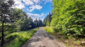
(S/E) The walk begins at the walkers’ car park at the Fichtelsee campsite on Fichtelseestraße (opposite number 30).
Alternatively, the circular walk can also be started at the Seehaus service area and car park on the B303 between Bischofsgrün and Tröstau. The leisure bus routes 1728 (Main-Eger-Express) and 1727 (Porzellan-Express) also stop here; the latter also passes through Fichtelberg (Fichtelsee stop).
From the car park, we walk past the entrance to the campsite and into the woods. The path leads us gently downhill to Fichtelsee.
(1) This 10.5-hectare man-made lake is fed by springs rising from the moor and therefore has its characteristic dark brown colour and a very low pH value. Before reaching Fichtelsee, we turn right onto the lakeside path.
On the opposite side, you can see the Hotel am Fichtelsee. We stay on the lakeside path and turn right at the end of the lake (signposted ‘Jakobsweg’ and ‘Seehausweg’). We follow the signposting straight ahead through the woods at the next two junctions. At the junction 250 metres further on, we also continue straight ahead.
(2) After about 100 m, we turn right onto another wide gravel path through the woods, which we follow to the left at the next fork.
(3) Just before we reach the road, we turn left at the car park onto the footpath (signpost).
A small bridge takes us over the Kratzebach stream and up the slope. From here, the path is heavily overgrown with roots and requires a bit more sure-footedness and care. We continue parallel to the road, past an unnamed rock formation on the left-hand side.
(4) After turning left onto the gravel track, we immediately come to the Predigtstuhl, another rock formation where there is also a small bench. After about 200 metres, we leave the gravel track again and continue along a bumpy path following the Fichtelberger Steinzeitweg signpost. The path leads us uphill at a moderate gradient.
(5) A good distance further on, on the left-hand side, are the rocks known as the Nasn. A short detour to the left is recommended here to take a closer look at the rocks. At the next two junctions with the gravel tracks, we continue straight ahead each time.
(6) After an S-bend in the path, we cross the B303 (caution: no traffic lights or similar) and continue straight ahead on the other side. From here, the route climbs steadily up the slope along narrow paths. We keep going straight ahead, following the occasional signpost with a ‘Platte’ marker. Further up the mountain, the path is also known as the Plattensteig.
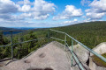
(7) The Plattensteig leads us straight onto the Platte. The summit consists more or less of an extensive scree slope of large granite boulders. Strictly speaking, the Platte is not actually in the Fichtelgebirge, but in its southern foothills, the Steinwald. Up here, it’s important to follow the signposts, which prevent overly daring walkers from scrambling any further up the scree slope. On the right-hand side is a rock formation which leads a little higher up via a few steps. At the foot of this formation are a few benches where you can rest.
After taking in the view and the fantastic scenery, we keep to the left whilst looking towards the Blockhalde (or even from the ascent).
(8) Somewhat hidden amongst the trees is a marker with a white ‘H’ on a red background. From here on, the Höhenweg and the Fränkische Gebirgsweg (Section 3) will be our guides across the ridge.
The markings now lead us steadily down the slope across large granite slabs and over roots, and further down we come to a wide gravel path, where we continue to the right and, after about 100 metres, follow the path to the left at the fork.
(9) After a good kilometre, we turn right, following the markings, onto the Seehaussteig, which climbs once again through somewhat more unspoilt countryside along the flank of the Nußhardt.
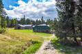
(10) After 600 m, this takes us to the Seehaus restaurant (with a beer garden in summer). We turn left in front of the building, walk past the benches in the beer garden and reach the woods, still following the ‘Höhenweg’ and ‘Fränkischer Gebirgsweg’ markings.
Here we come to a forest track, which we follow to the left. At the next fork, we turn left, then left again.
(11) The Fränkischer Gebirgsweg (or Höhenweg) takes us directly to the Nußhardt summit at an altitude of 972 m. If we follow the signpost for Nußhardt to the left, after a few metres we come to a bench and a rock behind it, which we can climb via a ladder to enjoy the view. From the rock, we head back to the path and continue to the left, past further rocks.
About 100 m after a path branches off to the right (we continue straight on), we come to a junction where we leave the Höhenweg and turn left onto the Karches-Höhenweg.
(12) This trail now leads us slowly downhill, initially along a bumpy path and then along a slightly more comfortable one. At the first junction, we go straight on; at the second, we turn left.
(13) From here, we follow the Franconian Mountain Trail again.
(14) We continue straight ahead along a wide forest track on the flank of the Nußhardt until we reach the Seehaus car park, where there is also a snack bar (alternative starting point). Before the snack bar, we cross the B303 for a second time (again, there are no pedestrian traffic lights etc. here). On the opposite side, the Fränkischer Gebirgsweg (together with the Seenweg) leads into the forest.
The gravel path takes us southwards, winding gently but always straight ahead through the Fichtelsee raised bog. All along the edge of the path, small streams flow with the brownish bog water.
(15) After about 800 metres, on the left-hand side behind a small bridge, you’ll find the Jean-Paul Fountain and a picnic area.
As we continue along the gravel path, we soon reach the northern shore of Lake Fichtel. A short distance before Lake Fichtel, the path forks; we take the left-hand branch, which leads us across log planks through the moorland and then merges back into a forest path once we reach the lakeshore.
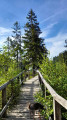
(16) Beyond the first section of Lake Fichtel, a walkable embankment (lined with trees on both sides) leads us to the right, followed by a curved footbridge taking us across to the other side. Once we reach the gravel path (Jean-Paul-Weg), we turn left.
(1) After about 300 metres, we reach the junction we passed on the way there and turn right.
(S/E) We walk past the entrance to the Fichtelsee campsite and back to the car park where we started the walk.


 Visorando Member
 Easy


