


 Country:
 City:
City:


(S/E) The walk starts at the (paid) lake car park on Bayreuther Straße (signposted).
Markings:
- no standardised markings; the circular route follows the lakeside path along Weißenstädter See
From the car park, we walk towards Weißenstädter See and turn right onto the lakeside path. We pass the sailing harbour and, on the right-hand side, the fish smokehouse, outside which there are tables and chairs that invite you to stop for a rest during the summer months.
Behind a basketball court, on the right-hand side, there are information boards about the fish in the lake; behind these lies a boulder with a hollow on its upper surface, in which water collects when it rains.
Shortly after that, on the left-hand side, a heart-shaped landscape picture frame has recently been installed, inviting you to take a photo in front of Lake Weißenstadt.
(1) A little further on, we come to a sort of weir or small dam spanning a bridge. Here, the River Eger, which feeds the lake, flows out of it again.
(2) We cross the bridge and, about 50 metres beyond it, take a detour to the right (signposted ‘Geopark Information Centre’). After a few metres, we turn right at the T-junction and, just before the bridge, keep to the left onto the footpath, which takes us along the River Eger to Bayreuther Straße. There, we keep to the right, cross the River Eger again and turn right once more at the small car park in front of the Geopark Information Centre.
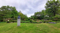
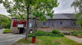
(3) Directly on the right-hand side lie the ruins of the former grinding workshop, which are well worth a closer look. We turn right onto the path in front of the ruins, walk a short distance alongside the elongated building of the Information Centre and pass the bust of Erhardt Ackermann, the inventor of hardstone grinding.
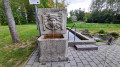
At a wall with a bench in front of it, we turn right and come to a field with sections of sawn-off tree trunks. Here, on the right-hand side, there is a pretty fountain in front of a Kneipp pool.
We walk past the fountain on the right, heading back towards the ruins, and turn left onto the path just before them. After a right-hand bend, this path takes us over a former railway bridge across the River Eger.
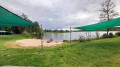
(4) After about 20 metres, we turn left and rejoin the lakeside path, where we turn right. We follow the lakeside path past a Greek restaurant; on the left is a small peninsula. Behind this, the lakeside path curves to the left, guiding us further round the lake. Here there is a small children’s beach.
(5) At the far end of the lake, on the right-hand side, there is a covered beer garden (Miles Seestübchen). Here we turn left. After about 150 metres, there is a toilet block on the right-hand side, behind which we can see a campsite. Here we follow the lakeside path to the left.
After a few metres, there are several ponds on the right-hand side, which are well worth a short detour. We continue along the lakeside path, which leads us through a small wetland (bird sanctuary) and, at the end, curves to the left around the lake.
(6) We stay on the lakeside path all the time and, after a few hundred metres, pass the Gesundheitshotel am Weißenstädter See, which also has a pavilion with a café.
(7) At the next junction, we turn left, cross the lake’s inlet via a bridge and continue along the lakeside path.
After about 350 m, we arrive back at the car park by the lake, where we started. (S/E)

