


Fairfield Horseshoe
Details
Creation:
Last update:
–
–
-
 Activity: Walking
 -
 Distance: 10.16 mi
 -
 Average duration: 7h 20
 -
 Difficulty: Not specified
 -
-
 Back to start: Yes
 -
 Ascent: + 3,087 ft
 -
 Descent: - 3,091 ft
 -
-
 Highest point: 2,858 ft
 -
 Lowest point: 213 ft
-
 Country:
United Kingdom
Country:
United Kingdom
-
 Area: Lake District
 -
 City:
Lakes
City:
Lakes -
 Start/End: N 54.448875° / W 2.978628°
 -


 Hour-by-hour weather


Waypoints
- S/E : mi 0 - alt. 262 ft
- 1 : mi 8.01 - alt. 1,217 ft - Keep left
- 2 : mi 8.06 - alt. 1,201 ft - Keep left
- 3 : mi 8.06 - alt. 1,198 ft - Turn left
- 4 : mi 8.46 - alt. 906 ft - Turn slight right
- 5 : mi 9.27 - alt. 354 ft - Turn sharp right
- 6 : mi 9.46 - alt. 213 ft - Turn right
- 7 : mi 10.11 - alt. 246 ft - Keep right
- S/E : mi 10.16 - alt. 259 ft
Other walks in the area
Rydal - Loughrigg Fell
 Visorando Member4.13 mi
+928 ft
-938 ft
2h 40
Visorando Member4.13 mi
+928 ft
-938 ft
2h 40
 Moderate
 Departure from Lakes (Westmorland and Furness)
A few kilometres from Ambleside, a walk to the top of Loughrigg Fell overlooking the lakes of the National Park Lake District.
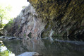
Rydal Cave
 1.65 mi
+282 ft
-259 ft
1h 00
1.65 mi
+282 ft
-259 ft
1h 00
 Easy
Departure from Lakes (Westmorland and Furness)
Easy
Departure from Lakes (Westmorland and Furness)
Short walk to see the famous Rydal cave. Dog friendly walk.
The Fairfield Horseshoe from Ambleside
10.27 mi
+2,897 ft
-2,897 ft
7h 15
Moderate
Departure from Lakes (Westmorland and Furness)
The Fairfield horseshoe includes seven other Lake District fells. Low Pike, High Pike, Dove Crag and Hart Crag form the outward route with the return over Great Rigg, Heron Pike and Nab Scar back to Ambleside via Rydal. This is a high level route so choose a good day to make the most of the views.
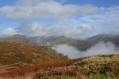
Loughrigg Fell from Ambleside by Lily Tarn
 5.24 mi
+2,267 ft
-2,257 ft
4h 25
Moderate
Departure from Lakes (Westmorland and Furness)
5.24 mi
+2,267 ft
-2,257 ft
4h 25
Moderate
Departure from Lakes (Westmorland and Furness)
A medium level walk with gorgeous views on Ambleside and distant summits. Dog friendly walk.
Fairfield Horseshoe & Loughrigg from High Close
13.95 mi
+3,776 ft
-3,783 ft
9h 40
 Difficult
Departure from Lakes (Westmorland and Furness)
Difficult
Departure from Lakes (Westmorland and Furness)
This variation of the Fairfield Horseshoe starts from High Close on the western edge of Loughrigg Fell. The route follows a clockwise direction offering a different perspective to the normal horseshoe route.
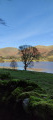
Rydal Water & Grasmere from Grasmere
 5.38 mi
+640 ft
-636 ft
3h 00
Easy
Departure from Lakes (Westmorland and Furness)
5.38 mi
+640 ft
-636 ft
3h 00
Easy
Departure from Lakes (Westmorland and Furness)
Starting from Grasmere this Lake District walk includes a circuit of Rydal water and Grasmere. The route includes some wonderful views especially from Loughrigg Terrace.
YHA Hopping in the Lake District - YHA Langdale to YHA Coniston Holly How
 Association / Club / Walk leader12.19 mi
+2,726 ft
-3,054 ft
8h 00
Difficult
Departure from Lakes (Westmorland and Furness)
Association / Club / Walk leader12.19 mi
+2,726 ft
-3,054 ft
8h 00
Difficult
Departure from Lakes (Westmorland and Furness)
This is a varied walk with a couple of fells to climb but nothing really difficult. Take care of yourself and look out for wildlife along the way. Just enjoy the journey and make the most of the moment. Along the way are 2 Wainwrights, 2 tarns, 2 pubs and a lake.
YHA hopping in The Lake District - YHA Langdale to YHA Hawkshead
9.39 mi
+1,033 ft
-1,352 ft
5h 15
Moderate
Departure from Lakes (Westmorland and Furness)
The YHA is a great institution and I guess most fell walkers have stayed at a hostel at some time in their lives. Funny how they were created "to help all, especially young people of limited means, to a greater knowledge, love and care of the countryside, particularly by providing hostels or other simple accommodation for them on their travels". Here's a collection of routes starting or finishing at a YHA in The Lakes. Along the way are 1 Wainwright, 1 tarn and 1 pub.
For more walks, use our search engine .
The GPS track and description are the property of this route's author. Please do not copy them without permission.

