Country:

 City:


Park in the car park at the Col de Fambétou, in the commune of Saint-Mathieu-de-Tréviers.
Preliminary note: this walk is challenging and involves some scrambling; furthermore, certain sections are exposed and are not suitable for those prone to vertigo.
(S/E) Follow the path south-eastwards and you’ll soon cross the path skirting the north face of Pic Saint-Loup.
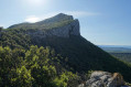
(1) Continue straight ahead, climbing gently, to reach the scree slope at the foot of the north face of Pic Saint-Loup, where there is a large cairn.
(2) Take the path on the left. Climb via the northern diagonal route: a 100-metre very steep ascent up a narrow ledge of rock cutting across the cliff face. A few climbing moves graded between 2 and 3+ featuring a nice dihedral. You must be comfortable with climbing on a rock face. Caution: the route is well marked, wide but exposed. Two technical sections graded 3+ where you’ll need to use your hands; strongly not recommended for those unaccustomed to climbing. Reach the final ledge via a further section graded 3 to emerge onto the ridge.
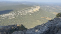
(3) Follow the ridge to the right to reach the summit of Pic Saint-Loup.
(4) Take the classic route up the peak to the left, on the south face. Join the GRP® Tours route on the Grand Pic Saint-Loup at the Croisette junction.
(5) Turn left and follow the yellow and red markings towards Montferrand until you reach a four-way junction.
(6) Leave the GRP®, veer left to follow the yellow-marked track towards the ridge. Cross this ridge, continue straight ahead and, via a steep descent, reach a fence.
(7) Walk along the fence to the left until you reach another multi-way junction.
(8) Here you have two options:
- carry on straight ahead to return to the car park (S/E) via the Fambétou path,
- turn onto thesecond path on the right – this is the route shown on the map – pass through the aluminium gate and then the Mascla building before arriving at the Château de Viviourès car park.
(9) Here, too, there are two options:
- take the D1 to return to the car park (S/E),
- cross the D1 – this is the route shown on the map – turn right onto the track above the road and head for the junction at the foot of the Hortus cliff.
(10) Head left up into the woods, follow a red-marked track and arrive at the foot of the cliff face.
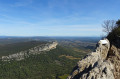
(11) Take the path which turns right; here you’ll need to use your hands to negotiate the short 2+ grade gully, then reach the Hortus ridge.
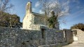
(12) Follow it to the left, pass the summit of the Hortus and stay on the ridge until you reach the Château de Viviourés.
(13) Continue along the path, which is faintly marked in blue, to return to the Col de Fambétou car park (S/E).
 Visorando Member

 Very difficult

 Moderate
 Association / Club / Walk leader