Country:
 City:


The starting point is Theydon Bois Underground station, on the Central line, a good half-hour from central London (Bank station). There is also a car park in front of the station.
The route follows the Oak Trail but is hardly signposted at all.
(S/E) Leave the underground via the Station Approach. Take the first street on the right, Forest Drive. After 500 m, the street ends and a sign marks the start of the path
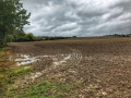
(1) The path runs alongside the fences of the houses for 500 m. Then carry on straight ahead. After 100 m, turn right into a field and then left to follow the hedge. After 300 m, at the end of the field, go through the gate behind the large oak tree and follow the path for 450 m until you come to a wooden gate.
(2) After the gate, turn immediately right into the field. At the end of the field, take the tarmac path on the left to cross over the motorway. After the bridge, carry on straight ahead through the field until you come to a road. Follow it to the left for a few dozen metres, then turn right into a park, walking alongside a children’s playground. Carry on straight ahead across the field as it slopes upwards. At the very top, at the edge of the woodland, the path joins another.
(3) Take a path to the left and , at the signpost, head towards Beil Common. After a short climb, go round a group of houses on the right. For about 500 m, the path runs between a road on the right and houses on the left. Cross a road and continue under the trees, keeping parallel to the road on your right. When you reach a stony path, take it to the right for a few dozen metres, then cross the grass (cricket pitch) to enter the woodland.
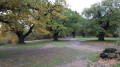
(4)You’ll immediately come to a dirt track; take this to the left. After 200 m, you’ll reach a Fork in the road: turn sharply right (a 270° turn) onto the path which descends gently as it heads deeper into the forest. After about 500 m, you’ll come to a crossroads with a signpost.
(5) Take the path slightly to the right, towards Long Running/Leighton. After 1 km, you’ll see the prehistoric site of Ambrebury Banks through the trees.
(6) Return to the dirt track and, at the next junction, continue straight on towards Long Running. After the car park, cross the road and continue straight on. About 800 m further on, you’ll reach a junction with a path branching off to the right.
(7)A few metres further on, a very faint path branches off to the left, just past an oak tree. Follow it (as far as possible) down through the woods for 300 m until you see a clearing on the right (it is actually a huge campsite).
(8) Go round the clearing on the left. The path then becomes more distinct and runs parallel to the clearing. Continue along the succession of clearings. After a short climb, the path comes to a metal gate, alongside which runs a bridle path.
(9) Take this path to the left, heading uphill.Follow the gate, which turns into a wire fence. This is the Deer Sanctuary. Pass through a wooden gate; the fence then also becomes wooden, and you’ll find yourselfin front of the entrance to Birch Hall Farm. Cross a road and continue along the path opposite… which quickly becomes hard to see. About 200 m past the road, you’ll come to a wide dirt track.
(10) Take the path on the right. It eventually joins the road. Follow it to the left to enter Theydon Bois. At the pedestrian crossing, turn left to reach the station (S/E).
 Visorando Member

 Easy