Between town and forest in Cestas

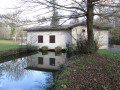
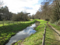
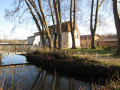
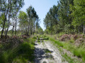
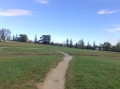
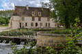
A walk through the wooded areas of the town of Cestas. Starting from the station, you’ll discover the Eau Bourde, a pretty river running through the town, Jauzereau Park, and a few peaceful ponds.

Details

n°39454179
Creation:
Last update:
Last review:
  • Walking
    Activity: Walking
  • ↔
    Distance: 7.42 mi
  • ◔
    Average duration: 3h 30 
  • ▲
    Difficulty: Moderate

  • ⚐
    Back to start: Yes
  • ↗
    Ascent: + 72 ft
  • ↘
    Descent: - 72 ft

  • ▲
    Highest point: 177 ft
  • ▼
    Lowest point: 98 ft
  • ⚐ Country: France
  • ⚐ City: Cestas (33610)
  • ⚑
    Start/End: N 44.77142° / W 0.700229°
  • ❏
    IGN map(s): Ref. 1437SB, 1536OT, 1537SB
  • Hour-by-hour weather

Description of the walk

There are several ways to access the walk:
- by car: around ten parking spaces are available along the railway line, opposite the station, on Chemin de la Bénédictine,
- by train: Gazinet-Cestas station; in this case, take the underpass beneath the tracks and exit the station via the south exit,
- by bus: line 23, Cestas-Gazinet stop. Cross the tracks to reach the starting point (100 m)

(S/E) Take the road called Chemin de la Bénédictine, which runs eastwards alongside the railway tracks. When you reach the junction with Avenue Salvador Allende (D214), turn left onto the cycle path and walk alongside the Mondelez warehouses. After passing the factory entrance, walk until you reach the bend.

(1) Just before this bend, cross the road and take the path leading into the woods on the right: (caution: busy road). After about fifty metres, follow the path to the left which runs alongside the high-voltage power line until you reach the first houses.

(2) Turn right onto a path that serves as a firebreak, and follow it until you’re running alongside the waste disposal centre. Join the road below.

(3) Follow it to the left, go under the motorway and carry on straight ahead until you reach the sign for the entrance to Canéjan.

(4) Turn right onto the cycle path for a few metres, then turn immediately left onto a small dirt track that follows the high-voltage power line. Follow the Chemin du Boisselier, then a road, alongside the vineyards. At the bend, take the path on the left which winds between the edge of the woodland and the vineyard. Continue to the Eau Bourde at a wooden bridge.

(5) Do not cross the bridge. Continue along the stream, keeping it on your left. Further on, pass another wooden bridge and the sewage treatment works on your left.

(6) Cross thethird wooden bridge spanning a tributary of the Eau Bourde, then the pretty stone bridge just beyond it. Continue to follow the river, keeping it on your right, until you reach the Route de Fourc (D214).

(7) Turn right onto the cycle path running alongside the road. Pass under the motorway again and carry on straight ahead to the roundabout.

(8) Cross the D214 and turn left towards Les Sources, passing in front of Cantelande Secondary School. Follow the road, passing the entrance to the equestrian centre, and carry on until you reach a junction with the Chemin du Petit Trianon. Turn left to follow this road, which descends to a pond.

(9) Take the path on the right just before this junction. Walk alongside the pond and then the river that feeds it, the Ruisseau des Sources, keeping them on your left. Follow the river to the place known as Les Sources.

(10) Leave the river behind by taking the small road on the right. Cross the road and take the path opposite, then continue to the right along a tarmac path until you reach the pond.

(11) Turn left to go round it. Walk the full length of the pond, then carry on straight ahead along the path that runs alongside the ditch until you reach a small wooden bridge. Cross the bridge and follow the ditch to the park’s exit at Avenue Julien Ducourt.

(12) Cross the junction to the right and take the footpath opposite which runs alongside the school and the small chapel. Join Avenue Jean Moulin, cross it at the pedestrian crossing, turn left then right to return to the car park at Cestas-Gazinet station (S/E).

Waypoints

  1. S/E : mi 0 - alt. 171 ft - Car park at the - Gare de Gazinet-Cestas
  2. 1 : mi 0.72 - alt. 174 ft - Entrance to the woods
  3. 2 : mi 1.08 - alt. 174 ft - Firebreak
  4. 3 : mi 2.15 - alt. 171 ft - Route
  5. 4 : mi 2.48 - alt. 167 ft - Entrance to Canéjan
  6. 5 : mi 3.11 - alt. 102 ft - L’Eau Bourde - Eau Bourde (rivière)
  7. 6 : mi 4.11 - alt. 108 ft - Third bridge
  8. 7 : mi 4.54 - alt. 118 ft - Cycle path
  9. 8 : mi 5.07 - alt. 144 ft - Cantelande Secondary School
  10. 9 : mi 5.72 - alt. 128 ft - Etang des Sources
  11. 10 : mi 6.27 - alt. 144 ft - Les Sources reception hall
  12. 11 : mi 6.7 - alt. 161 ft - Pond
  13. 12 : mi 7.26 - alt. 167 ft - Avenue Julien Ducourt
  14. S/E : mi 7.42 - alt. 171 ft - Car park at the - Gare de Gazinet-Cestas

Notes

After heavy rain, some sections may be muddy.
This walk takes you across the motorway. Some very noisy sections contrast with the peace and tranquillity of the wooded areas you pass through.

Worth a visit

(10) Les Sources: there is a reception hall here with a large gazebo where you can take shelter; an ideal spot for picnics.

Reviews and comments

3.8 / 5
Based on 4 reviews

Reliability of the description
4 / 5
Ease of following the route
4 / 5
Route interest
3.5 / 5
richard gigaud
richard gigaud

Overall rating : 4.3 / 5

Date of your route : Sep 04, 2026
Reliability of the description : ★★★★☆ Good
Ease of following the route : ★★★★★ Very good
Route interest : ★★★★☆ Good
Very busy route : No

A lovely walk.

Machine-translated

User 27397169

Overall rating : 3.7 / 5

Date of your route : Oct 18, 2025
Reliability of the description : ★★★★☆ Good
Ease of following the route : ★★★★☆ Good
Route interest : ★★★☆☆ Average
Very busy route : No

An easy, rather pleasant hike, especially the part through the woods (except in wet weather, when this section can be quite muddy) and near the lakes. We did this hike in October, so it was quiet and relaxing in the wooded area.
The only downside is the section through the town, which involves crossing relatively "dangerous" roads as they are very busy and sometimes run alongside the road without a pavement.

Machine-translated

User 8339005

Overall rating : 3.3 / 5

Date of your route : Sep 22, 2025
Reliability of the description : ★★★★☆ Good
Ease of following the route : ★★★☆☆ Average
Route interest : ★★★☆☆ Average
Very busy route : No

One part is on a very busy

Machine-translated

12Randoviso€
12Randoviso€
• Edited:

Overall rating : 4 / 5

Date of your route : Sep 11, 2023
Reliability of the description : ★★★★☆ Good
Ease of following the route : ★★★★☆ Good
Route interest : ★★★★☆ Good
Very busy route : No

Hello,
On Saturday 16th, at point 409, I did part of this walk. When I reached POINT 4, I came across a bit of confusion in the description: “take the cycle path… then turn immediately LEFT onto a small dirt track…” but to the left you have to cross the road again and head towards the Canéjan riding centre!!!
In fact, you need to turn RIGHT onto a small path...
I only did part of it because it was hot (in the afternoon). When I reached Cantelande Secondary School, I carried on along the cycle path and straight on to the station.
I’ll do the whole route again, but in the morning; besides, I know the rest of the walk, which is similar to the ‘Circuit des Sources starting from Gazinet’ route.
Apart from that, it was completely deserted until I reached the path running alongside the Eau Bourde.
Thank you.
Etevlys.

Machine-translated

Other walks in the area

For more walks, use our search engine .

The GPS track and description are the property of this route's author. Please do not copy them without permission.